- Kitui District
-
Kitui District Basisdaten Einwohner
- Bevölkerungsdichte515.422 Einw.
25 Einw./km²Fläche 20.402 km² Koordinaten 0° 22′ S, 38° 1′ O-0.3666666666666738.016666666667Koordinaten: 0° 22′ S, 38° 1′ O 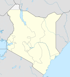

Kitui District Politik Provinz Eastern  Lage des Kitui Districts in Kenia
Der Kitui District ist ein Bezirk in der Provinz Eastern in Kenia. Die Hauptstadt ist Kitui. Im Distrikt lebten 1999 515.422 Menschen auf 20.402 km².[1] Der Distrikt ist in zehn Divisionen unterteilt: Central, Chuluni, Matinyani, Mwitika, Mutitu, Ikutha, Yatta, Mutongoni, Mutomo und Mutha. Das Klima im Bezirk ist semi-arid, 40 % der Distriktsfläche gelten als landwirtschaftlich nutzbar. Nur ein Prozent des Distriktes ist mit Wald bewachsen.[2]
Inhaltsverzeichnis
Wirtschaft
75 % der Bevölkerung lebt von der Landwirtschaft, 2005 lebten dabei 69 % der Menschen im Kitui District unterhalb der Armutsgrenze.[2] Die Bevölkerung lebt von der Viehzucht, hauptsächlich werden Rinder, Schafe und Ziegen gezüchtet. Ein kleinerer Teil der Menschen lebt von Geflügelzucht und Imkerei. Auf den landwirtschaftlich genutzten Flächen werden für den Eigenbedarf vorrangig Mais, Bohnen, Sorghum, Saubohnen, Hirse und Cassava angebaut. Für den Handel werden Baumwolle, Tabak, Mangos, Bananen, Süßkartoffeln, Auberginen, Okra und Spinat gezüchtet.[2]
Infrastruktur
2002 verfügte der Distrikt über 75 km Teerstraße, knapp 270 km des Straßennetzes waren geschottert, der Rest besteht aus Erdstraßen, die während der Regenzeit mitunter unpassierbar werden. Im Bezirk gab es 2002 66 Telefonzellen und 16 Postämter, außerdem elf Finanzinstitute. Außerhalb der Hauptstadt Kitui gibt es keinen Zugang zu elektrischem Strom, der Energiebedarf wird hauptsächlich über Holz und Kohle gedeckt. Fast 90 % der Haushalte in der Region haben direkten keinen Zugang zu sauberem Wasser.[2]
Gesundheitswesen
Kitui District verfügt über insgesamt 92 Einrichtungen des Gesundheitswesens, darunter vier Krankenhäuser und fünf Altenheime.[2] Das Kitui District Hospital als größtes der Krankenhäuser verfügt über 200 Betten.[3] Die Kindersterblichkeit im Distrikt ist hoch, 9,8 % der Kinder sterben vor ihrem 5. Geburtstag. Das Verhältnis Arzt-Patient beträgt 1:16.000. Die HIV/Aids-Inzidenz liegt bei 14 %.[2]
Einzelnachweise
- ↑ statoids.com – Districts of Kenya, abgerufen am 2. Mai 2011.
- ↑ a b c d e f Kitui District Profile auf kenyafoodsecurity.org, abgerufen am 2. Mai 2011.
- ↑ Kitui District Hospital auf ehealth.or.ke, abgerufen am 2. Mai 2011.
 Distrikte in Kenia
Central Province: Kiambu | Kirinyaga | Maragua | Murang’a | Nyandarua | Nyeri | Thika
Coast Province: Kilifi | Kwale | Lamu | Malindi | Mombasa | Taita-Taveta | Tana River
Eastern Province: Embu | Isiolo | Kitui | Machakos | Makueni | Marsabit | Mbeere | Meru Central | Meru North | Meru South | Moyale | Mwingi | Tharaka
North-Eastern Province: Garissa | Ijara | Wajir | Mandera
Nyanza Province: Bondo | Gucha | Homa Bay | Kisii Central | Kisumu | Kuria | Migori | Nyamira | Nyando | Rachuonyo | Siaya | Suba
Rift Valley Province: Baringo | Bomet | Buret | Kajiado | Keiyo | Kericho | Koibatek | Laikipia | Marakwet | Nakuru | Nandi | Narok | Samburu | Trans Mara | Trans-Nzoia | Turkana | Uasin Gishu | West Pokot
Western Province: Bungoma | Busia | Butere/Mumias | Kakamega | Lugari | Mount Elgon | Teso | Vihiga
Nairobi: Nairobi
Wikimedia Foundation.
Schlagen Sie auch in anderen Wörterbüchern nach:
Kitui District — is an administrative district in the Eastern Province of Kenya. Its capital town is Kitui. The district has a population of 515,422 (1999 census) and an area of 20,402 km² [http://www.statoids.com/yke.html] . Government The district has two local … Wikipedia
Kitui — Administration Pays Kenya District … Wikipédia en Français
Kitui — is a rural town in Kenya, 130 kilometres east of Nairobi and 75 kilometres east of Machakos. It is the capital of the Kitui District in Eastern Province of Kenya. Kitui town had a population of 13,244 in 1999. Large majority of the people are… … Wikipedia
Kitui Central Constituency — Kitui Central Constitency is an electoral constituency in Kenya. It is one of four constituencies in Kitui District. The constituency was established for the 1966 elections. Members of Parliament Wards References … Wikipedia
Mwingi District — is one of the seventy one districts of Kenya, located in that country s Eastern Province. The district has a population of 303.828 (1999 census). Its capital is the Mwingi town. Local people are mostly of the Akamba tribe. North of Mwingi town,… … Wikipedia
Mombasa District — District … Wikipedia
Mbeere District — Cumulative rainfall at Masinga dam, Kenya. Mbeere District is an administrative district in the Eastern Province of Kenya. Its capital town is Siakago. The district has a population of 170,950 and an area of 2,093 km².[1] … Wikipedia
Nyando District — is a fairly new district in Kenya which broke away from Kisumu District in Nyanza Province in 1998. Nyando district borders the Rift Valley Province. The district is named after the Nyando River. Its capital is in a small town called Awasi,… … Wikipedia
Nyandarua District — is an administrative district in the Central Province of Kenya. Its capital town is Ol Kalou. Formerly the capital was Nyahururu, but it is now part of the Laikipia District. Nyandarua District has population of 479,902 and an area of 3,304 km²… … Wikipedia
Mount Elgon District — (Mt. Elgon District) is an administrative district in the Western Province of Kenya. Its capital town is Kapsokwony. Contents 1 Geography and demographics 2 Government 3 Parliamentary representation … Wikipedia
Kitui District


18+
© Academic, 2000-2024
- Kontaktieren Sie uns: Unterstützung, Werbung
Wörterbücher Export, schritte mit PHP, Joomla, Drupal, WordPress, MODx.