- Isiolo District
-
Isiolo District Basisdaten Einwohner
- Bevölkerungsdichte100.861 Einw.
4 Einw./km²Fläche 25.698 km² Koordinaten 0° 53′ N, 38° 40′ O0.8833333333333338.666666666667Koordinaten: 0° 53′ N, 38° 40′ O 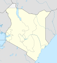

Isiolo District Politik Provinz Eastern Der Distrikt Isiolo ist ein Bezirk in der Provinz Eastern in Kenia. Die Hauptstadt des Distrikts ist Isiolo. Im Distrikt lebten 1999 100.861 Menschen auf 25.698 km².[1] 12,5 % der Haushalte sind an das Stromnetz angeschlossen.[2] Durch den Distrikt fließt der Uaso Nyiro.
Gliederung
Der Distrikt teilt sich in sechs Divisionen und zwei Wahlbezirke, Isiolo North und Isiolo South, auf.
Divisionen Division Einwohner[2] Hauptstadt Central 52.280 Isiolo Garba Tula 7.010 Garba Tula Kinna 7.133 Kinna Merti 15.771 Merti Oldonyiro 9.669 Sericho 8.998 Gesamt 100.861 - Religion
Der Distrikt Isiolo gehört zum Apostolischen Vikariat der römisch-katholischen Kirche. Neben mehreren Primary und Secondary Schools unterhält die katholische Kirche im Distrikt Isiolo Kinderheime, medizinische Ambulanzen, eine Krankenpflegeschule und eine Fachhochschule. 27.000 Katholiken leben im Distrikt Isiolo.[3]
Einzelnachweise
- ↑ statoids.com – Districts of Kenya, abgerufen am 13. Dezember 2009.
- ↑ a b Statistik auf cck.go.ke (pdf), abgerufen am 13. Dezember 2009.
- ↑ Apostolisches Vikariat Isiolo auf der Homepage der Kenya Episcopal Conference, abgerufen am 13. Dezember 2009.
 Distrikte in Kenia
Central Province: Kiambu | Kirinyaga | Maragua | Murang’a | Nyandarua | Nyeri | Thika
Coast Province: Kilifi | Kwale | Lamu | Malindi | Mombasa | Taita-Taveta | Tana River
Eastern Province: Embu | Isiolo | Kitui | Machakos | Makueni | Marsabit | Mbeere | Meru Central | Meru North | Meru South | Moyale | Mwingi | Tharaka
North-Eastern Province: Garissa | Ijara | Wajir | Mandera
Nyanza Province: Bondo | Gucha | Homa Bay | Kisii Central | Kisumu | Kuria | Migori | Nyamira | Nyando | Rachuonyo | Siaya | Suba
Rift Valley Province: Baringo | Bomet | Buret | Kajiado | Keiyo | Kericho | Koibatek | Laikipia | Marakwet | Nakuru | Nandi | Narok | Samburu | Trans Mara | Trans-Nzoia | Turkana | Uasin Gishu | West Pokot
Western Province: Bungoma | Busia | Butere/Mumias | Kakamega | Lugari | Mount Elgon | Teso | Vihiga
Nairobi: Nairobi
Wikimedia Foundation.
Schlagen Sie auch in anderen Wörterbüchern nach:
Isiolo District — is an administrative district in Eastern Province of Kenya. Its population is 100.861 (1999 census) [http://www.cck.go.ke/html/final annex1 cover status.pdf] , and its capital is Isiolo town. The local topography is arid or semi arid low plains.… … Wikipedia
Isiolo — is a town in the Eastern Province, Kenya, lying 45 kilometres north of Meru. It grew around the local military camps, much of the population being descended from former Somali soldiers who had fought in World War I. Isiolo is capital of the… … Wikipedia
Apostolisches Vikariat Isiolo — Basisdaten Staat Kenia Kirchenprovinz Immediat … Deutsch Wikipedia
Mbeere District — Cumulative rainfall at Masinga dam, Kenya. Mbeere District is an administrative district in the Eastern Province of Kenya. Its capital town is Siakago. The district has a population of 170,950 and an area of 2,093 km².[1] … Wikipedia
Mombasa District — District … Wikipedia
Mount Elgon District — (Mt. Elgon District) is an administrative district in the Western Province of Kenya. Its capital town is Kapsokwony. Contents 1 Geography and demographics 2 Government 3 Parliamentary representation … Wikipedia
Meru Central District — is one of the seventy one districts of Kenya, located in that country s Eastern Province. In 1992, it was split from the large Meru District, along with Meru North District, Meru South District, and Tharaka District. Meru Central District is the… … Wikipedia
Narok District — is an administrative district in Kenya. The Narok District is located in the Rift Valley Province, and has a population of 365,750. Its capital town is Narok. Along with Kisii District, Narok District has been identified as having the highest… … Wikipedia
Nyando District — is a fairly new district in Kenya which broke away from Kisumu District in Nyanza Province in 1998. Nyando district borders the Rift Valley Province. The district is named after the Nyando River. Its capital is in a small town called Awasi,… … Wikipedia
Marsabit District — District Coordinates … Wikipedia
Isiolo District

18+
© Academic, 2000-2024
- Kontaktieren Sie uns: Unterstützung, Werbung
Wörterbücher Export, schritte mit PHP, Joomla, Drupal, WordPress, MODx.