- Kisii Central District
-
Kisii Central District Basisdaten Einwohner
- Bevölkerungsdichte491.786 Einw.
758 Einw./km²Fläche 649 km² Koordinaten 0° 40′ S, 34° 45′ O-0.6666666666666734.75Koordinaten: 0° 40′ S, 34° 45′ O 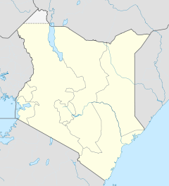

Kisii Central District Politik Provinz Nyanza Kisii Central ist ein Distrikt in der Provinz Nyanza in Kenia. Die Distriktshauptstadt ist Kisii. 1999 lebten knapp 492.000 Menschen dort auf 649 km².[1][2] 5,9% der Haushalte sind an das Stromnetz angeschlossen.[1]
Der Distrikt zeichnet sich durch eine hügelige Landschaft aus und wird sowohl vom Gucha als auch vom Mogusi durchquert, die beide in den Victoriasee münden. Im Kisii Central District werden hauptsächlich Kaffee, Tee, Tanacetum, Mais, Bohnen und Hirse angebaut.
2007 wurde der ursprüngliche größere Kisii District geteilt. Aus dem Norden des Distrikts wurde der Nyamira District, aus dem Süden der Gucha District. Die Gegend um die Stadt Kisii blieb als Kisii Central District erhalten.
Trotz des 2001 erlassenen Verbotes der Beschneidung weiblicher Genitalien findet diese im Kisii Central District nach wie vor in großer Zahl statt.[3]
Inhaltsverzeichnis
Klima
Kisii liegt in der tropischen Klimazone am Äquator, hat aber wegen seiner Höhenlage ein angenehmes Klima. Zwischen März und Mai und im Oktober/November gibt es zwei Regenzeiten. Die Temperaturen reichen von 10 °C bis 31 °C.
Gliederung
Der Kisii Central District teilt sich in Councils und Divisionen auf.
Councils Sitz der Behörde Typ Einwohner[1] Kisii Gemeinde 59248 Keroka Stadt 44.861 Masimba Stadt 40.218 Suneka Stadt 43.908 Gusii Kreis 303.551 Divisionen Division Einwohner[1] Hauptstadt Keumbu 109.837 Keumbu Kisii township 37.531 Kisii Marani 89.215 Marani Masaba 105.926 Masimba Mosocho 63.247 Nyakoe Suneka 86.030 Suneka Der Kisii Central District teilt sich in vier Wahlbezirke auf:
- Nyaribari Chache
- Kitutu Chache
- Bonchari
- Masaba
Einzelnachweise
- ↑ a b c d Statistik auf cck.go.ke (pdf), abgerufen am 9. Dezember 2009.
- ↑ statoids.com – Districts of Kenya, abgerufen am 9. Dezember 2009.
- ↑ Kenyan Girls flee circumcision, BBC News online, abgerufen am 15. Februar 2010.
Weblinks
- kisii.com – Home of the Abagusii People (englisch)
 Distrikte in Kenia
Central Province: Kiambu | Kirinyaga | Maragua | Murang’a | Nyandarua | Nyeri | Thika
Coast Province: Kilifi | Kwale | Lamu | Malindi | Mombasa | Taita-Taveta | Tana River
Eastern Province: Embu | Isiolo | Kitui | Machakos | Makueni | Marsabit | Mbeere | Meru Central | Meru North | Meru South | Moyale | Mwingi | Tharaka
North-Eastern Province: Garissa | Ijara | Wajir | Mandera
Nyanza Province: Bondo | Gucha | Homa Bay | Kisii Central | Kisumu | Kuria | Migori | Nyamira | Nyando | Rachuonyo | Siaya | Suba
Rift Valley Province: Baringo | Bomet | Buret | Kajiado | Keiyo | Kericho | Koibatek | Laikipia | Marakwet | Nakuru | Nandi | Narok | Samburu | Trans Mara | Trans-Nzoia | Turkana | Uasin Gishu | West Pokot
Western Province: Bungoma | Busia | Butere/Mumias | Kakamega | Lugari | Mount Elgon | Teso | Vihiga
Nairobi: Nairobi
Wikimedia Foundation.
Schlagen Sie auch in anderen Wörterbüchern nach:
Meru Central District — is one of the seventy one districts of Kenya, located in that country s Eastern Province. In 1992, it was split from the large Meru District, along with Meru North District, Meru South District, and Tharaka District. Meru Central District is the… … Wikipedia
Kisii — may refer to:* Kisii, a town in Kenya * Kisii Central District, a District in Kenya * Gucha District, in Kenya, also known as South Kisii District * Nyamira District, in Kenya, also known as North Kisii District * Kisii people, an ethnic group in … Wikipedia
Kisii — steht für: Kisii Central District, ein Distrikt in der Provinz Nyanza in Kenia Kisii (Stadt), die Hauptstadt des Distriktes Kisii Kisii (Volk), ein Volk in Kenia Kisii (Sprache), eine Sprache in Kenia den Kisii Speckstein … Deutsch Wikipedia
Kisii District — is one of the twelve districts of Nyanza Province in southwest Kenya, and is divided into five local authorities and eleven administrative districts. The district capital is Kisii. The district is mostly hilly and is dissected by rivers flowing… … Wikipedia
Kisii (comté du Kenya) — 0° 40′ 42″ S 34° 46′ 19″ E / 0.678306, 34.771966 … Wikipédia en Français
Meru North District — is one of the seventy one districts of Kenya, located in that country s Eastern Province. In 1992, it was split from the large Meru District, along with Meru Central District, Meru South District, and Tharaka District. Meru North District is the… … Wikipedia
Meru South District — is one of the seventy one districts of Kenya, located in that country s Eastern Province. In 1992, it was split from the large Meru District, along with Meru Central District, Meru North District, and Tharaka District. Meru South District is the… … Wikipedia
Gucha District — Basisdaten Einwohner Bevölkerungsdichte 460.939 Einw. [1] 697 Einw./km² Fläche 661 km² Koordinaten … Deutsch Wikipedia
Murang’a District — Basisdaten Einwohner Bevölkerungsdichte 348.304 Einw. [1] 375 Einw./km² Fläche 930 km² Koordinaten … Deutsch Wikipedia
Nyandarua District — Basisdaten Einwohner Bevölkerungsdichte 479.902 Einw. [1] 145 Einw./km² Fläche 3304 km² Koordinaten … Deutsch Wikipedia
Kisii Central District

18+
© Academic, 2000-2024
- Kontaktieren Sie uns: Unterstützung, Werbung
Wörterbücher Export, schritte mit PHP, Joomla, Drupal, WordPress, MODx.