- Kericho District
-
Kericho District Basisdaten Einwohner
- Bevölkerungsdichte468.493 Einw. [1]
222 Einw./km²Fläche 2111 km² Koordinaten 0° 22′ S, 35° 18′ O-0.3666666666666735.3Koordinaten: 0° 22′ S, 35° 18′ O 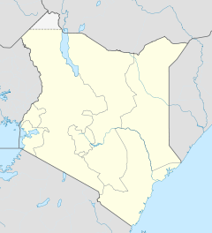

Kericho District Politik Provinz Rift Valley  Teepflücker bei Kericho.
Kericho District ist ein Distrikt in der kenianischen Provinz Rift Valley. Die Hauptstadt des Distriktes ist Kericho. Im Distrikt lebten 1999 468.000 Menschen auf 2111 km². Im Kericho District wird hauptsächlich Tee angebaut. Kericho ist das Zentrum des bedeutendsten Teeanbaugebietes in Kenia. Im Kericho District sind die Kipsigis beheimatet, die zum Volk der Kalendjin gehören.
Gliederung
Der Distrikt teilt sich in Councils und Divisionen auf. Es gibt drei Wahlbezirke: Belgut, Ainamoi und Kipkelion.
Councils Sitz der Behörde Typ Einwohner[2] Kericho Gemeinde 85.126 Londiani Stadt 37.538 Kipkelion Stadt 36.324 Kipsigis County 309.505 Gesamt - 468.493 Divisionen Division Einwohner[2] Hauptstadt Ainamoi 119.696 Kericho Belgut 100.325 Kabianga Chilchila 36.983 Kipkelion 64.477 Kipkelion Londiani 59.441 Londiani Sigowet 61.778 Soin 25.793 Gesamt 468.493 - Einzelnachweise
- ↑ statoids.com, abgerufen am 13. Februar 2010.
- ↑ a b Statistik auf cck.go.ke, abgerufen am 13. Februar 2010.
 Distrikte in Kenia
Central Province: Kiambu | Kirinyaga | Maragua | Murang’a | Nyandarua | Nyeri | Thika
Coast Province: Kilifi | Kwale | Lamu | Malindi | Mombasa | Taita-Taveta | Tana River
Eastern Province: Embu | Isiolo | Kitui | Machakos | Makueni | Marsabit | Mbeere | Meru Central | Meru North | Meru South | Moyale | Mwingi | Tharaka
North-Eastern Province: Garissa | Ijara | Wajir | Mandera
Nyanza Province: Bondo | Gucha | Homa Bay | Kisii Central | Kisumu | Kuria | Migori | Nyamira | Nyando | Rachuonyo | Siaya | Suba
Rift Valley Province: Baringo | Bomet | Buret | Kajiado | Keiyo | Kericho | Koibatek | Laikipia | Marakwet | Nakuru | Nandi | Narok | Samburu | Trans Mara | Trans-Nzoia | Turkana | Uasin Gishu | West Pokot
Western Province: Bungoma | Busia | Butere/Mumias | Kakamega | Lugari | Mount Elgon | Teso | Vihiga
Nairobi: Nairobi
Wikimedia Foundation.
Schlagen Sie auch in anderen Wörterbüchern nach:
Kericho District — Kericho is a district in the Rift Valley Province of Kenya. Its capital town is Kericho. It has a population of 468,493 (1999 census) and an area of 2,111 km² [http://www.statoids.com/yke.html] .The district has three constituencies: *Belgut… … Wikipedia
Kericho — is a Kenyan district located to the South West of the country and lies within the highlands west of The Great Rift Valley. The capital of the district is Kericho town. The district home to the best of Kenyan Tea which is world famous for its… … Wikipedia
Mbeere District — Cumulative rainfall at Masinga dam, Kenya. Mbeere District is an administrative district in the Eastern Province of Kenya. Its capital town is Siakago. The district has a population of 170,950 and an area of 2,093 km².[1] … Wikipedia
Mombasa District — District … Wikipedia
Nyando District — is a fairly new district in Kenya which broke away from Kisumu District in Nyanza Province in 1998. Nyando district borders the Rift Valley Province. The district is named after the Nyando River. Its capital is in a small town called Awasi,… … Wikipedia
Nyandarua District — is an administrative district in the Central Province of Kenya. Its capital town is Ol Kalou. Formerly the capital was Nyahururu, but it is now part of the Laikipia District. Nyandarua District has population of 479,902 and an area of 3,304 km²… … Wikipedia
Mount Elgon District — (Mt. Elgon District) is an administrative district in the Western Province of Kenya. Its capital town is Kapsokwony. Contents 1 Geography and demographics 2 Government 3 Parliamentary representation … Wikipedia
Meru Central District — is one of the seventy one districts of Kenya, located in that country s Eastern Province. In 1992, it was split from the large Meru District, along with Meru North District, Meru South District, and Tharaka District. Meru Central District is the… … Wikipedia
Narok District — is an administrative district in Kenya. The Narok District is located in the Rift Valley Province, and has a population of 365,750. Its capital town is Narok. Along with Kisii District, Narok District has been identified as having the highest… … Wikipedia
Marsabit District — District Coordinates … Wikipedia
Kericho District


18+
© Academic, 2000-2024
- Kontaktieren Sie uns: Unterstützung, Werbung
Wörterbücher Export, schritte mit PHP, Joomla, Drupal, WordPress, MODx.