- Pennine Way
-
Pennine Way 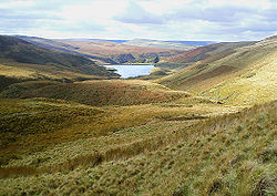
Pennine Way in der Nähe von MarsdenDaten Länge 429 km Lage Nordengland Startpunkt Edale
53° 22′ 14″ N, 1° 49′ 1″ W53.370416666667-1.8168055555556Zielpunkt Kirk Yetholm
55° 32′ 49″ N, 2° 16′ 32″ W55.547083333333-2.2754166666667Typ Fernwanderweg Höchster Punkt 893 m (Cross Fell) Schwierigkeitsgrad mittel Jahreszeit ganzjährig Der Pennine Way (deutsch: Penninen-Weg) ist ein Fernwanderweg in England, der die Pennines von Süden nach Norden durchquert.
Inhaltsverzeichnis
Beschreibung
Er hat eine Länge von 429 Kilometern und erstreckt sich von Edale in Derbyshire durch die Yorkshire Dales und den Northumberland National Park. Er endet bei Kirk Yetholm kurz hinter der Grenze zu Schottland.
Der Pennine Way verläuft durch sehr dünn besiedeltes Gebiet. Vielfach gibt es während der Tagesetappen wenige bis gar keine Einkehrmöglichkeiten. Der Weg verläuft zum Teil sehr ausgesetzt, bei schlechten Witterungsverhältnissen handelt es sich um einen schwierigen Wanderweg.
Wegmarkierungen in der im deutschsprachigen Raum und Frankreich bewährten Weise gibt es nicht, so dass Wanderer auf Karte und Kompass angewiesen sind. Übernachtungsmöglichkeiten bestehen in kleineren Hotels, Jugendherbergen und Bed and Breakfast Unterkünften.
Geschichte
Der Fernwanderweg war eine Idee des Journalisten Tom Stephenson, der sich ähnliche Wanderwege in den Vereinigten Staaten, insbesondere den Appalachian Trail zum Vorbild nahm. Stephenson machte seinen Plan 1935 im Daily Herald publik und leistete Lobbyarbeit im Parlament. Die letzte Etappe des Wegs wurde 1965 bei Malham eröffnet.
Streckenverlauf
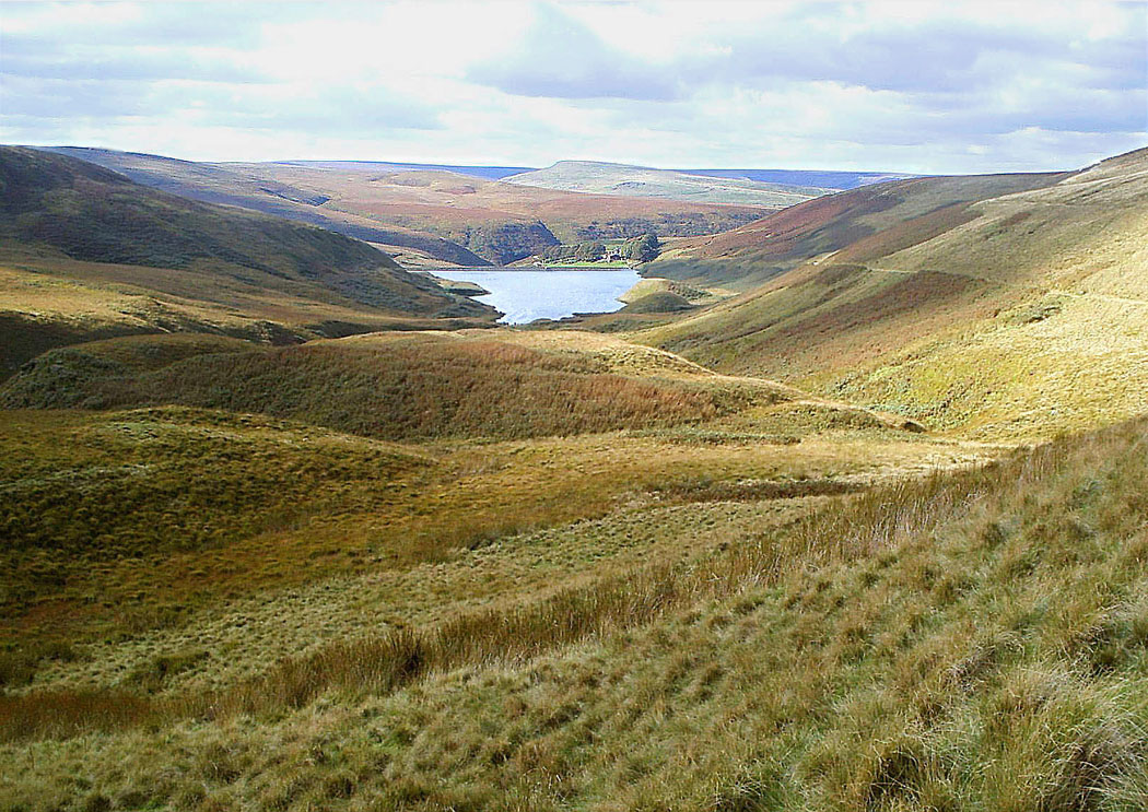
 Landschaft bei Malham
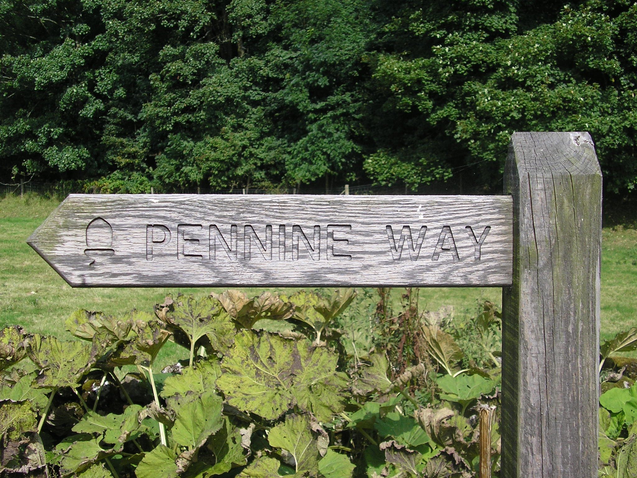
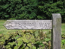 Wegzeichen des Pennine Way
 Cross Fell, der höchste Punkt des Pennine Way
Der Pennine Way passiert die folgenden Orte:
- Edale
- Kinder Scout
- Bleaklow
- Black Hill
- Saddleworth Moor
- Standedge
- Littleborough
- Stoodley Pike
- Todmorden
- Hebden Bridge
- Wadsworth Moor
- Keighley Moor
- Elslack Moor
- Lothersdale
- Settle
- Malham
- Fountains Fell
- Pen-y-ghent
- Horton in Ribblesdale
- Dodd Fell Hill
- Hawes
- Great Shunner Fell
- Kisdon
- Kisdon Force
- Keld (hier wird der Coast to Coast Walk gekreuzt)
- Tan Hill
- Querung der A66
- Middleton-in-Teesdale
- High Cup
- Great Dun Fell
- Cross Fell
- Alston
- Haltwhistle
- Hadrian's Wall
- Shitlington Crags
- Windy Gyle
- The Cheviot
- Kirk Yetholm
Literatur
- Alfred Wainwright: Pennine Way Companion. Dritte überarbeitete Ausgabe. Frances Lincoln, London 2004, ISBN 978-0-7112-2235-9.
Weblinks
 Commons: Pennine Way – Sammlung von Bildern, Videos und Audiodateien
Siehe auch
National Trails in England und Wales
Cleveland Way | Cotswold Way | Glyndŵr’s Way | Hadrian’s Wall Path | North Downs Way | Offa’s Dyke Path | Peddar’s Way | Pembrokeshire Coast Path | Pennine Bridleway | Pennine Way | The Ridgeway | South Downs Way | South West Coast Path | Thames Path | Yorkshire Wolds WayLong Distance Routes in Schottland
Great Glen Way | Southern Upland Way | Speyside Way | West Highland Way
Wikimedia Foundation.
Schlagen Sie auch in anderen Wörterbüchern nach:
Pennine Way — the Pennine Way a very long path (250 miles) along the Pennines, which people walk along for pleasure or exercise … Dictionary of contemporary English
Pennine Way — Infobox Hiking trail Name=Pennine Way Photo=Pennine scenery.jpg Caption=View from the Pennine Way, near Marsden Location=Northern England, United Kingdom Designation=UK National Trail Length=429 km (268 mi) Start/End Points=Edale, Derbyshire Kirk … Wikipedia
Pennine Way — /pɛnaɪn ˈweɪ/ (say penuyn way) noun a walking track in England reaching from Edale, Derbyshire, for 402 km to Kirk Yetholm in the Borders region …
Pennine Way — a path along the Pennines in northern England, used by people who like walking as a hobby. It is about 250 miles/400 kilometres long and passes through three national parks, including the Peak District. It was opened in 1965. * * * … Universalium
(the) Pennine Way — the Pennine Way [the Pennine Way] a path along the ↑Pennines in northern England, used by people who like walking as a hobby. It is about 250 miles/400 kilometres long and passes through three ↑national parks, including the ↑Peak District. It was … Useful english dictionary
Pennine Bridleway — Informationstafel des Pennine Bridleway … Deutsch Wikipedia
Pennine Bridleway — Infobox Hiking trail Name=Pennine Bridleway Photo=Pennine bridleway information board.jpg Caption=Information board at Hartington station Location=Northern England, United Kingdom Designation=UK National Trail Length=convert|130|mi|km|abbr=on… … Wikipedia
Pennine Cycleway — The Pennine Cycleway is a Sustrans sponsored route from the English city of Derby to Berwick upon Tweed on the Scottish border. It is part of the National Cycle Network (NCN 68) and was opened in 2003. It has a total length of about 355 miles,… … Wikipedia
way — [[t]we͟ɪ[/t]] ♦ ways 1) N COUNT: oft N of ing, N to inf If you refer to a way of doing something, you are referring to how you can do it, for example the action you can take or the method you can use to achieve it. Freezing isn t a bad way of… … English dictionary
Cleveland Way — Live Moor: the waymarked path crosses remote upland moors Length 110 miles (177 km) Location North Yorkshire, England Designation … Wikipedia
Pennine Way


18+
© Academic, 2000-2024
- Kontaktieren Sie uns: Unterstützung, Werbung
Wörterbücher Export, schritte mit PHP, Joomla, Drupal, WordPress, MODx.