- Southern Upland Way
-
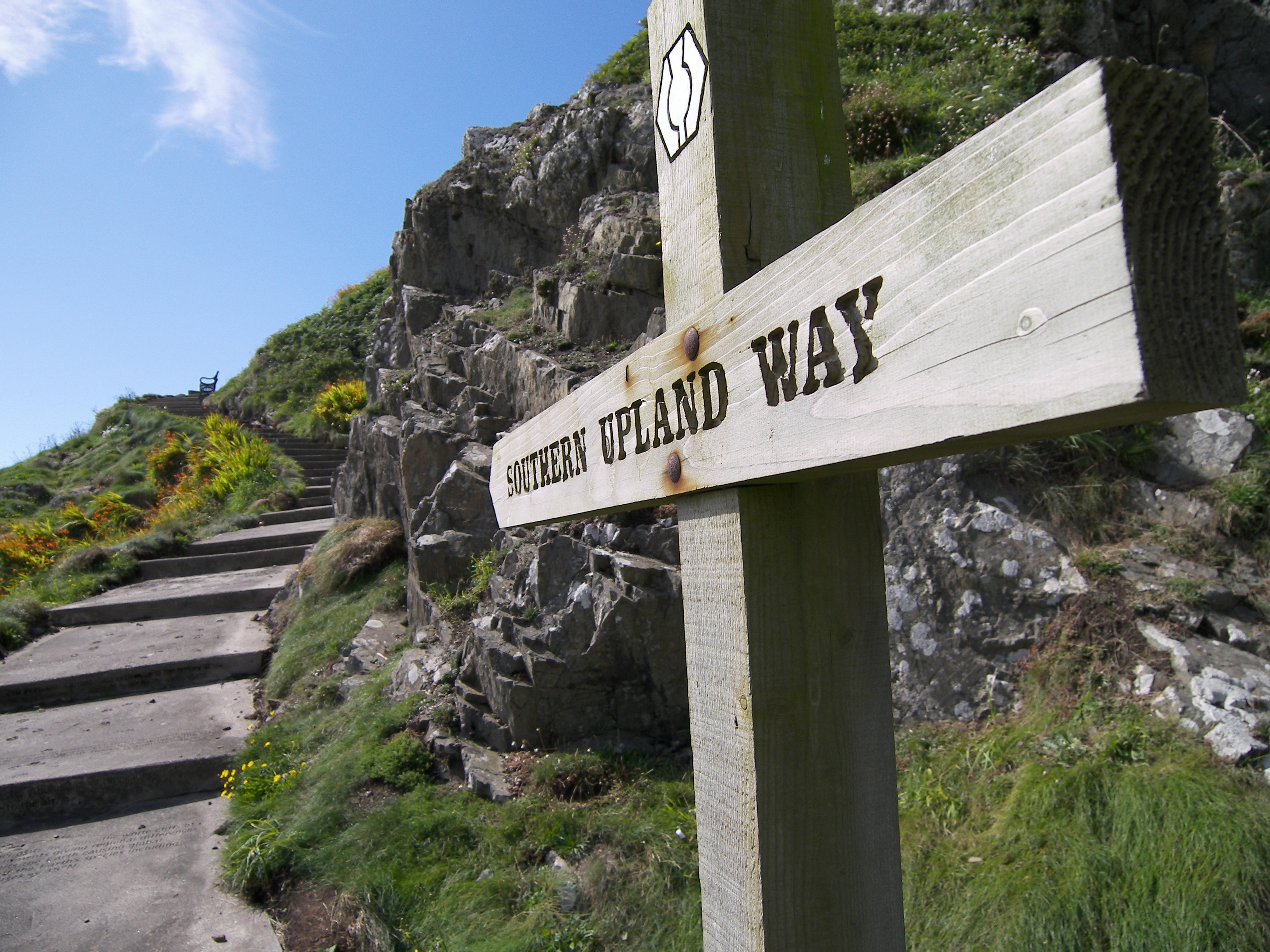
 Portpatrick
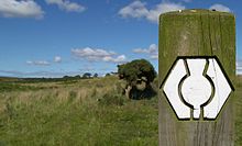 Typischer Wegweiser
Der Southern Upland Way ist ein schottischer Fernwanderweg.
Er führt von Portpatrick an Schottlands Westküste nach Cockburnspath an der Ostküste. Die Gesamtwanderlänge beträgt 337,6 Kilometer (209,8 Meilen), und er ist somit der längste schottische Wanderweg. Auf der gesamten Länge ist ein Aufstieg von 8720 Metern (28609 ft) zu bewältigen. Der höchste Punkt der Strecke liegt auf 712 Metern über dem Meeresspiegel[1].
Siedlungen am Weg
- Portpatrick
- Bargrennan
- St. John's Town of Dalry
- Sanquhar
- Wanlockhead
- Moffat
- Traquair
- Galashiels
- Melrose
- Longformacus
- Cockburnspath
Weblinks
 Commons: Southern Upland Way – Sammlung von Bildern, Videos und Audiodateien
- Offizielle Seite des schottischen Fremdenverkehrsamts (englisch)
- Southern Upland Way Ltd., Service rund um den Weg (englisch)
- Wegbeschreibung (deutsch)
Einzelnachweise
National Trails in England und Wales
Cleveland Way | Cotswold Way | Glyndŵr’s Way | Hadrian’s Wall Path | North Downs Way | Offa’s Dyke Path | Peddar’s Way | Pembrokeshire Coast Path | Pennine Bridleway | Pennine Way | The Ridgeway | South Downs Way | South West Coast Path | Thames Path | Yorkshire Wolds WayLong Distance Routes in Schottland
Great Glen Way | Southern Upland Way | Speyside Way | West Highland Way
Wikimedia Foundation.
Schlagen Sie auch in anderen Wörterbüchern nach:
Southern Upland Way — Infobox Hiking trail Name=Southern Upland Way Photo= Caption= Location=Southern Scotland, United Kingdom Designation=Long Distance Route Length=convert|212|mi|km Start/End Points=Portpatrick Cockburnspath Use=Hiking, horse riding, cycling… … Wikipedia
Southern Uplands — The Southern Uplands is the southernmost of Scotland s three major geographic areas (the others being the Central Belt and the Highlands). They lie South of the Southern Uplands fault line that runs from Girvan on the Ayrshire coast in the West… … Wikipedia
Southern Uplands — In den Southern Uplands Die Bergregion der Southern Uplands ist das südlichste Gebiet der geographischen Dreiteilung Schottlands. Zur Kontrastierung gegen die nördlichen Highlands werden die Southern Uplands und der Central Belt zusammengefasst… … Deutsch Wikipedia
Speyside Way — Der Speyside Way ist einer der vier offiziellen überregionalen Fernwanderwege in Schottland (neben dem West Highland Way, dem Southern Upland Way und dem Great Glen Way). Er wurde 1981 eröffnet und verläuft von der Spey Bay nach Ballindalloch.… … Deutsch Wikipedia
North Downs Way — The North Downs Way near Hollingbourne Length 246 kilometres (153 mi)[1] … Wikipedia
Cleveland Way — Live Moor: the waymarked path crosses remote upland moors Length 110 miles (177 km) Location North Yorkshire, England Designation … Wikipedia
Icknield Way — bei Lewknor in Oxfordshire Der Icknield Way ist ein historischer Fußpfad in Süd England. Er liegt im ganzjährig trockenen Gebiet oberhalb der Wasserquellen auf der Kreide Schichtstufe der Berkshire Downs und Chiltern Hills Inhaltsverzeichn … Deutsch Wikipedia
Cotswold Way — passing through the site of the Battle of Lansdowne Length 102 mi (164 km) Location Central England Desi … Wikipedia
Marches Way — The trail follows the River Usk near Abergavenny Length 218 miles (351 km) Location Wales Midlands, England … Wikipedia
West Highland Way — Der West Highland Way südlich von Fort William Daten Länge 154 km Lage Großbritannien, westliches Schottland … Deutsch Wikipedia
Southern Upland Way

18+
© Academic, 2000-2024
- Kontaktieren Sie uns: Unterstützung, Werbung
Wörterbücher Export, schritte mit PHP, Joomla, Drupal, WordPress, MODx.