- Fairfield County (Ohio)
-
 Fairfield County Courthouse (rechts) in Fairfield
Verwaltung US-Bundesstaat: Ohio Verwaltungssitz: Lancaster Adresse des
Verwaltungssitzes:County Courthouse
210 E. Main Street
Lancaster, OH 43130-3854Gründung: 9. Dezember 1800 Gebildet aus: Ross County
Washington CountyVorwahl: 001 740 Demographie Einwohner: 138.423 (2005) Bevölkerungsdichte: 105,8 Einwohner/km² Geographie Fläche gesamt: 1.317 km² Wasserfläche: 9 km² Karte 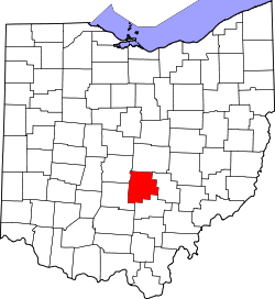
Website: www.co.fairfield.oh.us Fairfield County[1] ist ein County im Bundesstaat Ohio der Vereinigten Staaten von Amerika. Der Verwaltungssitz (County Seat) ist Lancaster.
Inhaltsverzeichnis
Geografie
Das County liegt etwas südlich des geographischen Zentrums von Ohio und hat eine Fläche von 1317 Quadratkilometern, wovon 9 Quadratkilometer Wasserfläche sind. Es grenzt im Uhrzeigersinn an folgende Countys: Licking County, Perry County, Hocking County, Pickaway County und Franklin County.
Geschichte
Fairfield County wurde am 9. Dezember 1800 aus Teilen des Ross County und des Washington County gebildet. Benannt wurde es möglicherweise nach den schönen, weiten Feldern (fair fields).
Historische Objekte
- Etwa 3,2 Kilometer nordöstlich von Carroll, auf der Havensport Road trifft man auf die John Bright No. 1 Iron Bridge. Die „eiserne“ Brücke wurde 1978 als historisches Denkmal vom National Register of Historic Places aufgenommen (NRHP 78002060).[2]
Demografische Daten
Historische Einwohnerzahlen Census Einwohner ± in % 1810 11.361 — 1820 16.633 50 % 1830 24.786 50 % 1840 31.924 30 % 1850 30.264 -5 % 1860 30.538 0,9 % 1870 31.138 2 % 1880 34.284 10 % 1890 33.939 -1 % 1900 34.259 0,9 % 1910 39.201 10 % 1920 40.484 3 % 1930 44.010 9 % 1940 48.490 10 % 1950 52.130 8 % 1960 63.912 20 % 1970 73.301 10 % 1980 93.678 30 % 1990 103.461 10 % 2000 122.759 20 % Vor 1900[3]  Alterspyramide für das Fairfield County
Nach der Volkszählung im Jahr 2000 lebten im Fairfield County 122.759 Menschen in 45.425 Haushalten und 34.159 Familien. Die Bevölkerungsdichte betrug 94 Einwohner pro Quadratkilometer. Ethnisch betrachtet setzte sich die Bevölkerung zusammen aus 95,15 Prozent Weißen, 2,67 Prozent Afroamerikanern, 0,20 Prozent amerikanischen Ureinwohnern, 0,72 Prozent Asiaten, 0,02 Prozent Bewohnern aus dem pazifischen Inselraum und 0,23 Prozent aus anderen ethnischen Gruppen; 1,01 Prozent stammten von zwei oder mehr Ethnien ab. 0,81 Prozent der Bevölkerung waren spanischer oder lateinamerikanischer Abstammung.
Von den 45.425 Haushalten hatten 36,8 Prozent Kinder und Jugendliche unter 18 Jahre, die bei ihnen lebten. 62,7 Prozent waren verheiratete, zusammenlebende Paare, 9,1 Prozent waren allein erziehende Mütter, 24,8 Prozent waren keine Familien, 20,7 Prozent waren Singlehaushalte und in 8,2 Prozent lebten Menschen im Alter von 65 Jahren oder darüber. Die Durchschnittshaushaltsgröße betrug 2,65 und die durchschnittliche Familiengröße lag bei 3,06 Personen.
Auf das gesamte County bezogen setzte sich die Bevölkerung zusammen aus 26,8 Prozent Einwohnern unter 18 Jahren, 8,0 Prozent zwischen 18 und 24 Jahren, 30,2 Prozent zwischen 25 und 44 Jahren, 23,9 Prozent zwischen 45 und 64 Jahren und 11,1 Prozent waren 65 Jahre alt oder darüber. Das Durchschnittsalter betrug 36 Jahre. Auf 100 weibliche Personen kamen 99,2 männliche Personen. Auf 100 Frauen im Alter von 18 Jahren oder darüber kamen statistisch 96,3 Männer.
Das jährliche Durchschnittseinkommen eines Haushalts betrug 47.962 USD, das Durchschnittseinkommen der Familien betrug 55.539 USD. Männer hatten ein Durchschnittseinkommen von 39.566 USD, Frauen 27.353 USD. Das Prokopfeinkommen betrug 21.671 USD. 4,5 Prozent der Familien und 5,9 Prozent der Bevölkerung lebten unterhalb der Armutsgrenze. Davon waren 7,4 Prozent Kinder oder Jugendliche unter 18 Jahre und 6,2 Prozent waren Menschen über 65 Jahre. [6]
Einzelnachweise
- ↑ Fairfield County im Geographic Names Information System des United States Geological Survey. Abgerufen am 22. Februar 2011
- ↑ NRIS
- ↑ U.S. Census Bureau _ Census of Population and Housing. Abgerufen am 17. Februar 2011
- ↑ Auszug aus Census.gov. Abgerufen am 21. Februar 2011
- ↑ Auszug aus factfinder.census.gov Abgerufen am 21. Februar 2011
- ↑ Fairfield County, Ohio, Datenblatt mit den Ergebnissen der Volkszählung im Jahre 2000 bei factfinder.census.gov.

Liste der Countys in Ohio
Adams | Allen | Ashland | Ashtabula | Athens | Auglaize | Belmont | Brown | Butler | Carroll | Champaign | Clark | Clermont | Clinton | Columbiana | Coshocton | Crawford | Cuyahoga | Darke | Defiance | Delaware | Erie | Fairfield | Fayette | Franklin | Fulton | Gallia | Geauga | Greene | Guernsey | Hamilton | Hancock | Hardin | Harrison | Henry | Highland | Hocking | Holmes | Huron | Jackson | Jefferson | Knox | Lake | Lawrence | Licking | Logan | Lorain | Lucas | Madison | Mahoning | Marion | Medina | Meigs | Mercer | Miami | Monroe | Montgomery | Morgan | Morrow | Muskingum | Noble | Ottawa | Paulding | Perry | Pickaway | Pike | Portage | Preble | Putnam | Richland | Ross | Sandusky | Scioto | Seneca | Shelby | Stark | Summit | Trumbull | Tuscarawas | Union | Van Wert | Vinton | Warren | Washington | Wayne | Williams | Wood | Wyandot
Wikimedia Foundation.
Schlagen Sie auch in anderen Wörterbüchern nach:
Fairfield County, Ohio — Infobox U.S. County county = Fairfield County state = Ohio founded = December 9, 1800cite web|url = http://www.odod.state.oh.us/research/FILES/S0/Fairfield.pdf |title = Ohio County Profiles: Fairfield County |accessdate = 2007 04 28 |publisher =… … Wikipedia
National Register of Historic Places listings in Fairfield County, Ohio — Location of Fairfield County in Ohio This is a list of the National Register of Historic Places listings in Fairfield County, Ohio. This is intended to be a complete list of the properties and districts on the National Register of Historic Places … Wikipedia
Clearcreek Township, Fairfield County, Ohio — Clearcreek Township, Ohio Township Municipalities and townships of Fairfield Cou … Wikipedia
Violet Township, Fairfield County, Ohio — Infobox Settlement official name = Violet Township, Fairfield County, Ohio settlement type = Township nickname = motto = imagesize = image caption = image mapsize = 250px map caption = Municipalities and townships of Fairfield County. mapsize1 =… … Wikipedia
Berne Township, Fairfield County, Ohio — Infobox Settlement official name = Berne Township, Ohio settlement type = Township nickname = motto = imagesize = image caption = image mapsize = 250x200px map caption = Municipalities and townships of Fairfield County. mapsize1 = map caption1 =… … Wikipedia
Liberty Township, Fairfield County, Ohio — Infobox Settlement official name = Liberty Township, Fairfield County, Ohio settlement type = Township nickname = motto = imagesize = image caption = image mapsize = 250px map caption = Municipalities and townships of Fairfield County. mapsize1 … Wikipedia
Rush Creek Township, Fairfield County, Ohio — Infobox Settlement official name = Rush Creek Township, Fairfield County, Ohio settlement type = Township nickname = motto = imagesize = image caption = image mapsize = 250px map caption = Municipalities and townships of Fairfield County.… … Wikipedia
Pleasant Township, Fairfield County, Ohio — Infobox Settlement official name = Pleasant Township, Ohio settlement type = Township nickname = motto = imagesize = image caption = image mapsize = 250x200px map caption = Municipalities and townships of Fairfield County. mapsize1 = map caption1 … Wikipedia
Walnut Township, Fairfield County, Ohio — Infobox Settlement official name = Walnut Township, Ohio settlement type = Township nickname = motto = imagesize = image caption = image mapsize = 250x200px map caption = Municipalities and townships of Fairfield County. mapsize1 = map caption1 … Wikipedia
Greenfield Township, Fairfield County, Ohio — Infobox Settlement official name = Greenfield Township, Ohio settlement type = Township nickname = motto = imagesize = image caption = image mapsize = 250x200px map caption = Municipalities and townships of Fairfield County. mapsize1 = map… … Wikipedia
Fairfield County (Ohio)


18+
© Academic, 2000-2024
- Kontaktieren Sie uns: Unterstützung, Werbung
Wörterbücher Export, schritte mit PHP, Joomla, Drupal, WordPress, MODx.