- Liste der Countys in Ohio
-
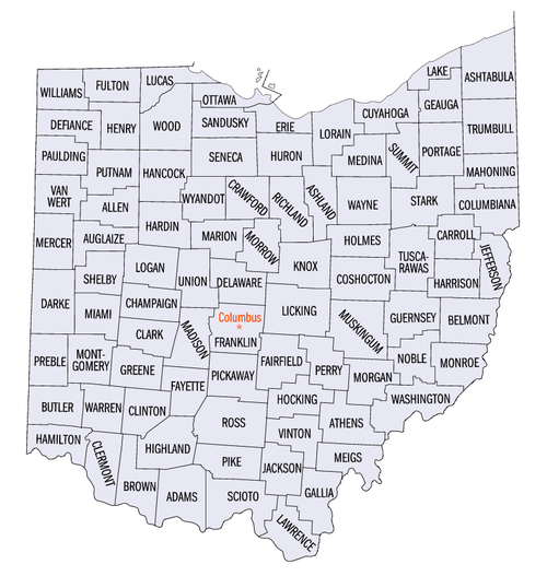
Der US-Bundesstaat Ohio ist in 88 Countys unterteilt. Sie werden im folgenden mit ihrem County Seat (Kreisstadt), dem Gründungsdatum und dem Namensgeber aufgeführt. Die Spalte „Ursprung“ gibt an, aus welchen anderen Countys ein Neues entstand.
County FIPS Code
[1]County Seat
[2]Gegründet
[2][3]Ursprung
[4]Namensherkunft
[3][4][5]Bevölkerung
[1][2]Fläche
[2]Karte
Adams County 001 West Union 10. Juli 1797 Hamilton County John Adams (1735–1826), President zur Zeit der Gründung des Countys 27.330 1.512 km² (58.391 sq mi) 
Allen County 003 Lima 1. März 1820 Shelby County John Allen (1771/1772–1813), Soldat im Britisch-Amerikanischen Krieg[6] 108.473 1.047 km² (40.443 sq mi) 
Ashland County 005 Ashland 24. Februar 1846 Wayne, Richland, Huron, und Lorain Countys Ashland, Heimat von Henry Clay. 52.523 1.099 km² (42.437 sq mi) 
Ashtabula County 007 Jefferson 7. Juni 1807 Trumbull und Geauga Countys Ashtabula River, das „Fisch-Fluss“ in Algonquianisch bedeutet[7] 102.728 1.819 km² (70.244 sq mi) 
Athens County 009 Athens 1. März 1805 Washington County Athen 62.223 1.313 km² (50.676 sq mi) 
Auglaize County 011 Wapakoneta 14. Februar 1848 Allen, Mercer, Darke, Hardin, Logan, Shelby, und Van Wert Countys Auglaize River, das bei den Shawnee „Fluss der gefallenen Bäume“ bedeutet 46.611 1.039 km² (40.125 sq mi) 
Belmont County 013 St. Clairsville 7. September 1801 Jefferson und Washington Countys Belle monte, französisch für „Schöner Berg“ 70.226 1.392 km² (53.735 sq mi) 
Brown County 015 Georgetown 1. März 1818 Adams und Clermont Countys General Jacob Brown (1775–1828), Offizier im Britisch-Amerikanischen Krieg 42.285 1.274 km² (49.176 sq mi) 
Butler County 017 Hamilton 1. Mai 1803 Hamilton County General Richard Butler (1743–1791), getötet in der Schlacht von Wabash 332.807 1.210 km² (46.727 sq mi) 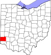
Carroll County 019 Carrollton 1. Januar 1833 Columbiana, Stark, Harrison, Jefferson, und Tuscarawas Countys Charles Carroll (1737–1832), letzter überlebender Unterzeichner der Unabhängigkeitserklärung 28.836 1.022 km² (39.467 sq mi) 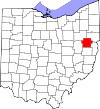
Champaign County 021 Urbana 1. März 1805 Greene und Franklin Countys Französisch für „Ebene“ als Beschreibung des Gebiets 38.890 1.110 km² (42.856 sq mi) 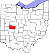
Clark County 023 Springfield 1. März 1818 Champaign, Madison, und Greene Countys General George Rogers Clark (1752–1818), der die Shawnee-Indianer bei Springfield besiegte 144.742 1.036 km² (39.986 sq mi) 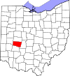
Clermont County 025 Batavia 6. Dezember 1800 Hamilton County Französisch für „freier Berg“ 177.977 1.171 km² (45.199 sq mi) 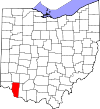
Clinton County 027 Wilmington 1. März 1810 Highland und Warren Countys George Clinton (1739–1812), Vizepräsident zur Zeit der Countygründung 40.543 1.064 km² (41.088 sq mi) 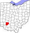
Columbiana County 029 Lisbon 1. Mai 1803 Jefferson und Washington Countys Abgeleitet von den Namen Christoph Columbus und Anna 112.075 1.379 km² (53.246 sq mi) 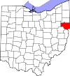
Coshocton County 031 Coshocton 31. Januar 1810 Muskingum und Tuscarawas Countys „Vereinigung der Wasser“ in der Sprache der Delaware-Indianer 36.655 1.461 km² (56.407 sq mi) 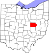
Crawford County 033 Bucyrus 1. April, 1820 Delaware County Offizier William Crawford (1732–1782) 46.966 1.041 km² (40.211 sq mi) 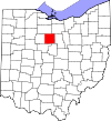
Cuyahoga County 035 Cleveland 7. Juni 1807 Geauga County Cuyahoga River, das „Krummer Fluss“ auf Irokesisch bedeutet[8] 1.393.978 1.187 km² (45.849 sq mi) 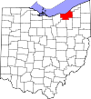
Darke County 037 Greenville 3. Januar 1809 Miami County General William Darke (1736–1801), Offizier im Unabhängigkeitskrieg 53.309 1.553 km² (59.980 sq mi) 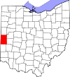
Defiance County 039 Defiance 7. April 1845 Williams, Henry, und Paulding Countys Fort Defiance, von Anthony Wayne 1794 errichtet 39.500 1.065 km² (41.116 sq mi) 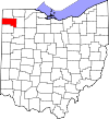
Delaware County 041 Delaware 1. April 1808 Franklin County Delaware-Indianer 110.106 1.146 km² (44.241 sq mi) 
Erie County 043 Sandusky March 15, 1838 Huron und Sandusky Countys Erie-Indianer 79.551 660 km² (25.488 sq mi) 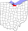
Fairfield County 045 Lancaster 9. Dezember 1800 Ross und Washington Countys Benannt nach den „schönen Feldern“ 122.759 1.308 km² (50.511 sq mi) 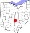
Fayette County 047 Washington Court House 1. März 1810 Ross und Highland Countys Marquis de Lafayette, Französischer Offizier und Aristokrat 28.433 1.053 km² (40.658 sq mi) 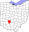
Franklin County 049 Columbus 30. April 1803 Ross und Wayne Countys Benjamin Franklin (1706–1791) 1.068.978 1.398 km² (53.987 sq mi) 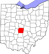
Fulton County 051 Wauseon 1. April 1850 Lucas, Henry, und Williams Countys Robert Fulton (1765 – 1815), Erfinder des Dampfschiffs 42.084 1.054 km² (40.678 sq mi) 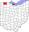
Gallia County 053 Gallipolis 30. April 1803 Washington und Adams Countys Gallien 31.069 1.214 km² (46.878 sq mi) 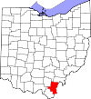
Geauga County 055 Chardon 1. März 1806 Trumbull County Ein Wort der Indianer für Waschbär 90.895 1.045 km² (40.366 sq mi) 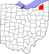
Greene County 057 Xenia 1. Mai 1803 Hamilton und Ross Countys General Nathanael Greene (1742–1786), Offizier im Unabhängigkeitskrieg 147.886 1.075 km² (41.488 sq mi) 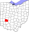
Guernsey County 059 Cambridge 1. März 1810 Belmont und Muskingum Countys Guernsey 40.792 1.352 km² (52.190 sq mi) 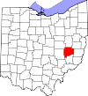
Hamilton County 061 Cincinnati 2. Januar 1790 Eines der ursprünglichen Countys Alexander Hamilton (1755/1757–1804) 845.303 1.055 km² (40.736 sq mi) 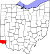
Hancock County 063 Findlay 1. April 1820 Logan County John Hancock (1737–1793) 71.295 1.376 km² (53.135 sq mi) 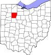
Hardin County 065 Kenton 1. April 1820 Logan County General John Hardin (1753–1792) 31.945 1.218 km² (47.029 sq mi) 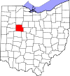
Harrison County 067 Cadiz 1. Februar 1813 Jefferson und Tuscarawas Countys General William H. Harrison (1773–1841) 15.856 1.045 km² (40.353 sq mi) 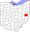
Henry County 069 Napoleon 1. April 1820 Shelby County Patrick Henry (1736–1799) 29.210 1.079 km² (41.650 sq mi) 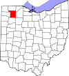
Highland County 071 Hillsboro 1. Mai 1805 Ross, Adams, und Clermont Countys Beschreibung der Landschaft 40.875 1.433 km² (55.328 sq mi) 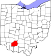
Hocking County 073 Logan 1. März 1818 Athens, Ross, und Fairfield Countys Eventuell vom Wort der Delaware-Indianer „Hoch-Hoch-ing“, das „Flasche“ bedeutet 28.241 1.095 km² (42.275 sq mi) 
Holmes County 075 Millersburg 20. Januar 1824 Coshocton, Wayne, und Tuscarawas Countys Major Andrew Holmes († 1814) 38.943 1.096 km² (42.299 sq mi) 
Huron County 077 Norwalk 7. März 1809 Portage und Cuyahoga Countys Huron-Indianer 59.847 1.276 km² (49.269 sq mi) 
Jackson County 079 Jackson 1. März 1816 Scioto, Gallia, Athens, und Ross Countys General Andrew Jackson (1767–1845) 32.641 1.089 km² (42.028 sq mi) 
Jefferson County 081 Steubenville 29. Juli 1797 Washington County Thomas Jefferson (1743–1826) 73.894 1.061 km² (40.961 sq mi) 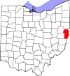
Knox County 083 Mount Vernon 1. März 1808 Fairfield County General Henry Knox 54.500 1.365 km² (52.712 sq mi) 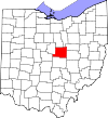
Lake County 085 Painesville 6. März 1840 Geauga und Cuyahoga Countys An den Ufern des Eriesees 227.511 591 km² (22.821 sq mi) 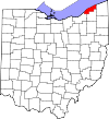
Lawrence County 087 Ironton 21. Dezember 1815 Gallia und Scioto Countys Captain James Lawrence (1781–1813) 62.319 1.178 km² (45.496 sq mi) 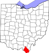
Licking County 089 Newark 1. März 1808 Fairfield County Nach den Salzlecken im County benannt 145.491 1.778 km² (68.650 sq mi) 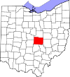
Logan County 091 Bellefontaine 1. März 1818 Champaign County General Benjamin Logan (~1742–1802) 46.005 1.187 km² (45.844 sq mi) 
Lorain County 093 Elyria 26. Dezember 1822 Huron, Cuyahoga, und Medina Countys Nach Lorraine in Frankreich 284.664 1.276 km² (49.250 sq mi) 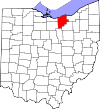
Lucas County 095 Toledo 20. Juni 1835 Wood, Sandusky, und Huron Countys Robert Lucas (1781–1853), Gouverneur von Ohio 455.054 882 km² (34.046 sq mi) 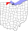
Madison County 097 London 1. März 1810 Franklin County President James Madison (1751–1836) 40.213 1.205 km² (46.544 sq mi) 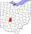
Mahoning County 099 Youngstown 1. März 1846 Columbiana und Trumbull Countys Mahoning River 257.555 1.075 km² (41.525 sq mi) 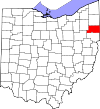
Marion County 101 Marion 1. April 1820 Delaware County General Francis Marion (1732–1795) 66.217 1.046 km² (40.384 sq mi) 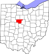
Medina County 103 Medina 18. Februar 1812 Portage County Medina, Hauptstadt von Al Madinah in Saudi-Arabien 151.095 1.092 km² (42.155 sq mi) 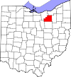
Meigs County 105 Pomeroy 1. April 1819 Gallia und Athens Countys Return Jonathan Meigs Jr. (1764–1825) 23.072 1.112 km² (42.942 sq mi) 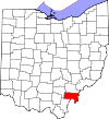
Mercer County 107 Celina 1. April 1820 Darke County General Hugh Mercer (1726–1777) 40.924 1.200 km² (46.327 sq mi) 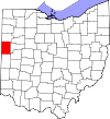
Miami County 109 Troy 1. März 1807 Montgomery County Miami-Indianer 98.868 1.054 km² (40.704 sq mi) 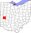
Monroe County 111 Woodsfield 29. Januar 1813 Belmont, Washington, und Guernsey Countys James Monroe (1758–1831) 15.180 1.180 km² (45.554 sq mi) 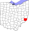
Montgomery County 113 Dayton 1. Mai 1803 Hamilton und Wayne Countys General Richard Montgomery (1738–1775) 559.062 1.196 km² (46.168 sq mi) 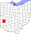
Morgan County 115 McConnelsville 29. Dezember 1817 Washington, Guernsey, und Muskingum Countys General Daniel Morgan (c.1735–1802) 14.897 1.082 km² (41.766 sq mi) 
Morrow County 117 Mount Gilead 1. März 1848 Knox, Marion, Delaware, und Richland Countys Jeremiah Morrow (1771–1852), Gouverneur von Ohio 31.628 1.052 km² (40.622 sq mi) 
Muskingum County 119 Zanesville 1. März 1803 Washington und Fairfield Countys Ein einheimisches Wort für „Dorf am Fluss“
oder
ein einheimisches Wort für „am Fluss“84.585 1.721 km² (66.463 sq mi) 
Noble County 121 Caldwell 1. April 1851 Monroe, Washington, Morgan, und Guernsey Countys John Noble (1785–1831), ein früher Siedler 14.058 1.033 km² (39.900 sq mi) 
Ottawa County 123 Port Clinton 6. März 1840 Erie, Sandusky, und Lucas Countys Ottawa-Indianer 40.985 660 km² (25.495 sq mi) 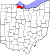
Paulding County 125 Paulding 1. April 1820 Darke County John Paulding (1758–1818) 20.293 1.078 km² (41.626 sq mi) 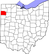
Perry County 127 New Lexington 1. März 1818 Washington, Fairfield, und Muskingum Countys Commodore Oliver Hazard Perry (1785–1819) 34.078 1.061 km² (40.978 sq mi) 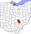
Pickaway County 129 Circleville 1. März 1810 Ross, Fairfield, und Franklin Countys Falschschreibung für den Piqua-Stamm
oder
Eine Ableitung des indianischen Wortes „Piqua“52.727 1.300 km² (50.191 sq mi) 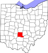
Pike County 131 Waverly 1. Februar 1815 Ross, Scioto, und Adams Countys General Zebulon Pike (1779–1813), Entdecker von Pikes Peak 27.695 1.143 km² (44.149 sq mi) 
Portage County 133 Ravenna 7. Juni 1807 Trumbull County Abgeleitet vom indianischen portage 152.061 1.275 km² (49.239 sq mi) 
Preble County 135 Eaton 1. März 1808 Montgomery und Butler Countys Captain Edward Preble (1761–1807) 42.337 1.100 km² (42.480 sq mi) 
Putnam County 137 Ottawa 1. April 1820 Shelby County General Israel Putnam (1718–1790), Offizier im Unabhängigkeitskrieg 34.726 1.253 km² (48.387 sq mi) 
Richland County 139 Mansfield 1. März 1808 Fairfield County Beschreibung des Bodens in dieser Gegend 128.852 1.287 km² (49.688 sq mi) 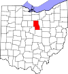
Ross County 141 Chillicothe 20. August 1798 Adams und Washington Countys James Ross 73.345 1.783 km² (68.841 sq mi) 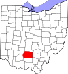
Sandusky County 143 Fremont 1. April 1820 Huron County Ein Wort der Irokesen für „kaltes Wasser“ 61.792 1.060 km² (40.918 sq mi) 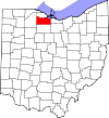
Scioto County 145 Portsmouth 1. Mai 1803 Adams County Scioto River; Das Wort bedeutet „Hirsch“ in der Sprache der Wyandot 79.195 1.586 km² (61.227 sq mi) 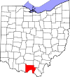
Seneca County 147 Tiffin 1. April 1820 Huron County Seneca-Indianer, welche hier lebten 58.683 1.426 km² (55.059 sq mi) 
Shelby County 149 Sidney 1. April 1819 Miami County General Isaac Shelby (1750–1826) 47.910 1.060 km² (40.927 sq mi) 
Stark County 151 Canton 13. Februar 1808 Columbiana County General John Stark (1728–1822) 378.098 1.492 km² (57.614 sq mi) 
Summit County 153 Akron 3. März 1840 Medina, Portage, und Stark Countys Weil hier der Ohio-Kanal seine höchste Stelle erreicht 542.899 1.069 km² (41.272 sq mi) 
Trumbull County 155 Warren 10. Juli 1800 Jefferson und Wayne Countys Jonathan Trumbull senior (1710–1785), Gouverneur von Connecticut 225.116 1.597 km² (61.648 sq mi) 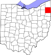
Tuscarawas County 157 New Philadelphia 15. März 1808 Muskingum County Tuscarawas River, „Fluss des offenen Mundes“
oder
Tuscarawas-Stamm90.914 1.470 km² (56.758 sq mi) 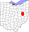
Union County 159 Marysville 1. April 1820 Delaware, Franklin, Logan, und Madison Countys So genannt, weil es aus vier anderen Countys vereinigt wurde 40.909 1.131 km² (43.665 sq mi) 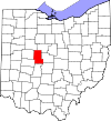
Van Wert County 161 Van Wert 1. April 1820 Darke County Isaac Van Wart (1760–1828), der den Spion John André während des Amerikanischen Unabhängigkeitskrieges festnahm 29.659 1.062 km² (41.009 sq mi) 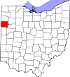
Vinton County 163 McArthur 23. März 1850 Athens, Gallia, Hocking, Jackson, und Ross Countys Samuel Finley Vinton (1792–1862) 12.806 1.072 km² (41.408 sq mi) 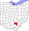
Warren County 165 Lebanon 1. Mai 1803 Hamilton County General Joseph Warren (1741–1775), Offizier im Amerikanischen Unabhängigkeitskrieg 158.383 1.035 km² (39.963 sq mi) 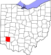
Washington County 167 Marietta 27. Juli 1788 Eines der ursprünglichen Countys George Washington (1732–1799) 63.251 1.645 km² (63.515 sq mi) 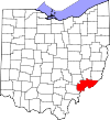
Wayne County 169 Wooster 1. März 1808 Aus noch nicht zugeteiltem Gebiet General Anthony Wayne (1745–1796), Offizier im Unabhängigkeitskrieg 111.564 1.438 km² (55.536 sq mi) 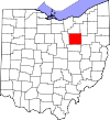
Williams County 171 Bryan 1. April 1820 Darke County David Williams (1754–1831) 39.188 1.092 km² (42.174 sq mi) 
Wood County 173 Bowling Green 1. April 1820 Aus noch nicht zugeteiltem Gebiet Eleazer D. Wood (1783–1814), Gründer von Fort Meigs 121.065 1.599 km² (61.732 sq mi) 
Wyandot County 175 Upper Sandusky 3. Februar 1845 Marion, Crawford, und Hardin Countys Wyandot-Indianer 22.908 1.051 km² (40.561 sq mi) 
Einzelnachweise
- ↑ a b EPA County FIPS Code Listing. EPA. Abgerufen am 9. April 2007.
- ↑ a b c d NACo – Find a County. Archiviert vom Original am 12. Juli 2008. Abgerufen am 22. Juli 2007.
- ↑ a b Federal Roster: Counties of Ohio, Derivation of Name and Date of Erection. Abgerufen am 22. Juli 2007. (Link nicht mehr abrufbar) [nicht mehr verfügbar]
- ↑ a b Ohio Genealogy Clickable County Map. Archiviert vom Original am 9. Juni 2008. Abgerufen am 25. Juli 2007. [nicht mehr verfügbar]
- ↑ The origin of Ohio's country names. rootsweb. Abgerufen am 22. März 2009.
- ↑ Resolution of 111th Ohio General Assembly designating John Allen as the person for which Allen County was named
- ↑ Ashtabula, Encyclopædia Britannica, 2007. Abgerufen am 19. November 2007
- ↑ Cuyahoga River, Encyclopædia Britannica, 2007. Abgerufen am 19. November 2007
Alabama | Alaska | Arizona | Arkansas | Colorado | Connecticut | Delaware | Florida | Georgia | Hawaii | Idaho | Illinois | Indiana | Iowa | Kalifornien | Kansas | Kentucky | Louisiana | Maine | Maryland | Massachusetts | Michigan | Minnesota | Mississippi | Missouri | Montana | Nebraska | Nevada | New Hampshire | New Jersey | New Mexico | New York | North Carolina | North Dakota | Ohio | Oklahoma | Oregon | Pennsylvania | Rhode Island | South Carolina | South Dakota | Tennessee | Texas | Utah | Vermont | Virginia | Washington | West Virginia | Wisconsin | Wyoming
Wikimedia Foundation.
Schlagen Sie auch in anderen Wörterbüchern nach:
Liste der Städte in Ohio — Im amerikanischen Bundesstaat Ohio wird eine Stadt gemäß Abschnitt 703.01(A) des Ohio Revised Code wie folgt definiert: “Municipal corporations, which, at the last federal census, had a population of five thousand or more, or five thousand… … Deutsch Wikipedia
Liste der Countys auf Hawaii — Counties Hawaiis Der US Bundesstaat Hawaii ist in 5 Countys unterteilt: Lage County Fläche Einwohner 1. Juli 2005 Verwaltungs sitz Einwohner 1. April 2000 Bereich … Deutsch Wikipedia
Liste der Countys in Lousiana — Parishes in Louisiana Der US Bundesstaat Louisiana in den Vereinigten Staaten ist in 64 Parishes unterteilt. Ihr Status entspricht dem der Countys in den anderen Bundesstaaten. Acadia … Deutsch Wikipedia
Liste der Countys in Nevada — Der US Bundesstaat Nevada ist in 17 Countys unterteilt. Die Hauptstadt Carson City ist eine unabhängige Stadt, zählt jedoch nach dem US Census Bureau als County. County Einwohner (1. Juli 2006) Verwaltungssitz Einwohner (1. Juli 2005) Carson City … Deutsch Wikipedia
Liste der Countys in Kentucky — Boone Ken ton Camp bell Pend leton Bracken Robertson … Deutsch Wikipedia
Liste der Countys in Michigan — Keweenaw Houghton Ontonagon Gogebic Iron Baraga … Deutsch Wikipedia
Liste der Countys in Montana — LN FH LK SA MN MS … Deutsch Wikipedia
Liste der Countys in Maryland — Garrett Allegany Washington Frederick Carroll Baltimore … Deutsch Wikipedia
Liste der Counties in North Carolina — Der US Bundesstaat North Carolina ist in 100 Countys unterteilt: Alamance County Alexander County Alleghany County Anson County Ashe County Avery County Beaufort County Bertie County … Deutsch Wikipedia
Liste der Grafschaften in Neumexiko — Der US Bundesstaat New Mexico ist in 33 Countys unterteilt. County Einwohner 1. Juli 2005 Verwaltungssitz Einwohner 1. Juli 2004 Bernalillo 603.562 Albuquerque 484.246 Catron 3.409 Reserve 345 Chav … Deutsch Wikipedia
Liste der Countys in Ohio


18+
© Academic, 2000-2024
- Kontaktieren Sie uns: Unterstützung, Werbung
Wörterbücher Export, schritte mit PHP, Joomla, Drupal, WordPress, MODx.