- Madron (Cornwall)
-
Madron 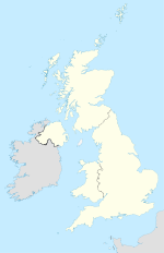

Madron Lage von Madron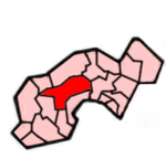 Lage im ehemaligen District Penwith
Basisdaten Status Civil Parish Region South West England Zerem. Grafschaft Cornwall Trad. Grafschaft Cornwall Verwaltungssitz Madron Einwohner 1.466 (2001) Postleitzahl TR20 8xx Telefonvorwahl 01736 Teilorte Tredinnick, Lower Ninnes, New Mill, Newbridge, Tregavarah Website Website von Madron Madron ist ein Ort und eine Gemeinde im ehemaligen District Penwith der Grafschaft Cornwall in England. Die Gemeinde umfasst die Siedlungen Tredinnick, Lower Ninnes, New Mill, Newbridge und Tregavarah. Insgesamt grenzt sie an sieben Gemeinden des Districts.
Weblinks
 Commons: Madron – Sammlung von Bildern, Videos und Audiodateien
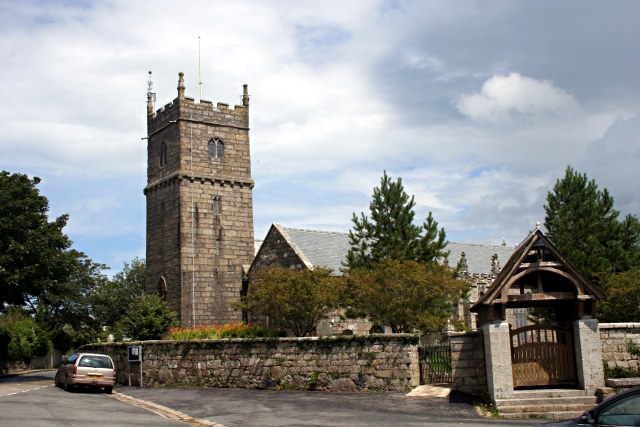
 Pfarrkirche von Madron
Gwinear-Gwithian | Hayle | Ludgvan | Madron | Marazion | Morvah | Paul | Penzance | Perranuthnoe | Sancreed | Sennen | St Buryan | St Erth | St Hilary | St Ives | St Just in Penwith | St Levan | St. Michael’s Mount | Towednack | Zennor
Wikimedia Foundation.
Schlagen Sie auch in anderen Wörterbüchern nach:
Madron — bezeichnet: einen Ort in Cornwall in England, siehe Madron (Cornwall) einen Berg im Mangfallgebirge der Bayerischen Voralpen, siehe Madron (Mangfallgebirge) einen Westernfilm aus dem Jahre 1970, siehe Madron (Film) Diese Seite ist eine … Deutsch Wikipedia
Madron Parish Church — Coordinates: 50°07′53″N 5°33′52″W / 50.1313°N 5.5645°W / 50.1313; 5.5645 … Wikipedia
Madron Monastery — was a Celtic monastery at Madron in Cornwall, UK. References Coordinates: 50°07′57″N 5°33′54″W / 50.132619°N 5.564984°W … Wikipedia
Madron — (spr. mēdrön), Stadt in der engl. Grafschaft Cornwall, 2 km nordwestlich von Penzance, hat eine alte gotische Kirche und (1901) 3486 Einw. 1 km nordwestlich Reste einer uralten Taufkapelle … Meyers Großes Konversations-Lexikon
Madron — Coordinates: 50°07′58″N 5°33′54″W / 50.13279°N 5.56496°W / 50.13279; 5.56496 Madron (Cornish … Wikipedia
Hundreds of Cornwall — Cornwall was originally divided into hundreds, some with the suffix shire as in Pydershire, East and West Wivelshire and Powdershire which were first recorded as names between 1184 1187. [Gover,1946, Research paper at the Courtney Library, Royal… … Wikipedia
Civil parishes in Cornwall — A map of Cornwall (Cornish: Kernow); the Isles of Scilly (Cornish: Enesek Syllan) are in the extreme bottom left. A civil parish is a subnational entity, forming the lowest unit of local government in Engla … Wikipedia
History of Cornwall — Boscawen Un stone circle looking north Ruin of Cornish tin mine … Wikipedia
St Hilary, Cornwall — Coordinates: 50°07′50″N 5°25′40″W / 50.13044°N 5.427820°W / 50.13044; 5.427820 … Wikipedia
Mullion, Cornwall — Coordinates: 50°01′37″N 5°14′28″W / 50.027°N 5.241°W / 50.027; 5.241 … Wikipedia
Madron (Cornwall)


18+
© Academic, 2000-2024
- Kontaktieren Sie uns: Unterstützung, Werbung
Wörterbücher Export, schritte mit PHP, Joomla, Drupal, WordPress, MODx.