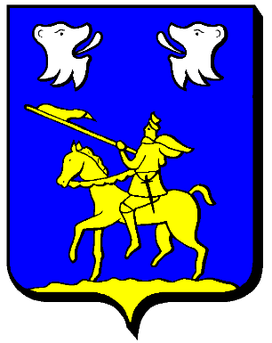
- Moncheux
-
Moncheux 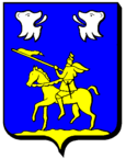
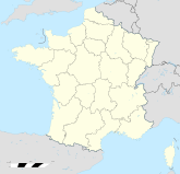

Region Lothringen Département Moselle Arrondissement Metz-Campagne Kanton Verny Koordinaten 48° 56′ N, 6° 20′ O48.9358333333336.3366666666667322Koordinaten: 48° 56′ N, 6° 20′ O Höhe 322 m (242–365 m) Fläche 7,35 km² Einwohner 150 (1. Jan. 2008) Bevölkerungsdichte 20 Einw./km² Postleitzahl 57420 INSEE-Code 57472 Moncheux ist eine französische Gemeinde, die im Département Moselle und in der Region Lothringen liegt. Sie gehört zum Arrondissement Metz-Campagne und zum Kanton Verny. Der Ort hat 150 Einwohner (Stand 1. Januar 2008).
Geografie
Moncheux liegt auf halbem Weg zwischen Metz und Château-Salins auf einer Höhe zwischen 242 und 365 m über dem Meeresspiegel. Das Gemeindegebiet umfasst 7,35 km².
Geschichte
Das Dorf trug 1915–18 den verdeutschten Namen Monchern und 1940–44 Mingen.
Bevölkerungsentwicklung
Jahr 1962 1968 1975 1982 1990 1999 2007 Einwohner 78 68 55 71 95 120 150 Buchy | Cheminot | Chérisey | Chesny | Coin-lès-Cuvry | Coin-sur-Seille | Cuvry | Féy | Fleury | Foville | Goin | Jury | Liéhon | Lorry-Mardigny | Louvigny | Marieulles | Marly | Mécleuves | Moncheux | Orny | Pagny-lès-Goin | Peltre | Pommérieux | Pontoy | Pouilly | Pournoy-la-Chétive | Pournoy-la-Grasse | Sailly-Achâtel | Saint-Jure | Secourt | Sillegny | Silly-en-Saulnois | Solgne | Verny | Vigny | Vulmont
Wikimedia Foundation.
Schlagen Sie auch in anderen Wörterbüchern nach:
Moncheux — Moncheux … Wikipedia
Moncheux — País … Wikipedia Español
Moncheux — 48° 56′ 12″ N 6° 20′ 15″ E / 48.9367, 6.3375 … Wikipédia en Français
Pullingen — Pouilly … Deutsch Wikipedia
Metz — For other uses, see Metz (disambiguation). Metz Commune Municipalité de Metz From top: Panora … Wikipedia
Communes of the Moselle department — The following is a list of the 730 communes of the Moselle département, in France. (CAF) Communauté d agglomération de Forbach, created in 2003. (CAM) Communauté d agglomération de Metz Métropole, created in 2002. (CAS) Communauté d agglomération … Wikipedia
Thionville — Thionville … Wikipedia
Dabo, Moselle — Dabo … Wikipedia
Dieuze — Dieuze … Wikipedia
Château-Salins — Town hall … Wikipedia
Moncheux

18+
© Academic, 2000-2024
- Kontaktieren Sie uns: Unterstützung, Werbung
Wörterbücher Export, schritte mit PHP, Joomla, Drupal, WordPress, MODx.