- Khvostof Island
-
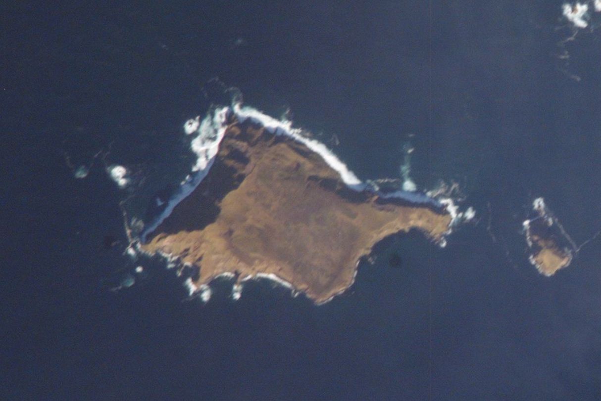
Khvostof NASA-Bild von Khvostof, rechts Pyramid Island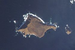
Gewässer Pazifischer Ozean Inselgruppe Rat Islands Geographische Lage 51° 58′ 30″ N, 178° 17′ 0″ O51.975178.28333333333265Koordinaten: 51° 58′ 30″ N, 178° 17′ 0″ O 

Höchste Erhebung 265 m Einwohner (unbewohnt) Karte der West-Aleuten, Khvostof im Osten (10)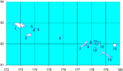
Khvostof Island (aleutisch:Atanax̂) ist eine unbewohnte Insel der Rat Islands und gehört zu den Aleuten. Die Insel steigt von ihrem westlichen Ufer steil auf eine Höhe von 256 m an. Der Ostteil der Insel ist durch ein relativ gleichmäßiges Plateau geprägt.
Khvostof ist wahrscheinlich der Überrest eines großen Vulkankegels, der im Tertiär in Folge einer gewaltigen Eruption explodierte.
Weblinks
Inseln der Rat IslandsAmchitka | Bird Rock | Davidof | Khvostof | Kiska | Little Kiska | Little Sitkin | Lopy | Pyramid | Rat | Segula | Semisopochnoi | Tanadak
Wikimedia Foundation.
Schlagen Sie auch in anderen Wörterbüchern nach:
Khvostof Island — Location map Alaska label= lat=52.161362 long= 186.606732 position=right width=250 float=right caption=Location in AlaskaKhvostof Island (Atanax̂ [Bergsland, K Aleut Dictionary Fairbanks: Alaska Native Language Center, 1994] in Aleut) is an… … Wikipedia
Lopy Island — Vorlage:Infobox Insel/Wartung/Fläche fehlt Lopy Island NASA Bild von Lopy, an der Nordspitze von Khvostof Gewä … Deutsch Wikipedia
Davidof Island — NASA Picture of Davidof, on left side Khvostof Island … Wikipedia
Amchitka Island — Die Standorte der drei Kernwaffentests Bild aus Film über den Test Long Shot Amchitka ist eine vulkanische, tektonisch instabile Ins … Deutsch Wikipedia
Pyramid Island (Alaska) — Vorlage:Infobox Insel/Wartung/Fläche fehlt Pyramid Island NASA Bild von Khvostof und … Deutsch Wikipedia
Davidof Island — Vorlage:Infobox Insel/Wartung/Fläche fehlt Davidof Island NASA Bild von Davidof, links Khvostof … Deutsch Wikipedia
Nunivak Island — Nunivak Maskette – Nunivak … Wikipedia
Medny Island — Map showing position of Commander Islands to the east of Kamchatka. The smaller island in the east is Medny and the larger island is Bering Island. Medny Island (also spelled Mednyy, Russian: остров Медный, sometimes called Copper Island in… … Wikipedia
Nelson Island (Alaska) — Nelson Native name: Qaluyaaq … Wikipedia
Unalaska Island — Unalaska Native name: Nawan Alaxsxa[1] Map of the island … Wikipedia
Khvostof Island

18+
© Academic, 2000-2024
- Kontaktieren Sie uns: Unterstützung, Werbung
Wörterbücher Export, schritte mit PHP, Joomla, Drupal, WordPress, MODx.