- Cle Elum River
-
Cle Elum River 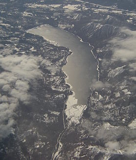
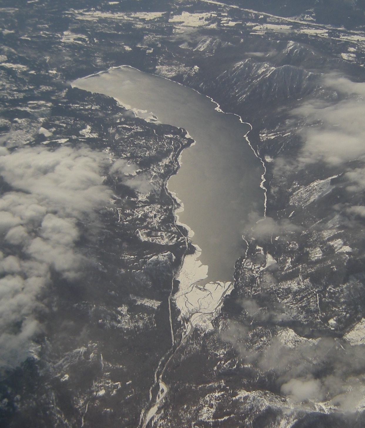
Luftbild des Cle Elum Lake von Norden
Daten Gewässerkennzahl US: 1517823 Lage Washington, Vereinigte Staaten Flusssystem Columbia River Abfluss über Yakima River → Columbia River → Pazifischer Ozean Ursprung Am Mount Daniel
47° 35′ 19″ N, 121° 10′ 1″ W47.5887238-121.1670408Mündung bei Cle Elum in den Yakima River 47.1770635-120.9970277592Koordinaten: 47° 10′ 37″ N, 120° 59′ 49″ W
47° 10′ 37″ N, 120° 59′ 49″ W47.1770635-120.9970277592Mündungshöhe 592 m Länge 45 km[1] Einzugsgebiet 525 km²[2] Durchflossene Stauseen Cle Elum Lake Kleinstädte Cle Elum Der Cle Elum River ist ein Fluss im Kittitas County im US-Bundesstaat Washington. Der 45 km lange Fluss entspringt am Osthang des Mount Daniel in der Kaskadenkette und fließt durch den Wenatchee National Forest südwärts in den Cle Elum Lake. Nach Verlassen des Sees fließt er südöstlich und mündet bei der Stadt Cle Elum in den Yakima River. Der Name des Flusses kommt aus der Sprache der Yakama und bedeutet Schnelles Wasser. Der Oberlauf des Flusses ist ein beliebtes Wildwasserrevier für Rafting und Kajakfahrer.
Der Cle Elum Lake ist ein natürlicher See, der durch den Cle Elum Dam weiter aufgestaut wird. Der Erddamm wurde als Teil des Yakima-Project vom Bureau of Reclamation zur künstlichen Bewässerung von 1931 bis 1933 erbaut und liegt 13 km nordwestlich der Stadt Cle Elum. Der 50 m hohe Damm hat ein Volumen von über 1 Mio. m³. Der 19,4 km² große Stausee ist 13 km lang und hat ein Stauvolumen von 538 Mio. m³. Der See ist ein beliebtes Erholungsgebiet mit Campingplatz, Wassersport- und Angelmöglichkeiten.
Weblinks
- Cle Elum River im Geographic Names Information System des United States Geological Survey
- Bureau of Reclamation: Cle Elum Dam
- Cle Elum Lake bei www.findlakes.com
Einzelnachweise
- ↑ www.britannica.com. Abgerufen am 12. Mai 2011.
- ↑ USGS: Cle Elum River. Abgerufen am 12. Mai 2011.
Kategorien:- Flusssystem Columbia River
- Fluss in Washington
- Fluss in Nordamerika
Wikimedia Foundation.