Port Sorell

Port Sorell
Port Sorell
Staat: Australien Australien
Bundesstaat: Flag Australia tasmania.png Tasmanien
Koordinaten: 41° 10′ S, 146° 33′ O-41.166666666667146.55Koordinaten: 41° 10′ S, 146° 33′ O
 
Einwohner: 2.211 (2006 [1])
 
Zeitzone: AEST (UTC+10)
LGA: City of Burnie
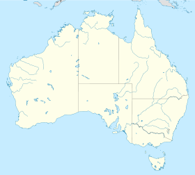
Port Sorell (Australien)
Port Sorell
Port Sorell


Port Sorell ist eine Stadt mit 2211 Einwohnern an der Nordküste Tasmaniens, die 117 Kilometer nördlich von Launceston, 20 Kilometer von Devonport und 254 Kilometer von Hobart entfernt liegt.

Inhaltsverzeichnis

Geschichte

Bis zum Eintreffen der Europäer lebte der Aborigine-Stamm der Punnilerpaner in diesem Gebiet. 1805 wurde der Rubicon River, der durch den Ort fließt, erforscht. Die Weißen ließen sich am Fluss nieder und gründeten die Ortschaft Burgess, die 1822 nach Vizegouverneur William Sorell in Port Sorell benannt wurde. Der Ort war zu jener Zeit der Hafen, der am häufigsten angelaufen wurde und die größte Stadt an der tasmanischen Nordküste. Port Sorell beherbergte ein Gefängnis am Watch House Hill, das später eingeebnet wurde. Ferner soll die Stadt einmal in ihrer Geschichte in Gänze durch ein Buschfeuer vernichtet worden sein.

Heute

Port Sorell ist im Sommer ein Ort, der von Touristen zum Wassersport, Wandern und zum Erleben der Wildnis belebt wird. Wasserski- und Kajakfahren bietet sich an den Küstengewässern an, aber auch die Ruhe an Sanddünen. Bei Port Sorell liegen die Strände Shearwater, Hawley Beach und Freers Beach, die die Besucher anziehen und diesem Ort die Bezeichnung Port of Golden Beaches gaben. Angeln vom im Ort befindlichen Ponton, eine Rampe zum Boote ins Wasser lassen, ein Campingplatz und ein Golfplatz sind vorhanden. Durch die Stadt fließt der Rubicon River. An diesem Fluss liegt der Narawntapu National Park, der sich unweit des Ortes befindet.

Quellen

Einzelnachweise

  1. Australian Bureau of Statistics (25. Oktober 2007): Port Sorell (Urban Centre/Locality) (Englisch). 2006 Census QuickStats. Abgerufen am 13. April 2009.

Wikimedia Foundation.

Игры ⚽ Поможем сделать НИР

Schlagen Sie auch in anderen Wörterbüchern nach:

  • Port Sorell — Original name in latin Port Sorell Name in other language Port Sorell, Порт Сорелл State code AU Continent/City Australia/Hobart longitude 41.16652 latitude 146.55283 altitude 5 Population 2294 Date 2012 02 28 …   Cities with a population over 1000 database

  • Port Sorell, Tasmania — Infobox Australian Place | type = town name = Port Sorell state = tas caption = lga = Latrobe Council postcode = 7307 est = pop = 2,211 pop footnotes= elevation= elevation footnotes= maxtemp = mintemp = rainfall = stategov = Braddon fedgov =… …   Wikipedia

  • Sails on Port Sorell Boutique Apartments — (Порт Сорелл,Австралия) Категория отеля: 4 звездочный отель Адрес …   Каталог отелей

  • Sorell — See also Sorel and SorrellSorell may refer to: * William Sorell (1775–1848), Lieutenant Governor of Tasmania * Sorell, Tasmania north east of Hobart * Cape Sorell, Tasmania on the west coast of Tasmania *Port Sorell, Tasmania on the north coast …   Wikipedia

  • Sorell — Sorell, Hafen an der Nordküste von Vandiemensland (Australien), westlich von Port Dalrymple, dabei die von den Engländern gegründete Stadt Sorelltown …   Pierer's Universal-Lexikon

  • Sorell, Tasmania — Infobox Australian Place | type = town name = Sorell state = tas caption = Information Centre main street, Sorell lga = Sorell Council postcode = 7172 est = pop = 3,606 (2001) Combined Sorell Midway Point population. cite web… …   Wikipedia

  • Sorell Causeway — Infobox Bridge bridge name=Sorell Causeway caption= The western approach official name= carries= crosses= Orielton Lagoon locale= Hobart, Tasmania maint= Department of Infrastructure, Energy and Resources id= design= Causeway mainspan= length=… …   Wikipedia

  • Port Arthur massacre (Australia) — Infobox civilian attack title = Port Arthur Massacre caption = Location of Port Arthur, where the majority of the shootings occurred location = Port Arthur, Tasmania, Australia target = Port Arthur Historic Site date = April 28, 1996 time = 1pm… …   Wikipedia

  • Port Arthur, Tasmania — Infobox Australian Place | type = town name = Port Arthur state = tas caption = The iconic view of the penitentiary originally built as a flour mill, across the water. lga = Tasman Council postcode = 7182 est = 1830 pop = 499 pop footnotes=… …   Wikipedia

  • Geology of Tasmania — Tasmania has a varied geological history, with the world s biggest exposure of diabase, or dolerite. Rocks from the Neoproterozoic, Paleozoic and Mesozoic time periods appear. It is one of the few southern hemisphere areas glaciated during the… …   Wikipedia

Share the article and excerpts

Direct link
Do a right-click on the link above
and select “Copy Link”