- Mooresville (Indiana)
-
Mooresville 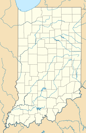

Mooresville Lage in IndianaBasisdaten Staat: Vereinigte Staaten Bundesstaat: Indiana County: Koordinaten: 39° 36′ N, 86° 22′ W39.608055555556-86.369166666667217Koordinaten: 39° 36′ N, 86° 22′ W Zeitzone: Eastern Standard Time (UTC−5) Einwohner: 9273 (Stand: 2000) Bevölkerungsdichte: 648,5 Einwohner je km² Fläche: 14,4 km² (ca. 6 mi²)
davon 14,3 km² (ca. 6 mi²) LandHöhe: 217 m Postleitzahl: 46158 Vorwahl: +1 317 FIPS: 18-50976 GNIS-ID: 0439412 Mooresville ist eine Ortschaft im Brown Township, im Morgan County, im US-Bundesstaat Indiana. Bei der Volkszählung im Jahr 2000 wurden 9.273 Einwohner registriert.
Geographie
Mooresville liegt 39°36'29" Nord, 86°22'9" West.
Nach Angaben des United States Census Bureau bedeckt die Stadt eine Fläche von 14,4 km², 14,1 km² davon sind Land und 0,1 km² sind wasserbedeckt (0,36 %).
Demografie
Die bei der Volkszählung im Jahr 2000 ermittelten 9.273 Einwohner von Mooresville lebten in 3.535 Haushalten; darunter waren 2.594 Familien. Die Bevölkerungsdichte betrug 646 pro km². Im Ort wurden 3.688 Wohneinheiten erfasst, davon waren 3.535 bewohnt.
98,52 % der Einwohner sind Kaukasier, 0,09 % Afroamerikaner, 0,30 % Indianer, 0,40 % Asiaten, 0,02 % pazifischer Herkunft, 0,18 % verschiedener Herkunft.
39,1 % der Haushalte haben Kinder unter 18 Jahren; 57,5 % sind verheiratete zusammenlebende Paare.
Der Median des Haushaltseinkommens betrug 47.292 $, der Median des Familieneinkommens 52.543 $. Das Prokopfeinkommen in Mooresville betrug 21.504 $. Unter der Armutsgrenze lebten 4,2 % der Familien und 4,3 % der Bevölkerung.
Einzelnachweise
- ↑ Mooresville town, Indiana, Datenblatt mit den Ergebnissen der Volkszählung im Jahre 2000 bei factfinder.census.gov.
 Orte in der Indianapolis Metropolitan Area
Städte mit über 20.000 Einwohnern:
Carmel | Fishers | Greenwood | Lawrence | Noblesville | Plainfield | WestfieldStädte mit weniger als 20.000 Einwohnern:
Arcadia | Avon | Bargersville | Beech Grove | Brooklyn | Brownsburg | Cicero | Clermont | Cloverdale | Cumberland | Danville | Edinburgh | Fairland | Fortville | Franklin | Greencastle | Greenfield | Lebanon | Martinsville | McCordsville | Mooresville | Morristown | New Palestine | New Whiteland | Pittsboro | Princes Lakes | Shelbyville | Sheridan | Speedway | Southport | St. Paul | Thorntown | Whiteland | ZionsvilleCountys:
Boone | Brown | Hamilton | Hancock | Hendricks | Johnson | Marion | Morgan | Putnam | Shelby
Wikimedia Foundation.
Schlagen Sie auch in anderen Wörterbüchern nach:
Mooresville, Indiana — Town … Wikipedia
Mooresville (Indiana) — Mooresville Pueblo de los Estados Unidos … Wikipedia Español
Mooresville — ist der Name mehrerer Orte in den Vereinigten Staaten: Mooresville (Alabama) Mooresville (Indiana) Mooresville (Kentucky) Mooresville (Maine) Mooresville (Missouri) Mooresville (North Carolina) Mooresville (Ohio) Mooresville (Tennessee)… … Deutsch Wikipedia
Mooresville — may refer to: Mooresville, Alabama Mooresville, Indiana Mooresville, Missouri Mooresville, North Carolina This disambiguation page lists articles about distinct geographical locations with the same name. If an … Wikipedia
Indiana locations by per capita income — Indiana has the twenty seventh highest per capita income in the United States of America, at $20,397 (2000). Its personal per capita income is $28,783 (2003).Indiana Counties Ranked by Per Capita IncomeThere are ninety two counties located in… … Wikipedia
Indiana District (LCMS) — The Indiana District is one of the 35 districts of the Lutheran Church Missouri Synod (LCMS), and encompasses the state of Indiana as well as most of western Kentucky; the remainder of Kentucky is divided between the Mid South District and the… … Wikipedia
Mooresville — Mooresville, MO U.S. village in Missouri Population (2000): 89 Housing Units (2000): 48 Land area (2000): 0.181691 sq. miles (0.470578 sq. km) Water area (2000): 0.000000 sq. miles (0.000000 sq. km) Total area (2000): 0.181691 sq. miles (0.470578 … StarDict's U.S. Gazetteer Places
Mooresville, IN — U.S. town in Indiana Population (2000): 9273 Housing Units (2000): 3688 Land area (2000): 5.536014 sq. miles (14.338209 sq. km) Water area (2000): 0.016097 sq. miles (0.041690 sq. km) Total area (2000): 5.552111 sq. miles (14.379899 sq. km) FIPS… … StarDict's U.S. Gazetteer Places
Indiana State Road 267 — Infobox road state=IN type=IN route=267 alternate name= length mi=28.7 length round=1 length ref= [http://illi indi.com/EndsPage.php?id=1267 section=1 Indiana Highway Ends SR 267] ] established= direction a=South starting terminus= junction=… … Wikipedia
Indiana State Road 144 — Infobox road state=IN type=IN route=144 alternate name= length mi=12.9 length round=2 length notes=Western segment: convert|7.8|mi|km|2 Eastern segment: convert|5.1|mi|km|2 established= direction a= starting terminus= in Mooresville junction= in… … Wikipedia
Mooresville (Indiana)

18+
© Academic, 2000-2024
- Kontaktieren Sie uns: Unterstützung, Werbung
Wörterbücher Export, schritte mit PHP, Joomla, Drupal, WordPress, MODx.