Kaibab — can mean:* Kaibab, Arizona, a small community in the United States * Kaibab Band of Paiute Indians of the Kaibab Indian Reservation * Kaibab National Forest, Arizona * Kaibab Limestone, in Arizona, Utah, Nevada, and California * Kaibab Plateau in … Wikipedia
Kaibab — Kaibab, AZ U.S. Census Designated Place in Arizona Population (2000): 275 Housing Units (2000): 116 Land area (2000): 189.513027 sq. miles (490.836465 sq. km) Water area (2000): 0.007982 sq. miles (0.020672 sq. km) Total area (2000): 189.521009… … StarDict's U.S. Gazetteer Places
Kaibab, AZ — U.S. Census Designated Place in Arizona Population (2000): 275 Housing Units (2000): 116 Land area (2000): 189.513027 sq. miles (490.836465 sq. km) Water area (2000): 0.007982 sq. miles (0.020672 sq. km) Total area (2000): 189.521009 sq. miles… … StarDict's U.S. Gazetteer Places
Kaibab (Arizona) — Kaibab Lugar designado por el censo de los Estados Unidos … Wikipedia Español
Kaibab National Forest — Infobox protected area | name = Kaibab National Forest iucn category = VI caption = locator x = 60 locator y = 100 location = Coconino, Yavapai, and Mohave counties, Arizona, USA nearest city = Williams, AZ lat degrees = 35 lat minutes = 57 lat… … Wikipedia
Kaibab Squirrel — Taxobox name = Kaibab Squirrel image width = 225px regnum = Animalia phylum = Chordata classis = Mammalia ordo = Rodentia familia = Sciuridae genus = Sciurus species = S. aberti subspecies = S. a. kaibabensis trinomial = Sciurus aberti… … Wikipedia
Kaibab National Forest — der Sycamore Canyon im Kaibab National Forest Der Kaibab National Forest ist ein Nationalforst im US Bundesstaat Arizona, der an den Grand Canyon grenzt und unter der Verwaltung des United States Forest Service steht. Der Wald hat eine Fläche von … Deutsch Wikipedia
Kaibab Limestone — The Kaibab is a geologic formation that is spread across the U.S. states of northern Arizona, southern Utah, east central Nevada and southeast California. This geologic unit is part of the Park City Group in Nevada and Utah and is sometimes… … Wikipedia
Kaibab Plateau — The Kaibab Plateau is located in northern Arizona in the United States. The plateau, part of the larger Colorado Plateau, is bordered on the south by the Grand Canyon and reaches an elevation of 9,241 feet (2,817 m) above sea level. The Plateau… … Wikipedia
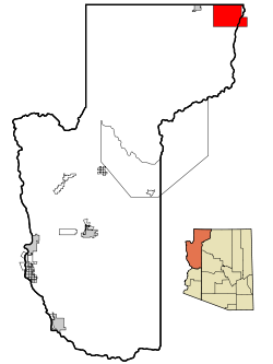
Kaibab, Arizona — Infobox Settlement official name = Kaibab, Arizona settlement type = CDP imagesize = image caption = image imagesize = image caption = image mapsize = 250px map caption = Location in Mohave County and the state of Arizona mapsize1 = map caption1 … Wikipedia
 Lage im County und in Arizona