- Franconia Notch State Park
-
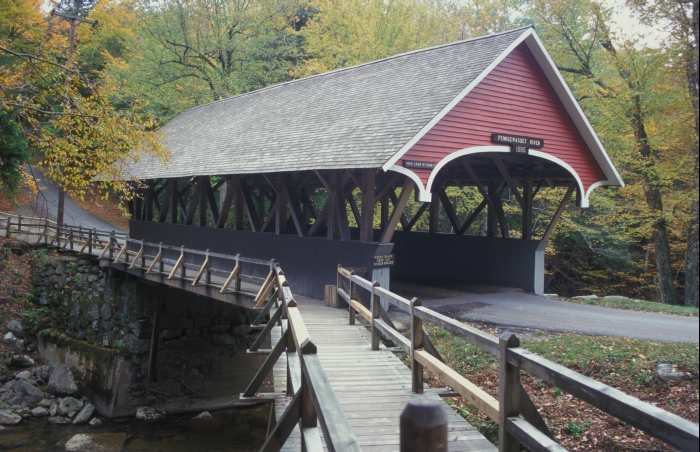
 Eine überdachte Brücke, die Pemigewassett covered bridge, im Franconia Notch State Park
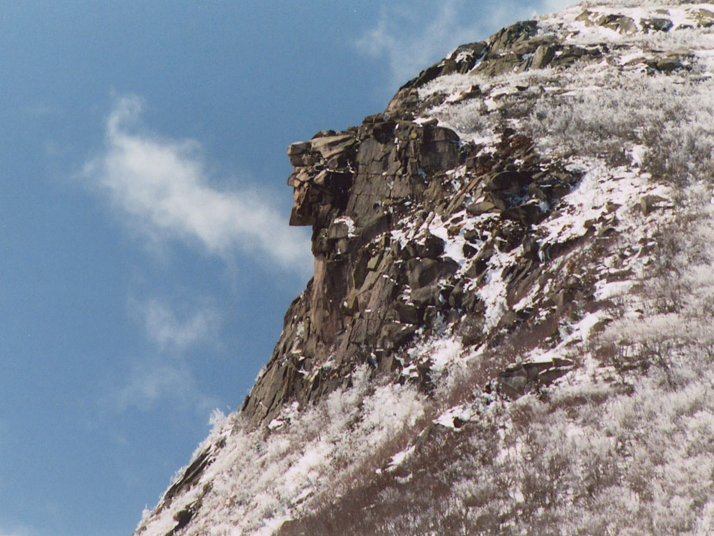
Der Franconia Notch State Park ist ein State Park des US-Bundesstaates New Hampshire mit einer Größe von 2700 Hektar. Er liegt – eingebettet in den White Mountain National Forest – im Norden dieses Staates. 1972 wurde das Gebiet als National Natural Landmark eingetragen.[1] Zu seinen Hauptattraktionen zählen eine 240 Meter lange Klamm, eine Luftseilbahn, die auf den Gipfel des Cannon Mountain (Berg) in knapp 1300 Metern Höhe fährt, und der Profile Lake (See). Über die Grenzen New Hampshires hinaus bekannt war der Old Man of the Mountain („Alter Mann des Berges“), eine natürliche Granitformation am Cannon Mountain, die vom Profile Lake aus wie das zerklüftete Gesicht eines Menschen wirkte, am 3. Mai 2003 aber trotz wiederholter Rettungsversuche zu Tal stürzte.[2]
Galerie
-
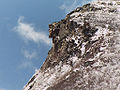
Der "Old Man" am 26. April 2003
-
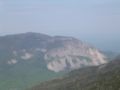
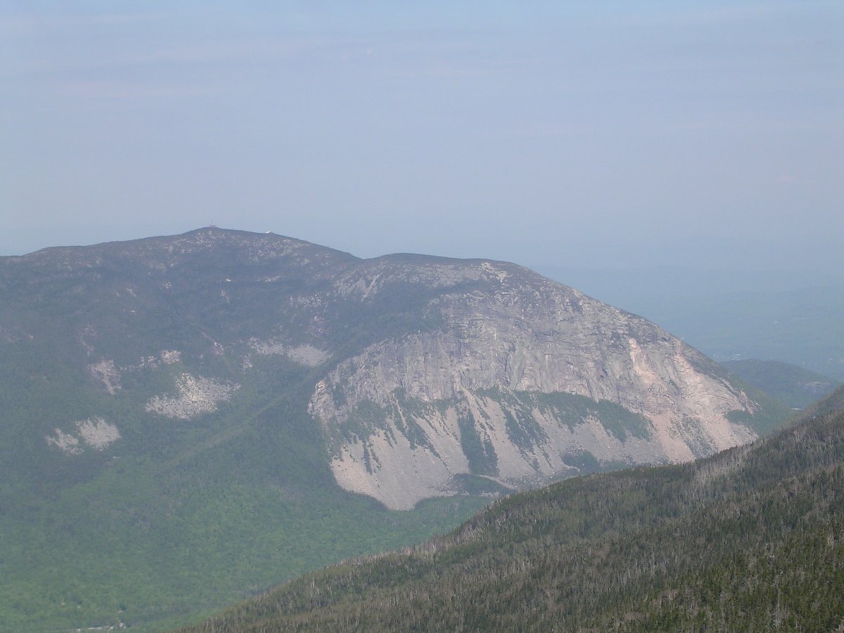
Cannon Mountain
-
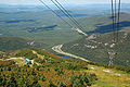
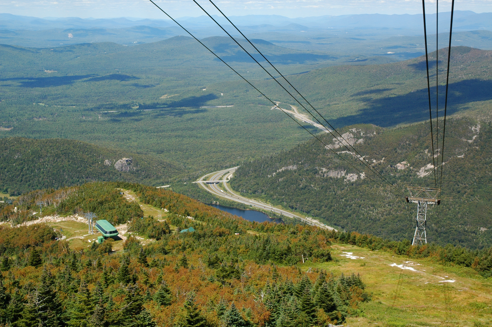
Blick vom Cannon Mountain nach Nordosten auf den Profile Lake
-

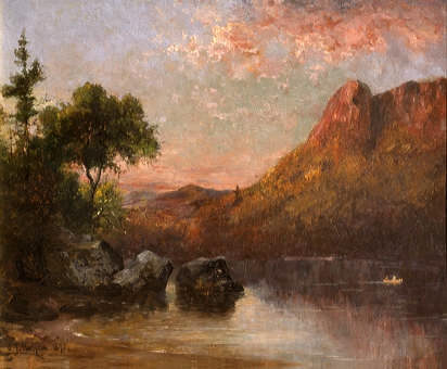
Eagle Cliff am Profile Lake, 1876 von Sylvester Phelps Hodgdon
Verweise
- ↑ http://www.nature.nps.gov/nnl/Registry/USA_Map/States/NewHampshire/NNL/FN/index.cfm
- ↑ http://www.nhstateparks.com/franconia.html
Weblinks
-
 Commons: Franconia Notch State Park – Sammlung von Bildern, Videos und Audiodateien
 - Franconia Notch State Park
- Franconia Notch State Park im Geographic Names Information System des United States Geological Survey

Alabama | Alaska | Arizona | Arkansas | Colorado | Connecticut | Delaware | Florida | Georgia | Hawaii | Idaho | Illinois | Indiana | Iowa | Kalifornien | Kansas | Kentucky | Louisiana | Maine | Maryland | Massachusetts | Michigan | Minnesota | Mississippi | Missouri | Montana | Nebraska | Nevada | New Hampshire | New Jersey | New Mexico | New York | North Carolina | North Dakota | Ohio | Oklahoma | Oregon | Pennsylvania | Rhode Island | South Carolina | South Dakota | Tennessee | Texas | Utah | Vermont | Virginia | Washington | West Virginia | Wisconsin | Wyoming
Wikimedia Foundation.
Schlagen Sie auch in anderen Wörterbüchern nach:
Franconia Notch State Park — is located in the White Mountains in northern New Hampshire and straddles convert|8|mi|km of Interstate 93 as it passes through Franconia Notch, a mountain pass between the Kinsman Range and Franconia Range. Attractions in the state park include… … Wikipedia
Crawford Notch State Park — Coordinates: 44°10′55″N 71°23′57″W / 44.18194°N 71.39917°W / 44.18194; 71.39917 Crawford Notch State Park is located … Wikipedia
Franconia Notch — Infobox Mountain Pass Name =Franconia Notch Photo =Franconia Notch.jpg Caption =View of Franconia Notch in the morning; Cannon Mountain is shown. Elevation = convert|1950|ft|m| 1|lk=on Location=New Hampshire, USA Range =White Mountains… … Wikipedia
Echo Lake (Franconia Notch) — Infobox lake lake name = Echo Lake image lake = Echo Lake, Franconia Notch, NH.jpg caption lake = Echo Lake c.1905, looking south image bathymetry = caption bathymetry = location = Grafton County, New Hampshire coords =… … Wikipedia
Franconia Notch — ▪ pass, New Hampshire, United States scenic pass between the towering peaks of the Franconia (east) and Kinsman (west) ranges in the White Mountains, northwestern New Hampshire, U.S. The pass is located in Grafton county just north of North … Universalium
Moose Brook State Park — Coordinates: 44°24′28″N 71°13′50″W / 44.40778°N 71.23056°W / 44.40778; 71.23056 … Wikipedia
Mount Washington State Park — The summit of Mount Washington is frequently obscured by clouds … Wikipedia
Milan Hill State Park — Coordinates: 44°34′21″N 71°13′25″W / 44.5725°N 71.22361°W / 44.5725; 71.22361 Milan Hill State Park is a state pa … Wikipedia
Franconia, New Hampshire — Infobox Settlement official name = Franconia, New Hampshire nickname = motto = image imagesize = image caption = imagesize = image caption = mapsize = 250px map caption = Location in Grafton County, New Hampshire settlement type = Town mapsize1 … Wikipedia
State Parks in New Hampshire — Dies ist eine Liste der State Parks im US Bundesstaat New Hampshire. Die Verwaltung erfolgt durch die New Hampshire Division of Parks and Recreation. Cardigan State Park … Deutsch Wikipedia
-
Franconia Notch State Park
18+
© Academic, 2000-2024
- Kontaktieren Sie uns: Unterstützung, Werbung
Wörterbücher Export, schritte mit PHP, Joomla, Drupal, WordPress, MODx.