- East Dunbartonshire
-
East Dunbartonshire
Siorrachd Dhùn Bhreatainn an Ear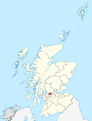
Verwaltungssitz Kirkintilloch Fläche 175 km² (26.) Einwohner 104.580 (2010)[1] (20.) ISO 3166-2 GB-EDU ONS-Code 00QL Website www.eastdunbarton.gov.uk East Dunbartonshire (gälisch Siorrachd Dhùn Bhreatainn an Ear) ist eine von 32 Unitary Authorities in Schottland. Sie grenzt an West Dunbartonshire, Glasgow, Stirling und North Lanarkshire. Der Verwaltungsbezirk umfasst Teile der traditionellen Grafschaften Stirlingshire, Dunbartonshire und Lanarkshire.
Inhaltsverzeichnis
Orte
- Bearsden
- Bishopbriggs
- Kirkintilloch
- Lennoxtown
- Lenzie
- Milngavie
- Milton of Campsie
- Torrance
- Twechar
Sehenswürdigkeiten
- Campsie Fells
- West Highland Way
Politik
Der Council von East Dunbartonshire umfasst 24 Sitze, die sich wie folgt auf die Parteien verteilen:[2]
Partei Sitze Scottish National Party 8 Scottish Labour 6 Scottish Conservatives 5 Liberal Democrats 3 Unabhängig 2 Einzelnachweise
- ↑ Amtliche Einwohnerzahlen 2010
- ↑ East Dunbartonshire Council: http://www.eastdunbarton.gov.uk/web%20site/live/edweblive.nsf/QuickLinkPagesWeb/Councillors%20by%20Ward?OpenDocument List of Councillors with Map of Wards (abgerufen am 13. April 2008)

Aberdeen | Aberdeenshire | Angus | Argyll and Bute | Clackmannanshire | Dumfries and Galloway | Dundee | East Ayrshire | East Dunbartonshire | East Lothian | East Renfrewshire | Edinburgh | Falkirk | Fife | Glasgow | Highland | Inverclyde | Midlothian | Moray | Äußere Hebriden | North Ayrshire | North Lanarkshire | Orkney | Perth and Kinross | Renfrewshire | Scottish Borders | Shetland | South Ayrshire | South Lanarkshire | Stirling | West Dunbartonshire | West Lothian
Wikimedia Foundation.
Schlagen Sie auch in anderen Wörterbüchern nach:
East Dunbartonshire — Géographie Superficie 26e Total 175 km² … Wikipédia en Français
East Dunbartonshire — East Dunbartonshire, [ iːst ], Verwaltungsgebiet in Schottland, 172 km2, 109 600 Einwohner; Verwaltungssitz ist Kirkintilloch … Universal-Lexikon
East Dunbartonshire — infobox Scotland council area Council= East Dunbartonshire Siorrachd Dhùn Bhreatainn an Ear SizeRank= 26th Size= 175 km² Water= ? AdminHQ= Kirkintilloch ISO= GB EDU ONS= 00QL PopulationRank= 20th PopulationDate= 2004 Population= 106,550… … Wikipedia
East Dunbartonshire — ▪ council area, Scotland, United Kingdom council area, west central Scotland. East Dunbartonshire s largest towns, Bearsden and Milngavie in the southwest and Kirkintilloch in the southeast, lie within the historic county of Dunbartonshire … Universalium
East Dunbartonshire — Sp Rytų Danbártonšyras Ap East Dunbartonshire L Škotijos adm. sr., D. Britanija … Pasaulio vietovardžiai. Internetinė duomenų bazė
East Dunbartonshire — Admin ASC 2 Code Orig. name East Dunbartonshire Country and Admin Code GB.SCT.U5 GB … World countries Adminstrative division ASC I-II
East Dunbartonshire (disambiguation) — East Dunbartonshire may refer to:* East Dunbartonshire council area of Scotland * East Dunbartonshire (UK Parliament constituency), 1950 to 1983, and 2005 to present … Wikipedia
East Dunbartonshire (UK Parliament constituency) — Coordinates: 55°58′34″N 4°12′40″W / 55.976°N 4.211°W / 55.976; 4.211 … Wikipedia
East Dunbartonshire Independent Alliance — The East Dunbartonshire Independent Alliance is a minor political party operating in East Dunbartonshire, Scotland. They presently have two councillors on East Dunbartonshire Council: Charles Kennedy who is one of three councillors representing… … Wikipedia
East Dunbartonshire Council election, 2007 — Elections to East Dunbartonshire Council were held on the May 3 2007 the same day as the other Scottish local government elections and the Scottish Parliament general election. The election was the first one using 8 new wards created as a results … Wikipedia
East Dunbartonshire

18+
© Academic, 2000-2024
- Kontaktieren Sie uns: Unterstützung, Werbung
Wörterbücher Export, schritte mit PHP, Joomla, Drupal, WordPress, MODx.