- Coos Bay (Oregon)
-
Coos Bay 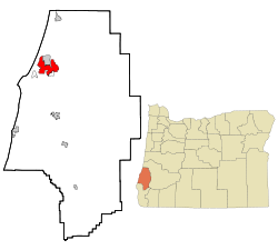 Lage in Oregon
Basisdaten Gründung: 1874 Staat: Vereinigte Staaten Bundesstaat: Oregon County: Koordinaten: 43° 23′ N, 124° 14′ W43.385833333333-124.234444444443.1Koordinaten: 43° 23′ N, 124° 14′ W Zeitzone: Pacific Standard Time (UTC−8) Einwohner: 16.005 (Stand: 2006) Bevölkerungsdichte: 584,1 Einwohner je km² Fläche: 41,3 km² (ca. 16 mi²)
davon 27,4 km² (ca. 11 mi²) LandHöhe: 3.1 m Postleitzahl: 97420 Vorwahl: +1 (541) 269 FIPS: 41-15250 GNIS-ID: 1166633 Webpräsenz: www.coosbay.org Bürgermeister: Jeff McKeown Coos Bay ist eine 1874 gegründete Hafenstadt in Südwest-Oregon im Pazifischen Nordwesten der USA.
Der im Coos County gelegene Ort mit 15.620 Einwohnern (Zensus 2002)[1] auf einer Fläche von 41,3 km² ist vor allem wegen seines Sandstrandes mit weitläufigen Dünen ein beliebtes Touristenziel. Ein Großteil des Dünengebietes ist Teil des Oregon Dunes National Recreation Area,[2] einem National Recreation Area (Erholungsgebiet von Nationaler Bedeutung) unter der Leitung des US Forest Service. Vom nördlich gelegenen North Bend führt die Oregon State Road OR 540, der Cape Arago Highway, über 22 km entlang der Küste zu den drei State Parks Sunset Bay, Shore Acres und Cape Arago.[3]
In Coos Bay mündet der Coos River bei der Coos Bay in den Pazifischen Ozean. Die Kleinstadt verfügt im Osten – in der Upper Bay von Coos Bay – über einen Seehafen (Port of Coos Bay).
Seit dem 10. Februar 1983 besteht eine Städtepartnerschaft mit Chōshi in Japan.
Einzelnachweise
- ↑ City of Coos Bay - Demographics (PDF)
- ↑ USDA United States Department of Agriculture Forest Service (Engl.)
- ↑ Cape Arago Highway. Abgerufen am 23. August 2011.
Weblinks
 Commons: Coos Bay – Sammlung von Bildern, Videos und Audiodateien
- Port of Coos Bay (Engl.)
- Oregon's Bay Area (Engl.)
Kategorien:- Ort in Oregon
- Ort mit Seehafen

Wikimedia Foundation.