- Reguenga
-
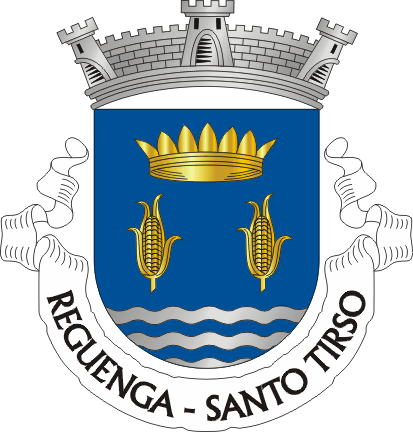
Reguenga Wappen Karte 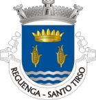

Basisdaten Region: Norte Unterregion: Ave Distrikt: Porto Concelho: Santo Tirso Koordinaten: 41° 16′ N, 8° 28′ W41.274868-8.463415Koordinaten: 41° 16′ N, 8° 28′ W Einwohner: 1.595 (Stand: 2001) Fläche: 4,5 km² Bevölkerungsdichte: 354 Einwohner pro km² Politik Adresse der Gemeindeverwaltung: Junta de Freguesia de Reguenga
Rua Bom Sucesso
4825-373 ReguengaReguenga ist eine Gemeinde im Norden Portugals.
Reguenga gehört zum Kreis Santo Tirso im Distrikt Porto, besitzt eine Fläche von 4,5 km² und hat 1.595 Einwohner (Stand: 2001).[1]
Einzelnachweise
- ↑ Daten zu Reguenga. alea.pt, abgerufen am 31. Mai 2011 (englisch).
Weblinks
- Karte der Freguesia Reguenga beim Instituto Geográfico do Exército
- Information zu Reguenga. cm-stirso.pt, abgerufen am 31. Mai 2011 (portugiesisch).
 Freguesias im Concelho Santo Tirso
Agrela | Água Longa | Areias | Burgães | Campo (São Martinho) | Carreira | Couto (Santa Cristina) | Couto (São Miguel) | Guimarei | Lama | Lamelas | Monte Córdova | Negrelos (São Mamede) | Negrelos (São Tomé) | Palmeira | Rebordões | Refojos de Riba de Ave | Reguenga | Roriz | Santo Tirso (Freguesia) | São Salvador do Campo | Sequeiró | Vila das Aves | Vilarinho
Wikimedia Foundation.
Schlagen Sie auch in anderen Wörterbüchern nach:
Reguenga — Infobox Parish pt official name = Reguenga image coat of arms = STS reguenga.png Municipality = Santo Tirso area total = 3.93 population total = 1,595 (2001) population density = 405,9 website = footnotes =Reguenga is a rural parish located 6km… … Wikipedia
Районы округа Порту — … Википедия
Регенга — Район Регенга Reguenga Герб … Википедия
Paradela — Drapeau Blason … Wikipédia en Français
Santo Tirso — Infobox Municipality pt official name = Santo Tirso image coat of arms = STS1.png Region = Norte Subregion = Ave District = Porto Mayor name = Castro Fernandes Mayor party = PS area total = 136.5 population total = 71,623 (2001) population… … Wikipedia
List of postal codes in Portugal — Aveiro districtMealhada municipality*3050 Antes *3050 Barcouço *3050 Casal Comba *3050 Luso *3050 Mealhada *3050 Pampilhosa *3050 Vacariça *3050 Ventosa do BairroMurtosa municipality*3870 Bunheiro *3870 Monte *3870 Murtosa *3870 TorreiraOliveira… … Wikipedia
Reguengo — may refer to several parishes in Portugal:*Reguenga, a parish in the municipality of Santo Tirso *Reguengo, a parish in the municipality of Portalegre *Reguengo do Fetal, a parish in the municipality of Batalha *Reguengo Grande, a parish in the… … Wikipedia
PEX14 — Peroxisomal biogenesis factor 14, also known as PEX14, is a human gene.cite web | title = Entrez Gene: PEX14 peroxisomal biogenesis factor 14| url = http://www.ncbi.nlm.nih.gov/sites/entrez?Db=gene Cmd=ShowDetailView TermToSearch=5195| accessdate … Wikipedia
PXMP4 — Peroxisomal membrane protein 4, 24kDa, also known as PXMP4, is a human gene.cite web | title = Entrez Gene: PXMP4 peroxisomal membrane protein 4, 24kDa| url = http://www.ncbi.nlm.nih.gov/sites/entrez?Db=gene Cmd=ShowDetailView TermToSearch=11264| … Wikipedia
Monte Córdova — Wappen Karte … Deutsch Wikipedia
Reguenga

18+
© Academic, 2000-2024
- Kontaktieren Sie uns: Unterstützung, Werbung
Wörterbücher Export, schritte mit PHP, Joomla, Drupal, WordPress, MODx.