- Matapia Island
-
Matapia Island Ninety Mile Beach, im Hintergrund Matapia Island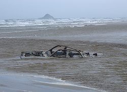
Gewässer Tasmansee Geographische Lage 34° 36′ 21,7″ S, 172° 47′ 54,9″ O-34.606023172.798577353Koordinaten: 34° 36′ 21,7″ S, 172° 47′ 54,9″ O 

Länge 210 m Breite 170 m Fläche 3 ha Höchste Erhebung 53 m Einwohner (unbewohnt) Matapia Island ist eine Insel im Far North Distrikt der Region Northland auf der Nordinsel Neuseelands.
Die Insel liegt in der Tasmansee etwa 1,2 km nordwestlich vor der Ninety Mile Beach. Sie ist etwa 210 m lang und 170 m breit und erreicht eine Höhe von 53 m.
Quellen
Kategorien:- Unbewohnte Insel
- Insel (Neuseeland)
- Insel (Australien und Ozeanien)
- Insel (Tasmansee)
- Northland (Region)

Wikimedia Foundation.