- Mafamude
-
Mafamude Wappen Karte 
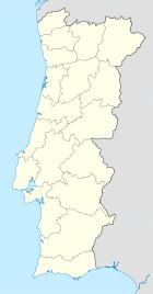

Basisdaten Region: Norte Unterregion: Grande Porto Distrikt: Porto Concelho: Vila Nova de Gaia Koordinaten: 41° 8′ N, 8° 37′ W41.135277777778-8.6169444444444Koordinaten: 41° 8′ N, 8° 37′ W Einwohner: 38.940 (Stand: 2001) Fläche: 5,39 km² Bevölkerungsdichte: 7.224 Einwohner pro km² Politik Adresse der Gemeindeverwaltung: Junta de Freguesia de Mafamude
Rua Soares dos Reis 1154
4430-240 Vila Nova de GaiaWebseite: www.jfmafamude.net/ Mafamude ist eine portugiesische Gemeinde (Freguesia) im Concelho Vila Nova de Gaia.
Sie bildet zusammen mit den Freguesias Santa Marinha, Canidelo und Vilar de Andorinho die Stadt Vila Nova de Gaia.
Schutzpatron des Ortes ist der heilige Christophorus.
1847 wurde hier der Bildhauer António Soares dos Reis geboren, 1930 die Dichterin Maria Alberta Menéres.
Bauwerke
 Moderne Wohnbauten kennzeichnen das Gesicht von Mafamude.
- Casa de Maravedis
- Escola Primária do Cedro (1958-60)
- Palácio de Justiça de Vila Nova de Gaia
- Edifício da Santa Casa da Misericórdia de Vila Nova de Gaia
- Igreja Paroquial de Mafamude
- Antigo Tribunal Judicial de Vila Nova de Gaia
- Colégio de Nossa Senhora da Bonança
- Bairro do Cabo Mor
Weblinks
- Karte der Freguesia Mafamude beim Instituto Geográfico do Exército
 Freguesias im Concelho Vila Nova de Gaia
Arcozelo | Avintes | Canelas | Canidelo | Crestuma | Grijó | Gulpilhares | Lever | Madalena | Mafamude | Olival | Oliveira do Douro | Pedroso | Perosinho | Sandim | Santa Marinha | São Félix da Marinha | São Pedro da Afurada | Seixezelo | Sermonde | Serzedo | Valadares | Vilar de Andorinho | Vilar do Paraíso
Wikimedia Foundation.
Schlagen Sie auch in anderen Wörterbüchern nach:
Mafamude — Freguesia de Portugal … Wikipedia Español
Mafamude — Location of Mafamude in Vila Nova de Gaia. Mafamude is a Portuguese parish (freguesia) in the municipality of Vila Nova de Gaia, in district of Porto. It has a population of 38,940 (2001) and an area of 5.39 km². It is an urban parish in the … Wikipedia
Vía de Cintura Interna — Mapa general de la VCI Concejo(s): Oporto y Vila Nova de Gaia Freguesia(s): Oporto: Massarelos, Lordelo do Ouro, Ramalde, Par … Wikipedia Español
Мафамуде — Посёлок Мафамуде Mafamude Страна ПортугалияПортугалия … Википедия
Autoroute portugaise VCI — VCI (Voie de Ceinture Interne) VCI Longueur 21 km De Porto Intersections … Wikipédia en Français
Vila Nova de Gaia — seen from Porto Vila Nova de Gaia, or simply Gaia (Portuguese pronunciation: [ˈvilɐ ˈnɔvɐ ðɨ ˈɣajɐ]) is a city in Vila Nova de Gaia Municipality, Portugal. It is located in the Porto District, south of the city of Porto on the other side of… … Wikipedia
Bruno Vale — Football player infobox2 playername = Bruno Vale fullname = Bruno Miguel Esteves Vale nickname = dateofbirth = birth date and age|1983|4|8 cityofbirth = Mafamude countryofbirth = Portugal height = height|m=1.93 currentclub = Vitória Setúbal… … Wikipedia
Bruno Vale — Bruno Vale Spielerinformationen Voller Name Bruno Miguel Esteves do Vale Geburtstag 8. April 1983 Geburtsort Mafamude, Portugal Größe 193 cm … Deutsch Wikipedia
Bruno Vale — Saltar a navegación, búsqueda Bruno Vale Nombre Bruno Miguel Esteves Vale Nacimiento 8 de abril de 1983 Mafamude, Portugal … Wikipedia Español
Районы округа Порту — … Википедия
Mafamude


18+
© Academic, 2000-2024
- Kontaktieren Sie uns: Unterstützung, Werbung
Wörterbücher Export, schritte mit PHP, Joomla, Drupal, WordPress, MODx.