L’Anse-au-Clair

L’Anse-au-Clair
L’Anse-au-Clair
Lage in Neufundland und Labrador
L’Anse-au-Clair (Neufundland und Labrador)
L’Anse-au-Clair
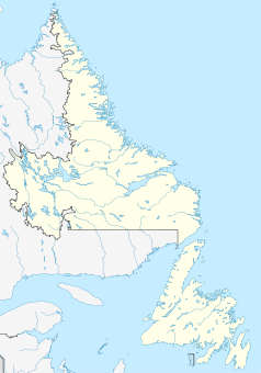
L’Anse-au-Clair
Staat: Kanada
Provinz: Neufundland und Labrador
Koordinaten: 51° 26′ N, 57° 4′ W51.43242-57.06426Koordinaten: 51° 26′ N, 57° 4′ W
Einwohner: 264 (Stand: 2006)
Zeitzone: Newfoundland Time (UTC-3:30)
Postleitzahl: A0K

L’Anse-au-Clair ist ein Dorf in der kanadischen Provinz Neufundland und Labrador. Es ist das südlichste Dorf in der Region Labrador. Das Dorf besitzt eine Post, ein Einkaufszentrum, eine Eisbahn, eine Garage, eine Tankstelle und eine Gaststätte. L’Anse-au-Clair wurde im frühen 18. Jahrhundert von Franzosen gegründet.

Weblinks


Wikimedia Foundation.

Игры ⚽ Нужен реферат?

Schlagen Sie auch in anderen Wörterbüchern nach:

  • L'Anse-au-Clair — Cove of Light   Town   Coordinates …   Wikipedia

  • L'Anse-au-Clair, Newfoundland and Labrador — Infobox Settlement official name = L Anse au Clair other name = native name = Cove of Light nickname = settlement type = Town motto = imagesize = image caption = flag size = image seal size = image shield = shield size = city logo = citylogo size …   Wikipedia

  • Cartwright-L'Anse au Clair — Infobox Canadian provincial riding name = Cartwright L Anse au Clair province = Newfoundland and Labrador legislature = Newfoundland and Labrador House of Assembly member type = MHA party colour = Liberal member = Yvonne Jones member party =… …   Wikipedia

  • Clair, New Brunswick — Clair   Village   Flag …   Wikipedia

  • St. Clair Shores, Michigan — Infobox Settlement official name = Pagename other name = native name = nickname = settlement type = City motto = imagesize = image caption = Public beach in St. Clair Shores flag size = image seal size = image shield = shield size = image blank… …   Wikipedia

  • L'Anse Creuse Public Schools — is a collection of K 12 schools located in Macomb County, Michigan. The district stretches from as far north as 24 Mile Road in Chesterfield Township down to Jefferson Avenue and I 94 in St. Clair Shores. The district occupies 37 square miles of… …   Wikipedia

  • St. Clair Shores — Lage im Co …   Deutsch Wikipedia

  • Saint Clair Shores (Michigan) — Saint Clair Shores Pays  États Unis État …   Wikipédia en Français

  • Saint Clair Shores — 42° 29′ 44″ N 82° 54′ 01″ W / 42.495556, 82.900278 …   Wikipédia en Français

  • Newfoundland and Labrador general election, 2011 — 2007 ← members October 11, 2011 members …   Wikipedia

Share the article and excerpts

Direct link
Do a right-click on the link above
and select “Copy Link”