- Gnojno
-
Gnojno 

Gnojno Basisdaten Staat: Polen Woiwodschaft: Heiligkreuz Landkreis: Busko-Zdrój Geographische Lage: 50° 36′ N, 20° 51′ O50.60305555555620.844444444444Koordinaten: 50° 36′ 11″ N, 20° 50′ 40″ O Einwohner: -
(31. Dez. 2010)[1]Postleitzahl: 28-114 Telefonvorwahl: (+48) 41 Kfz-Kennzeichen: TBU Wirtschaft und Verkehr Straße: DW 765 Chmielnik – Osiek Nächster int. Flughafen: Krakau-Balice Gemeinde Gemeindeart: Landgemeinde Fläche: 95,7 km² Einwohner: 4601
(31. Dez. 2010) [2]Bevölkerungsdichte: 48 Einw./km² Gemeindenummer (GUS): 2601022 Verwaltung (Stand: 2011) Bürgermeister: Jolanta Barbara Stachowicz Adresse: Gnojno 145
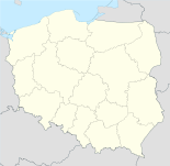
28-114 GnojnoWebpräsenz: www.gnojno.gminy.com.pl/ Gnojno ist die am weitesten im Norden gelegene Gemeinde (eine Landgemeinde) und deren Hauptort im Landkreis Busko-Zdrój in Polen in der Wojewodschaft Heiligkreuz etwa 35 km südöstlich von Kielce und 18 km nordöstlich der Kreisstadt Busko-Zdrój. Die Einwohnerzahl der Gemeinde betrug im Jahr 2007 4735.
Inhaltsverzeichnis
Geschichte
Die Siedlungsgeschichte reicht bis in die Römerzeit zurück. Gnojno lag an der Bernsteinstraße. In geschichtlicher Zeit wird Gnojno erstmals im Zusammenhang mit dem Tatareneinfall 1341 genannt, als die örtliche Kirche verbrannt wurde. Das Land stand damals unter der Herrschaft der Familie Gnoiński. Krzystof Gnoiński ließ 1540 einen Herrenhof errichten, in dem heute das Zentrum für Sozialfürsorge untergebracht ist.
1795 fiel Gnojno mit der Dritten Polnischen Teilung an Österreich. 1809 kam es an das Großherzogtum Warschau und 1815 an das Königreich Polen. Nach Ende des Ersten Weltkriegs kam der Ort wieder zum neu entstandenen Polen.
Gemeinde
Zu Gnojno gehören die Ortsteile Balice, Bugaj, Falki, Glinka, Gorzakiew, Grabki Małe, Janowice Poduszowskie, Janowice Raczyckie, Januszowice, Jarząbki, Kostera, Maciejowice, Płośnia, Poręba, Pożogi, Raczyce, Ruda, Rzeszutki, Skadla, Wola Bokrzycka, Wola Zofiowska, Wólka Bosowska, Zagrody, Zawada und Zofiówka. Die Gemeinde ist landwirtschaftlich geprägt; vorherrschend ist der Kartoffelanbau.
Sehenswürdigkeiten
 Kirche in Balice
- Die einschiffige Kirche Johannes des Täufers (Jana Chrzciciela) und der hl. Thekla aus der Zeit um 1470, ausgebaut zwischen 1596 und 1598 und barockisiert ab 1677, mit einem Frontturm und Querhaus.
- Der Gutshof im Renaissancestil aus der Zeit um 1540.
- Das klassizistische Gutshaus in Balice aus dem 19. Jahrhundert.
Literatur
- Ziemia Buska, Swiatowid, Kielce 2009, ISBN 978-83-925632-9-7, S. 64-71.
Fußnoten
- ↑ Population. Size and Structure by Territorial Division. As of December 31, 2010. Główny Urząd Statystyczny (GUS), abgerufen am 30. Juni 2011.
- ↑ Population. Size and Structure by Territorial Division. As of December 31, 2010. Główny Urząd Statystyczny (GUS), abgerufen am 30. Juni 2011.
Kategorien:- Gmina in der Woiwodschaft Heiligkreuz
- Ort der Woiwodschaft Heiligkreuz


Wikimedia Foundation.