- Feltham Urban District
-
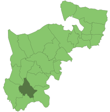 Feltham in der früheren Grafschaft Middlesex
Der Feltham Urban District war ein Bezirk im Ballungsraum der britischen Hauptstadt London. Er existierte von 1904 bis 1965 und lag im Süden der ehemaligen Grafschaft Middlesex.
Geschichte
Feltham war ursprünglich ein Civil parish in der Harde (hundred) Spelthorne. Ab 1894 war die Gemeinde Teil des Staines Rural District, wurde jedoch bereits zehn Jahre später abgetrennt und bildete einen eigenen Urban District. Als der restliche Staines Rural District im Jahr 1930 aufgelöst wurde, fusionierten die bisher eigenständigen Gemeinden East Bedfont und Hanworth mit Feltham, wodurch sich die Fläche beinahe verdreifachte.[1]
Bei der Gründung der Verwaltungsregion Greater London im Jahr 1965 entstand aus der Fusion von Feltham mit den Municipal Boroughs Brentford and Chiswick und Heston and Isleworth der London Borough of Hounslow.
Statistik
Bis zum Jahr 1930 betrug die Fläche 1790 acres (7,24 km²), danach 4925 acres (19,93 km²). Die Volkszählungen ergaben folgende Einwohnerzahlen:[2]
Jahr 1901 1911 1921 1931 1951 1961 Einwohner 4.534 5.135 11.567 16.317 44.861 51.047 Einzelnachweise
- ↑ Frederic Youngs: Guide to the Local Administrative Units of England. Volume I: Southern England. Royal Historical Society, London 1979, ISBN 0901050679.
- ↑ Feltham UD: Census Tables. In: A vision of Britain through time. University of Portsmouth, 2009, abgerufen am 28. Mai 2011 (englisch).
Aufgelöste Verwaltungseinheiten auf dem Gebiet des 1965 gegründeten Greater LondonCounty of London Battersea | Bermondsey | Bethnal Green | Camberwell | Chelsea | Deptford | Finsbury | Fulham | Greenwich | Hackney | Hammersmith | Hampstead | Holborn | Islington | Kensington | Lambeth | Lewisham | Paddington | Poplar | Shoreditch | Southwark | St Marylebone | St Pancras | Stepney | Stoke Newington | Wandsworth | Westminster | Woolwich
Essex Barking | Chigwell (teilweise) | Chingford | Dagenham | East Ham | Hornchurch | Ilford | Leyton | Romford | Walthamstow | Wanstead and Woodford | West Ham
Hertfordshire Barnet | East Barnet
Middlesex Acton | Brentford and Chiswick | Ealing | Edmonton | Enfield | Feltham | Finchley | Friern Barnet | Harrow | Hayes and Harlington | Hendon | Heston and Isleworth | Hornsey | Ruislip-Northwood | Southall | Southgate | Tottenham | Twickenham | Uxbridge | Wembley | Willesden | Wood Green | Yiewsley and West Drayton
Kent Beckenham | Bexley | Bromley | Chislehurst and Sidcup | Crayford | Erith | Orpington | Penge
Surrey Barnes | Beddington and Wallington | Carshalton | Coulsdon and Purley | Croydon | Kingston upon Thames | Malden and Coombe | Merton and Morden | Mitcham | Sutton and Cheam | Surbiton | Richmond | Wimbledon
Kategorien:- Ehemalige Verwaltungseinheit in London
- London Borough of Hounslow

Wikimedia Foundation.