Cacuaco

Cacuaco
Cacuaco
Cacuaco (Angola)
Cacuaco
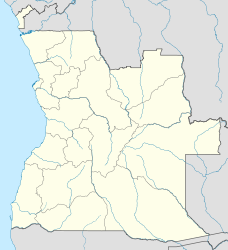
Cacuaco
Basisdaten
Staat Angola
Provinz Luanda
Höhe 20 m
Fläche 571 km²
Einwohner 613.000
Dichte 1.073,6 Ew./km²
ISO 3166-2 AO-LUA
Politik
Gouverneur José Maria dos Santos
Partei Movimento Popular de Libertação de Angola
-8.783333333333313.366666666667

Cacuaco ist eines der neun Kommunen, Municipios, die die angolanische Metropolregion der Hauptstadt Luanda bilden, in der gleichnamigen Provinz Luanda.

Cacuaco hat eine Fläche von 571 Quadratkilometer und circa 613.000 Einwohner (2005). Der Ort besteht vorwiegend aus Hüttensiedlungen und war im Jahr 2005 im Blick der Weltöffentlichkeit, als die UNO dort Fälle des Marburgvirus entdeckte und publik machte.[1]

Im Norden grenzt der Ort an den Atlantische Ozean mit der Bucht von Bengo, im Süden an Viana und Sambizanga, im Osten an Dande in der Provinz Bengo. Durch die Gemeinde fließt der Rio Bengo in südlicher Richtung.

Weblinks

Einzelnachweise

  1. Marburgvirus Überragung in Cacuaco (englisch)
-8.831641813.2591334

Wikimedia Foundation.

Игры ⚽ Нужно сделать НИР?

Schlagen Sie auch in anderen Wörterbüchern nach:

  • Cacuaco — Saltar a navegación, búsqueda 08°46′37″S 13°22′18″E /  8.77694, 13.37167 Cacuaco , Kakuako en idioma Be …   Wikipedia Español

  • Cacuaco — Infobox Settlement official name = PAGENAME other name = native name = nickname = settlement type = Municipality motto = imagesize = image caption = flag size = image seal size = image shield = shield size = image blank emblem = blank emblem type …   Wikipedia

  • Cacuaco Municipality — Admin ASC 2 Code Orig. name Cacuaco Municipality Country and Admin Code AO.20.2243171 AO …   World countries Adminstrative division ASC I-II

  • Luanda — Luanda …   Deutsch Wikipedia

  • Provincia de Luanda — Este artículo o sección necesita una revisión de ortografía y gramática. Puedes colaborar editándolo (lee aquí sugerencias para mejorar tu ortografía). Cuando se haya corregido, borra este aviso por favor …   Wikipedia Español

  • Luanda — For the mystic of the Han Dynasty, see Luan Da. Infobox Settlement official name =Luanda other name =formerly called Loanda native name = nickname = settlement type = motto = imagesize = 300px image caption =Luanda s waterfront flag size = image… …   Wikipedia

  • Cuando Cubango Province — Cuando Cubango is a province of Angola and it has an area of 199,049 km² and a population of approximately 140,000. Menongue is the capital of the province. The governor of the province is General Eusebio de Brito. According to 1988 US… …   Wikipedia

  • Cuanza Norte Province — Coordinates: 9°1′S 15°4′E / 9.017°S 15.067°E / 9.017; 15.067 …   Wikipedia

  • Cunene Province — Cunene   province   Country …   Wikipedia

  • Huambo —   Municipality and town   Church in Huambo …   Wikipedia

Share the article and excerpts

Direct link
Do a right-click on the link above
and select “Copy Link”