Rosholt (South Dakota)

Rosholt (South Dakota)
Rosholt
Roberts County South Dakota Incorporated and Unincorporated areas Rosholt Highlighted.svg
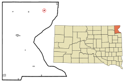
Lage in South Dakota
Basisdaten
Staat: Vereinigte Staaten
Bundesstaat: South Dakota
County:

Roberts County

Koordinaten: 45° 52′ N, 96° 44′ W45.865833333333-96.731944444444330Koordinaten: 45° 52′ N, 96° 44′ W
Zeitzone: Central Standard Time (UTC−6)
Einwohner: 419 (Stand: 2000)
Bevölkerungsdichte: 523,8 Einwohner je km²
Fläche: 0,8 km² (ca. 0 mi²)
davon 0,8 km² (ca. 0 mi²) Land
Höhe: 330 m
Postleitzahl: 57260
Vorwahl: +1 605
FIPS: 46-56340
GNIS-ID: 1257489

Rosholt ist ein Dorf im Roberts County im US-Bundesstaat South Dakota. Rosholt hat 419 Einwohner auf einer Fläche von 0.8 km².

Demografische Daten

Das durchschnittliche Einkommen eines Haushalts liegt bei 30.547 USD, das durchschnittliche Einkommen einer Familie bei 37.292 USD. Männer haben ein durchschnittliches Einkommen von 31.250 USD gegenüber den Frauen mit durchschnittlich 16.875 USD. Das Pro-Kopf-Einkommen liegt bei 15.437 USD. 18,8 % der Einwohner und 9,2 % der Familien leben unterhalb der Armutsgrenze. 20,8 % der Einwohner sind unter 18 Jahre alt und auf 100 Frauen ab 18 Jahre und darüber kommen statistisch 74,7 Männer. Das Durchschnittsalter beträgt 50 Jahre. (Stand: 2000).


Wikimedia Foundation.

Игры ⚽ Нужно решить контрольную?

Schlagen Sie auch in anderen Wörterbüchern nach:

  • Rosholt, South Dakota — Infobox Settlement official name = Rosholt, South Dakota other name = native name = nickname = settlement type = Town motto = imagesize = image caption = flag size = image seal size = image shield = shield size = image blank emblem = blank emblem …   Wikipedia

  • South Dakota locations by per capita income — South Dakota is the forty fourth richest state in the United States of America, with a per capita income of $17,562 (2000).# Cottonwood town, South Dakota $79,000 # Naples town, South Dakota $78,450 # Camp Crook town, South Dakota $30,178 #… …   Wikipedia

  • South Dakota Highway 127 — Infobox road state=SD type=SD route=127 length mi=37.3 established=1980 direction a=North starting terminus= ND 127 direction b=South ending terminus= cities=Rosholt, New Effington, SissetonSouth Dakota Highway 127 is a highway that runs from… …   Wikipedia

  • Ortley, South Dakota — For other uses, see Ortley (disambiguation). Ortley, South Dakota   Town   …   Wikipedia

  • Corona, South Dakota —   Town   Location …   Wikipedia

  • Roberts County, South Dakota — Infobox U.S. County county = Roberts County state = South Dakota founded year = 1883 [ Legislative Manual, South Dakota, 2005, p. 597] founded date = seat wl = Sisseton largest city wl = area total sq mi = 1135 area total km2 = 2941 area land sq… …   Wikipedia

  • Rosholt — may refer to: * Rosholt, Wisconsin, a town in Portage County, Wisconsin * Rosholt, South Dakota, a town in Roberts County, South Dakota * Jake Rosholt, college wrestler * Jerry Rosholt, author and historian * Nils Røsholt, Norwegian politician …   Wikipedia

  • List of high schools in South Dakota — This is a list of high schools in the state of South Dakota.Aurora County*Plankinton High School, Plankinton *Stickney High School, Stickney *White Lake High School, White LakeBeadle County*Hitchcock Tulare High School, Hitchcock *Huron High… …   Wikipedia

  • National Register of Historic Places listings in Roberts County, South Dakota — Location of Roberts County in South Dakota This is a list of the National Register of Historic Places listings in Roberts County, South Dakota. This is intended to be a complete list of the properties and districts on the National Register of… …   Wikipedia

  • Agency Village, South Dakota — Agency Village redirects here. For the municipality in the state of Missouri, see Agency, Missouri. Agency Village, South Dakota   Census designated place   …   Wikipedia

Share the article and excerpts

Direct link
Do a right-click on the link above
and select “Copy Link”