Rio Rico Southeast — Rio Rico Southeast, AZ U.S. Census Designated Place in Arizona Population (2000): 1590 Housing Units (2000): 439 Land area (2000): 11.062361 sq. miles (28.651383 sq. km) Water area (2000): 0.000000 sq. miles (0.000000 sq. km) Total area (2000):… … StarDict's U.S. Gazetteer Places
Rio Rico Southeast, AZ — U.S. Census Designated Place in Arizona Population (2000): 1590 Housing Units (2000): 439 Land area (2000): 11.062361 sq. miles (28.651383 sq. km) Water area (2000): 0.000000 sq. miles (0.000000 sq. km) Total area (2000): 11.062361 sq. miles… … StarDict's U.S. Gazetteer Places
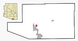
Rio Rico Southeast, Arizona — Infobox Settlement official name = Rio Rico Southeast, Arizona settlement type = CDP imagesize = image caption = imagesize = image caption = mapsize = 250px map caption = Location in Santa Cruz County and the state of Arizona mapsize1 = map… … Wikipedia
Rio Rico, Arizona — Rio Rico, Arizona, is an unincorporated group of census designated places (CDP) in Santa Cruz County, Arizona, United States. * Rio Rico Northeast, Arizona * Rio Rico Northwest, Arizona * Rio Rico Southeast, Arizona * Rio Rico Southwest, Arizona … Wikipedia
Río Grande — /ree oh grahn day, dee/; Sp. /rddee aw grddahn de/ 1. a city in NE Puerto Rico. 12,047. 2. a river in central Nicaragua, flowing NE to the Caribbean Sea. ab. 200 mi. (320 km) long. * * * in Mexico Río Bravo River, North America. One of the… … Universalium
Puerto Rico — Puerto Rican. /pwer teuh ree koh, pwer toh, pawr teuh, pohr /; Sp. /pwerdd taw rddee kaw/ an island in the central West Indies: a commonwealth associated with the U.S. 3,196,520; 3435 sq. mi. (8895 sq. km). Cap.: San Juan. Formerly (until 1932),… … Universalium
Naguabo, Puerto Rico — Municipality Flag … Wikipedia
Humacao, Puerto Rico — Infobox Settlement settlement type = subdivision type = Country subdivision name = United States subdivision type1 = Territory subdivision name1 = Puerto Rico subdivision type2 = subdivision name2 = timezone=AST utc offset= 4 timezone DST= utc… … Wikipedia
National Register of Historic Places listings in southern Puerto Rico — This is a list of properties and districts in the southern municipalities of Puerto Rico that are listed on the National Register of Historic Places. It includes places along the southern coast, and on islands, and in the peaks and on the south… … Wikipedia
Moca, Puerto Rico — Municipality … Wikipedia
 Lage im County und in Arizona