- Raetihi
-
Raetihi 

Koordinaten 39° 26′ S, 175° 17′ O-39.426844444444175.2816Koordinaten: 39° 26′ S, 175° 17′ O Einwohner 1.035 (2006) Region Manawatu-Wanganui Distrikt Ruapehu-Distrikt Raetihi ist eine Gemeinde im Ruapehu-Distrikt auf der zentralen Nordinsel Neuseelands.[1] Sie liegt an der Kreuzung der State Highways 4 und 49, 11 km westlich von Ohakune. Beim Zensus 2006 hatte sie 1.035 Einwohner; dies ist ein Rückgang um 3,4 % oder 33 Einwohner gegenüber dem Zensus von 2001. Bereits zwischen 1996 und 2001 war die Bevölkerung um 8,2 % (99 Einwohner) gesunken.[2] 58,2 % der Bewohner bezeichneten sich 2006 als Māori.[3]
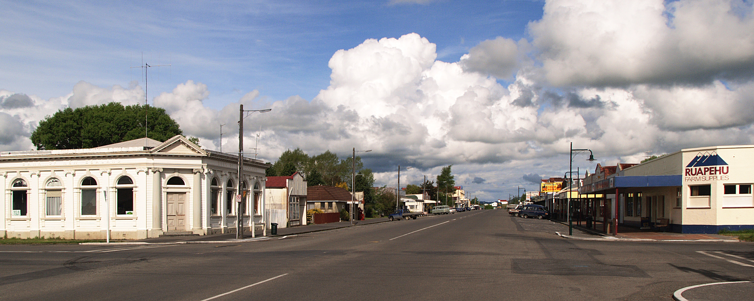
 Raetihi, Hauptstraße des Ortes
Vom 18. Dezember 1917 bis zum 1. Januar 1968 wurde Raetihi vom Raetihi Branch, einer von der Hauptbahnlinie der Nordinsel, dem North Island Main Trunk in Ohakune abzweigenden Nebenbahn bedient. Das Bahnhofsgebäude wurde in das Waimarino Museum umgesetzt und restauriert.[4] Das Museum besitzt ein Archiv von Dokumenten und Fotos aus dem weiteren Umfeld des Ruapehu.[5]
Obwohl Raetihi heute eine kleine Landgemeinde ist, war es zwischen 1900 und den 1950er Jahren ein kleineres Industriezentrum. 1900 war der Ort das größte Ballungszentrum des King Country mit fast 4.500 Einwohnern. Zahlreiche Sägewerke waren der Hauptarbeitgeber der Region. Als die Bäume abgeholzt waren, schlossen diese und die Landwirtschaft wurde wichtiger, insbesondere Viehzucht und Gemüseanbau. Eine Genossenschaftsmolkerei wurde jedoch bereits 1903 gegründet.
Am 18. März 1918 zerstörte ein Großfeuer etwa 200 Häuser,[6] im gleichen Jahr wurde der Ort von der Spanischen Grippe heimgesucht.
Der Niedergang der Holzindustrie hatte einen negativen Einfluss auf den Ort. Seit kurzem erlebt er aber durch den Tourismus einen leichten Aufschwung. Seine Nähe zum Mount Ruapehu und beliebte Skigebiete haben zum Entstehen von Übernachtungsmöglichkeiten und Cafes für die steigende Besucherzahl gesorgt.
Quellen
- ↑ Land Information New Zealand Geographic Placenames Database: Detailseite zu Raetihi
- ↑ Raetihi Urban Area Community Profile, Statistics New Zealand
- ↑ Statistics New Zealand, "Raetihi Urban Area Quick Stats" 15. Oktober 2008.
- ↑ David Leitch and Brian Scott, Exploring New Zealand's Ghost Railways. Grantham House, Wellington 1998 S. 27-30
- ↑ Website des Waimarino Museum, Archivbilder, 29. Oktober 2007
- ↑ Dick Craig: The King Country. Waitomo News, Waitomo 199. S. 136-137
Kategorien:- Manawatu-Wanganui (Region)
- Ort in der Region Manawatu-Wanganui

Wikimedia Foundation.