- Plimmerton
-
Plimmerton 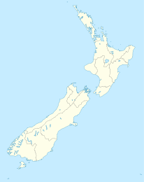

Koordinaten 41° 5′ S, 174° 52′ O-41.083333333333174.86666666667Koordinaten: 41° 5′ S, 174° 52′ O Einwohner 2.058 (2006) Region Wellington Distrikt Porirua City Council 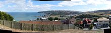 Plimmerton
Plimmerton ist eine Vorstadt von Porirua auf der Nordinsel Neuseeland. Im Norden liegt Pukerua Bay, im Osten Camborne, im Süden Mana und ein Teil des Porirua Harbour, im Westen der Porirua Harbour und die Cookstraße.
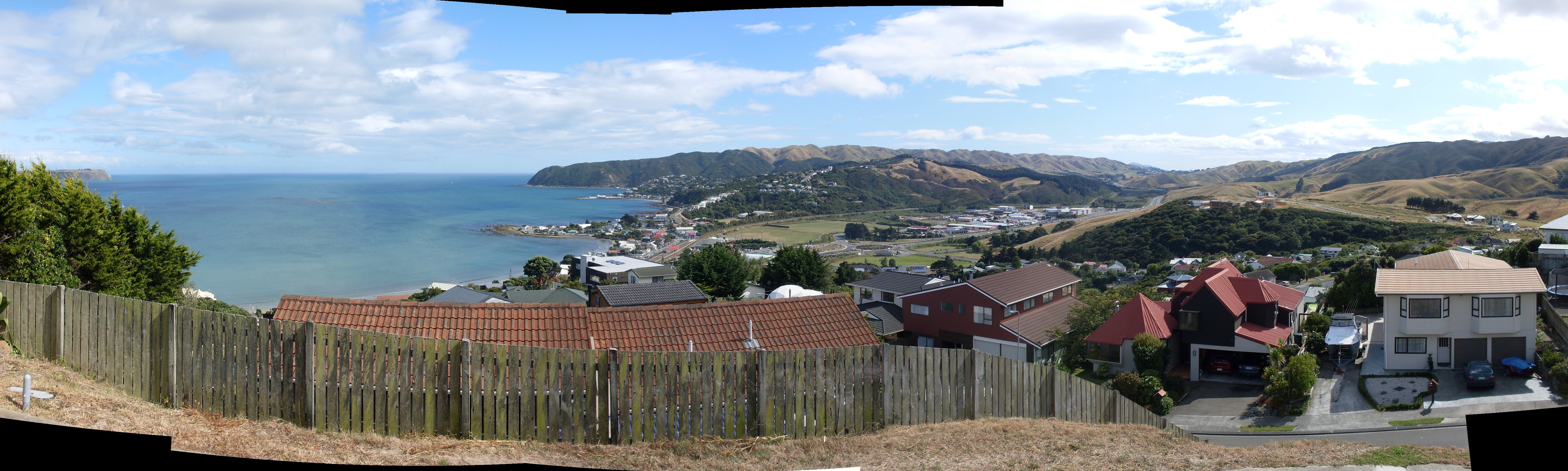
Der Ort grenzt an einen der bekannteren Strände des nordwestlichen Großraumes Wellington. Er hatte zusammen mit Hongoeka Bay beim Zensus 2006 2058 Einwohner, nur eine geringe Änderung gegenüber 2052 in den Jahren 1996 und 2001.[1]
Die vorwiegend von Māori bewohnte Siedlung Ngati Toa im Nordwesten wird für die meisten Zwecke zu Plimmerton gezählt.
Im Norden des Industriegebietes befindet sich der Taupo Swamp, der größte mit Neuseeländer Flachs bewachsene Sumpf der Südhälfte der Nordinsel. Der State Highway 1, hier St Andrews Road benannt, trennt Plimmerton und die im 20. Jahrhundert entstandene Vorstadt Camborne.
Plimmerton besitzt ein zwei Häuserblocks umfassendes Einkaufsgebiet am Bahnhof, zwei Kirche, ein medizinisches Zentrum, Schule, Kindergarten, eine Bibliothek und eine Freiwillige Feuerwehr.
Geschichte
Das Gebiet wurde von den Māori während ihrer Besiedlung Neuseelands bereits frühzeitig besiedelt. Der bedeutende Pā Taupo befand sich in der Nähe. In den 1840er Jahren war er Sitz von Te Rauparaha, der hier von den Briten 1846 gefangengenommen wurde. In der Nähe des Südendes der Motuhara Road besteht ein winziges Schutzgebiet mit einem Kohlbaum (Cordyline australis), möglicherweise einem Abkömmling des Baumes, in dessen Nähe er gefangen wurde, sowie eine Gedenktafel.
Die ursprüngliche Straßenführung und die Straßennamen gehen auf die Wellington and Manawatu Railway Company zurück, die die Bahnverbindung zwischen Wellington nach Longburn in der Nähe von Palmerston North baute. Entlang der Strecke wurden mehrere Städte gegründet, um eine Besiedlung zu begünstigen, die der Linie wirtschaftlich zugute kommen würde. John Plimmer, Mitglied des Wellington Provincial Council, war maßgeblicher Organisator des Unternehmens. In den späten 1890ern war Plimmerton ein bekannter Ferienort.
Lange Zeit gehörte er administrativ zum Hutt County, am 1. April 1973 wurde er zum Vorort von Porirua.
Weblinks
- The Storied Shores of Plimmerton aus: New Zealand Railways Magazine, 1940
- Bild des Pa Taupo, 1840
- Plimmerton auf New Zealand Wikia
Einzelnachweise
Kategorien:- Wellington (Region)
- Ort in der Region Wellington

Wikimedia Foundation.