- Newport (North Carolina)
-
Newport 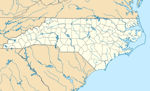

Newport Lage in North CarolinaBasisdaten Staat: Vereinigte Staaten Bundesstaat: North Carolina County: Koordinaten: 34° 47′ N, 76° 52′ W34.787777777778-76.8666666666675Koordinaten: 34° 47′ N, 76° 52′ W Zeitzone: Eastern Standard Time (UTC−5) Einwohner: 3349 (Stand: 2000) Bevölkerungsdichte: 176,3 Einwohner je km² Fläche: 19,1 km² (ca. 7 mi²)
davon 19,0 km² (ca. 7 mi²) LandHöhe: 5 m Postleitzahl: 28570 Vorwahl: +1 252 FIPS: 37-46860 GNIS-ID: 1013948 Webpräsenz: www.townofnewport.com Bürgermeister: Derryl Garner 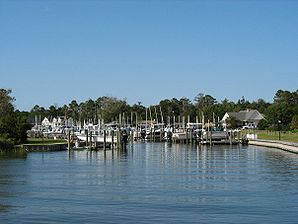
Privater Bootshafen in NewportNewport ist eine Stadt im Carteret County, North Carolina (Vereinigte Staaten). Sie hatte 3349 Einwohner bei der Volkszählung im Jahr 2000.
Geschichte
Newport erhielt offiziell 1866 das Stadtrecht. Obwohl die Gemeinde am Fluss Newport unter diesem Namen schon einige Jahrzehnte vorher existierte, war das Gebiet in früheren Jahren auch als Bell’s Corner und Shepardsville bekannt. Erste Industriezweige waren Land- und Holzwirtschaft sowie Zulieferindustrie für den Schiffbau, einschließlich Terpentinherstellung. Während der frühen Geschichte der Stadt war der Fluss Newport auf der ganzen Strecke bis zu der in den Atlantischen Ozean mündenden kleinen Bucht Old-Topsail-Inlet, jetzt bekannt als Beaufort-Inlet, schiffbar.
Die Stadt war die Heimat einer der ersten organisierten Kirchen im Carteret County, der 1778 gegründeten Newport River Primitive Baptist Church. Das Bauwerk wurde gegen Ende des Amerikanischen Bürgerkrieges niedergebrannt, aber kurze Zeit später an der Church Street wiederaufgebaut und ist bis heute in Benutzung.
Im Jahr 1858 wurde mit dem Verlegen der Schienen auf der 96 Meilen langen Strecke von Goldsboro über Newport nach Beaufort die Atlantic and North Carolina Railroad fertiggestellt. Auf dem Stadtgebiet liegen zahlreiche Schlachtfelder, Forts und strategische Positionen des Amerikanischen Bürgerkrieges. Newport war die längste Zeit des Krieges durch Unionstruppen besetzt.
Ein Teil der Wohnbebauung der Stadt ist als Housing Project bekannt und wurde ursprünglich als Wohngebiet für die Angestellten und das Militärpersonal der nahegelegenen Marine Corps Air Station Cherry Point entwickelt.
Politik
Die Stadtverwaltung ist in der Form des Council-Manager-Systems aufgebaut und besteht aus Bürgermeister, Town-Manager (Stadtgeschäftsführer) und einem fünfköpfigen Stadtrat. Derryl Garner ist seit 1978 als Bürgermeister von Newport im Amt.
Öffentliche Einrichtungen
Seit den 1940er Jahren gibt es in der Stadt die Freiwillige Feuerwehr Newport, die auch für den Rettungsdienst zuständig ist.
An öffentlichen Schulen bestehen in Newport die Newport Elementary School (Grundschule) und die Newport Middle School (Mittelschule). Die Newport Consolidated School, eine zwölfklassige Schule, die 1926 gegründet worden war, wurde 1966 abgerissen, nachdem der Bau einer neuen Consolidated High School für das County, der West Carteret High im nahegelegenen Morehead City, fertiggestellt war.
Kategorie:- Ort in North Carolina


Wikimedia Foundation.