- Loxton Waikerie Council
-
District Council of Loxton Waikerie 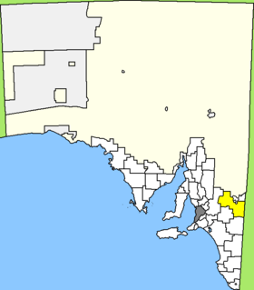
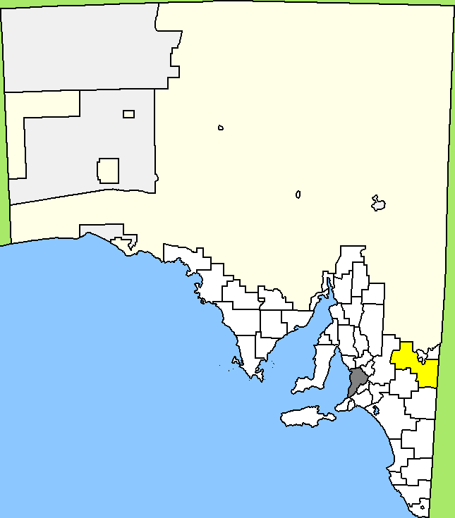
Lage des Loxton Waikerie Council in South AustraliaGliederung Staat:  Australien
Bundesstaat:  South Australia
Verwaltungssitz: Loxton Daten und Zahlen Fläche: 7.957 km² Einwohner: 11.604 (2006) [1] Bevölkerungsdichte: 1,5 Einwohner je km² -34.45140.56666666667Koordinaten: 34° 27′ S, 140° 34′ ODer District Council of Loxton Waikerie ist ein lokales Verwaltungsgebiet (LGA) im australischen Bundesstaat South Australia. Das Gebiet ist 7957 km² groß und hat etwa 12.000 Einwohner.
Loxton Waikerie liegt am Ostrand von South Australia an der Grenze zu Victoria südlich des Murray River und etwa 190 km östlich der Metropole Adelaide. Das Gebiet beinhaltet 57 Ortsteile und Ortschaften: Alawoona, Bakara, Bayah, Bookpurnong, Boolgun, Browns Well, Bugle Hut, Caliph, Cobera, Devlin Pound, Golden Heights, Hartwig Corner, Holder, Kanni, Kingston-on-Murray, Lock No 2, Lowbank, Loxton , Loxton North, Maggea, Maize Island, Malpas, Markeri, Meribah, Moorook, Mootatunga, Murbko, Myrla, Nadda, Naidia, Nangari, Netherleigh, New Residence, New Well, Noora, Notts Well, Oxford Landing, Paisley, Pata, Peebinga, Poogincok, Pyap, Qualco, Ramco, Ramco Heights, Sunlands, Taldra, Taplan, Taylorville, Tookayerta, Tuscan, Veitch, Waikerie, Wappilka, Woolpunda, Wunkar und Yinkanie. Der Verwaltungssitz des Councils befindet sich in Loxton am Murray.
Verwaltung
Der Council von Loxton Waikerie hat zwölf Mitglieder, die elf Councillor und der Vorsitzende und Mayor (Bürgermeister) des Councils werden von den Bewohnern der LGA gewählt. Loxton Waikerie ist nicht in Bezirke untergliedert.
Weblinks
Einzelnachweise
- ↑ Australian Bureau of Statistics (25. Oktober 2007): Loxton Waikerie (DC) (Local Government Area) (Englisch). 2006 Census QuickStats. Abgerufen am 6. April 2010.
Kategorie:- Local Government Area in South Australia
Wikimedia Foundation.