Loch Linnhe

Loch Linnhe
Loch Linnhe
56.701388888889-5.2619444444445
Loch Linnhe (Schottland)
Loch Linnhe
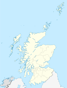
Loch Linnhe

Loch Linnhe ist eine Meeresbucht (In Schottland spricht man von sea loch zur Unterscheidung von „normalen“ lochs , Binnenseen. Schottisch: loch, gesprochen wie das deutsche Wort: Loch) in den Highlands an der Westküste Schottlands.

Loch Linnhe hat eine Länge von 15 Kilometer und ist im Durchschnitt zwei Kilometer breit. An seinem südwestlichen Ende öffnet er sich in den Firth of Lorn. Die Stadt Fort William liegt an seinem nordöstlichen Ende, dort wo der Fluss Lochy mündet.

Der Loch Linnhe ist vermutlich mit dem bei Ptolemäus erscheinenden Fluss Longos identisch.[1]

Einzelnachweise

  1. Ptolemäus Geographie 2.3

Wikimedia Foundation.

Игры ⚽ Поможем написать курсовую

Schlagen Sie auch in anderen Wörterbüchern nach:

  • Loch Linnhe — Loch Linnhe. Loch Linnhe (conocido en gaélico escocés como An Linne Dhubh corriente arriba de Corran y como An Linne Sheileach corriente abajo de Corran) es un loch marítimo, es decir, un estuario o fiordo y no un lago, en la costa occidental de… …   Wikipedia Español

  • Loch Linnhe — (known in Gaelic as An Linne Dhubh upstream of Corran and as An Linne Sheileach downstream of Corran) is a sea loch on the west coast of Scotland.Loch Linnhe extends 15 kilometres and is an average of 2 kilometres wide. It opens onto the Firth of …   Wikipedia

  • Loch Linnhe — Le Loch Linnhe Le Loch Linnhe vu depuis Fort William …   Wikipédia en Français

  • Loch Linnhe — Sp Linio ẽžeras Ap Loch Linnhe angliškai, geliškai (škotiškai) Sp Lòch Linis Ap Loch Linnhe angliškai, geliškai (škotiškai) L D. Britanijoje (Škotijoje) …   Pasaulio vietovardžiai. Internetinė duomenų bazė

  • Loch Linnhe — noun an inlet of the Atlantic Ocean on the western coast of Scotland • Instance Hypernyms: ↑loch • Part Holonyms: ↑Scotland …   Useful english dictionary

  • Shuna, Loch Linnhe — Infobox Scottish island | latitude=56.59 longitude= 5.395 GridReference=NM916490 celtic name= norse name= meaning of name= area=155 ha area rank= 122 highest elevation=Tom an t Seallaidh 71 m Population=0 population rank= main settlement= island… …   Wikipedia

  • Loch Lochy — Geographische Lage Highland, Schottland Zuflüsse Kaledonisch …   Deutsch Wikipedia

  • Loch Creran — Vue depuis Appin vers Sgurr Mor, Benderloch Administration Pays …   Wikipédia en Français

  • Loch Eil — Vue du sud est depuis la rive situé à l extrémité ouest du loch Eil. Administration Pays …   Wikipédia en Français

  • Loch Eil — (Scottish Gaelic, Loch Iall ) is a sea loch in Lochaber, Scotland that opens into Loch Linnhe near the town of Fort William.Loch Eil Outward Bound railway station and Locheilside railway station are both situated on the northern shore of the loch …   Wikipedia

Share the article and excerpts

Direct link
Do a right-click on the link above
and select “Copy Link”