- Liste der Countys in Texas
-
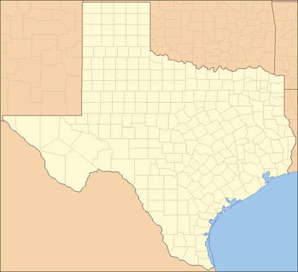
Der US-Bundesstaat Texas ist in 254 Countys unterteilt, mehr als alle anderen Bundesstaaten.
Texas entstand aus Gebieten, die zuvor unter spanischer bzw. mexikanischer Kontrolle waren. Die lokalen Verwaltungseinheiten hießen daher vor der Ausrufung der Republik Texas (1836) „Gemeinden“. 1836 gab es 23 solcher Gemeinden, die dann zu den 23 ursprünglichen Countys wurden. Die anderen Countys entstanden in der Regel durch Abspaltung aus einem oder mehreren der älteren Countys wenn die steigende Bevölkerungsdichte dies notwendig erscheinen ließ (Siehe Spalte „Ursprung“ in der Tabelle).
Der FIPS-Code für Texas ist 48, die einzelnen Countys haben also einen Code der Form 48XXX, wobei die XXX durch den Code des entsprechenden Countys ersetzt werden.
Liste
County FIPS Code
[1]Verwaltungssitz
(County Seat)
[2]Gegründet Ursprung Namensherkunft Bevölkerung
[2]Fläche
[2]Karte Anderson County 001 Palestine 1846 Houston County Kenneth Lewis Anderson (1805–1845), letzter Vize-Präsident der Republik Texas 55.109 2.774 km² (1.071 sq mi) 
Andrews County 003 Andrews 1876 Bexar County Richard Andrews (?–1835), erster texanischer Soldat, der im Texanischen Unabhängigkeitskrieg fiel 13.004 3.888 km² (1.501 sq mi) 
Angelina County 005 Lufkin 1846 Nacogdoches County Eine Hainai-Indianerin, die den spanischen Missionaren half und „kleiner Engel“ genannt wurde (Spanisch: Angelina) 80.130 2.077 km² (802 sq mi) 
Aransas County 007 Rockport 1871 Refugio County Aransas Bay, seinerseits nach einem spanischen Fort, eventuell nach Sanctuario de Aránzazu
(Arantzazu ist baskisch für „Platz der Dornen“)22.497 653 km² (252 sq mi) 
Archer County 009 Archer City 1858 Fannin County Branch Tanner Archer 8.854 2.357 km² (910 sq mi) 
Armstrong County 011 Claude 1876 Bexar County Eine amerikanische Siedlerfamilie 2.148 2.367 km² (914 sq mi) 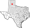
Atascosa County 013 Jourdanton 1856 Bexar County Spanisch: Sumpfig 38.628 3.191 km² (1.232 sq mi) 
Austin County 015 Bellville 1836 Eines der ursprünglichen 23 Countys Stephen F. Austin (1793–1836), bekannt als „Vater von Texas“ 23.590 1.691 km² (653 sq mi) 
Bailey County 017 Muleshoe 1876 Bexar County Peter James Bailey, Verteidiger in Alamo 6.594 2.142 km² (827 sq mi) 
Bandera County 019 Bandera 1856 Bexar County Bandera Pass, nach dem spanischen Wort für „Flagge“ 17.645 2.051 km² (792 sq mi) 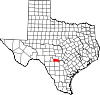
Bastrop County 021 Bastrop 1836 Eines der ursprünglichen 23 Countys Felipe Enrique Neri, Baron de Bastrop, dänischer Siedler 57.733 2.300 km² (888 sq mi) 
Baylor County 023 Seymour 1858 Fannin County Henry Weidner Baylor, Chirurg der Texas Rangers während des Mexikanisch-Amerikanischen Krieges 4.093 2.256 km² (871 sq mi) 
Bee County 025 Beeville 1857 San Patricio County, Goliad County, Refugio County, Live Oak County, und Karnes County Barnard Elliott Bee, Sr. (1787–1853), Politiker der Republik Texas 32.359 2.279 km² (880 sq mi) 
Bell County 027 Belton 1850 Milam County Peter Hansborough Bell, dritter Gouverneur von Texas (1849–1853) 237.974 2.743 km² (1.059 sq mi) 
Bexar County 029 San Antonio 1836 Eines der ursprünglichen 23 Countys San Antonio de Béxar, ein wichtiges Presidio im mexikanischen Texas, nach dem San Antonio River und Baltasar de Zúñiga, 1st Duke of Arión, Herzöge von Béjar 1.392.931 3.230 km² (1.247 sq mi) 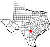
Blanco County 031 Johnson City 1858 Burnet County, Comal County, Gillespie County und Hays County Blanco River 8.418 1.841 km² (711 sq mi) 
Borden County 033 Gail 1876 Bexar County Gail Borden, Jr. (1801–1874), Geschäftsmann, Verleger und Erfinder der Kondensmilch 729 2.328 km² (899 sq mi) 
Bosque County 035 Meridian 1854 McLennan County The Bosque River
(Bosque ist Spanisch für „hölzern“)17.204 2.561 km² (989 sq mi) 
Bowie County 037 Boston 1840 Red River County James Bowie (1796–1836), Kämpfer in der Schlacht von Alamo 89.306 2.300 km² (888 sq mi) 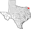
Brazoria County 039 Angleton 1836 Eines der ursprünglichen 23 Countys Brazoria (Texas), früher Hafen am Brazos River 241.767 3.592 km² (1.387 sq mi) 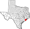
Brazos County 041 Bryan 1841 Washington County
Hieß biss 1842 Navasota CountyBrazos River 152.415 1.518 km² (586 sq mi) 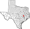
Brewster County 043 Alpine 1887 Presidio County Henry Percy Brewster (1816–1884), Kriegsminister der Republik Texas und Soldat im Bürgerkrieg 8.866 16.040 km² (6.193 sq mi) 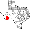
Briscoe County 045 Silverton 1876 Bexar County Andrew Briscoe (1810–1849), Unterzeichner der Unabhängigkeitserklärung von Texas 1.790 2.331 km² (900 sq mi) 
Brooks County 047 Falfurrias 1911 Starr County John Abijah Brooks, Texas Ranger und Politiker 7.976 2.442 km² (943 sq mi) 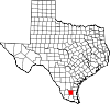
Brown County 049 Brownwood 1856 Comanche County und Travis County Henry Stevenson Brown, Offizier im Battle of Velasco 37.674 2.445 km² (944 sq mi) 
Burleson County 051 Caldwell 1846 Milam County Edward Burleson (1798–1851), General und Staatsmann der Texanischen Revolution 16.470 1.725 km² (666 sq mi) 
Burnet County 053 Burnet 1852 Bell County, Travis County und Williamson County David Gouverneur Burnet, erster Präsident der Republik Texas (1836) 34.147 2.577 km² (995 sq mi) 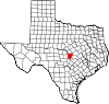
Caldwell County 055 Lockhart 1848 Bastrop County und Gonzales County Mathew Caldwell, Unterzeichner der Texanischen Unabhängigkeitserklärung und Soldat während der Texanischen Revolution 32.194 1.414 km² (546 sq mi) 
Calhoun County 057 Port Lavaca 1846 Jackson County, Matagorda County und Victoria County John C. Calhoun, siebter Vizepräsident der USA (1825–1832) 20.647 1.326 km² (512 sq mi) 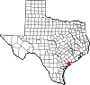
Callahan County 059 Baird 1858 Bexar County, Bosque County, and Travis County James Hughes Callahan, Soldat während der Texanischen Revolution 12.905 2.328 km² (899 sq mi) 
Cameron County 061 Brownsville 1848 Nueces County und Ländereien Mexikos Ewen Cameron, Soldat während der Texanischen Revolution, getötet während der Black Bean Episode 335.227 2.347 km² (906 sq mi) 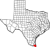
Camp County 063 Pittsburg 1874 Upshur County John Lafayette Camp (1828–1891), Politiker 11.549 513 km² (198 sq mi) 
Carson County 065 Panhandle 1876 Bexar County Samuel Price Carson, Erster Secretary of State der Republik Texas (1836–1838) 6.516 2.391 km² (923 sq mi) 
Cass County 067 Linden 1846 Bowie County Lewis Cass (1782–1866), Senator aus Michigan Hieß Davis County 1861–1871 30.438 2.429 km² (938 sq mi) 
Castro County 069 Dimmitt 1876 Bexar County Henri Castro (1786–1865), Französischer General 8.285 2.326 km² (898 sq mi) 
Chambers County 071 Anahuac 1858 Jefferson County und Liberty County Thomas Jefferson Chambers, früher Anwalt in Texas 26.031 1.551 km² (599 sq mi) 
Cherokee County 073 Rusk 1846 Nacogdoches County Die Cherokee-Indianer 46.659 2.725 km² (1.052 sq mi) 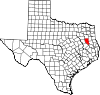
Childress County 075 Childress 1876 Bexar County und Young County George Campbell Childress (1804–1841), Einer der Autoren der texanischen Unabhängigkeitserklärung 7.688 1.839 km² (710 sq mi) 
Clay County 077 Henrietta 1857 Cooke County Henry Clay, Politiker aus Kentucky und US-Außenminister (1825–1829) 11.006 2.844 km² (1.098 sq mi) 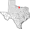
Cochran County 079 Morton 1876 Bexar County und Young County Robert E. Cochran (1810–1836), Verteidiger von „The Alamo“ 3.730 2.007 km² (775 sq mi) 
Coke County 081 Robert Lee 1889 Tom Green County Richard Coke, fünfzehnter Gouverneur von Texas (1874–1876) 3.864 2.328 km² (899 sq mi) 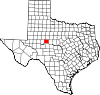
Coleman County 083 Coleman 1858 Brown County und Travis County Robert M. Coleman, Unterzeichner der Texanischen Unabhängigkeitserklärung und Soldat in der Schlacht von San Jacinto 9.235 3.297 km² (1.273 sq mi) 
Collin County 085 McKinney 1846 Fannin County Collin McKinney (1766–1861), Autor der texanischen Unabhängigkeitserklärung 491.675 2.196 km² (848 sq mi) 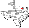
Collingsworth County 087 Wellington 1876 Bexar County und Young County James Collinsworth, Unterzeichner der texanischen Unabhängigkeitserklärung und Politiker
(Schreibweise der Namen unterscheidet sich wegen einem Schreibfehler in der Gründungsakte des Countys)3.206 2.380 km² (919 sq mi) 
Colorado County 089 Columbus 1836 Eines der ursprünglichen 23 Countys Colorado River 20.390 2.494 km² (963 sq mi) 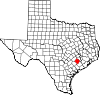
Comal County 091 New Braunfels 1846 Bexar County Comal River 78.021 1.456 km² (562 sq mi) 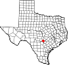
Comanche County 093 Comanche 1856 Bosque County und Coryell County Die Comanche 14.026 2.429 km² (938 sq mi) 
Concho County 095 Paint Rock 1858 Bexar County Concho River 3.966 2.569 km² (992 sq mi) 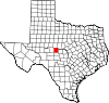
Cooke County 097 Gainesville 1848 Fannin County William Gordon Cooke, Soldat während der texanischen Revolution 36.363 2.264 km² (874 sq mi) 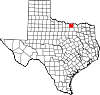
Coryell County 099 Gatesville 1854 Bell County James Coryell, Trapper, der von Indianern getötet wurde 74.978 2.725 km² (1.052 sq mi) 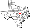
Cottle County 101 Paducah 1876 Fannin County George Washington Cottle, Soldat gestorben bei der Verteidigung von The Alamo (Texas) 1.904 2.334 km² (901 sq mi) 
Crane County 103 Crane 1887 Tom Green County William Carey Crane, Präsident der Baylor University 3.996 2.036 km² (786 sq mi) 
Crockett County 105 Ozona 1875 Bexar County David Crockett (1786–1836), legendärer Kämpfer, der in der Schlacht von The Alamo fiel 4.099 7.273 km² (2.808 sq mi) 
Crosby County 107 Crosbyton 1876 Bexar County und Young County Stephen Crosby 7.072 2.331 km² (900 sq mi) 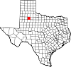
Culberson County 109 Van Horn 1911 El Paso County David Browning Culberson, Anwalt und Soldat im Amerikanischen Bürgerkrieg 2.975 9.876 km² (3.813 sq mi) 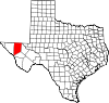
Dallam County 111 Dalhart 1876 Bexar County James Wilmer Dallam, Anwalt und Zeitungsverleger 6.222 3.898 km² (1.505 sq mi) 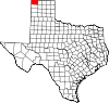
Dallas County 113 Dallas 1846 Nacogdoches County und Robertson County George Mifflin Dallas, elfter Vizepräsident der USA(1845–1849) (Disputed) 2.294.706 2.279 km² (880 sq mi) 
Dawson County 115 Lamesa 1846 Bexar County Nicholas Mosby Dawson, Soldat während der texanischen Revolution und Opfer des Dawson-Massaker 14.985 2.336 km² (902 sq mi) 
Deaf Smith County 117 Hereford 1876 Bexar County Erastus "Deaf" Smith (1787–1837), Aufklärer während der texanischen Revolution 18.561 3.877 km² (1.497 sq mi) 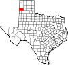
Delta County 119 Cooper 1870 Hopkins County und Lamar County Wegen seiner dreieckigen Form nach dem griechischen Buchstaben Delta 5.327 717 km² (277 sq mi) 
Denton County 121 Denton 1846 Fannin County John Bunyan Denton (1806–1841), Soldat 584.238 2.300 km² (888 sq mi) 
DeWitt County 123 Cuero 1846 Goliad County, Gonzales County und Victoria County Green DeWitt, empresario der eine frühe Kolonie in Texas gegründet hatte 20.013 2.354 km² (909 sq mi) 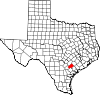
Dickens County 125 Dickens 1876 Bexar County J. Dickens, gefallen in der Schlacht von the Alamo 2.762 2.341 km² (904 sq mi) 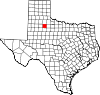
Dimmit County 127 Carrizo Springs 1858 Bexar County, Maverick County, Uvalde County und Webb County Philip Dimmitt, bedeutende Person der texanischen Revolution 10.248 3.447 km² (1.331 sq mi) 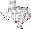
Donley County 129 Clarendon 1876 Bexar County Stockton P. Donley, Rechtsgelehrter an der Front 3.828 2.409 km² (930 sq mi) 
Duval County 131 San Diego 1858 Live Oak County, Nueces County und Starr County Burr Harrison DuVal (1809–1836), Soldat, gefallen im Goliad Massacre 13.120 4.644 km² (1.793 sq mi) 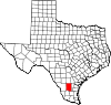
Eastland County 133 Eastland 1858 Bosque County, Coryell County und Travis County William Mosby Eastland, Soldat in der texanischen Revolution 18.297 2.398 km² (926 sq mi) 
Ector County 135 Odessa 1887 Tom Green County Mathew Ector (1822–1879), General der Konföderation 121.123 2.334 km² (901 sq mi) 
Edwards County 137 Rocksprings 1858 Bexar County Haden Edwards (1771–1849) 2.162 5.491 km² (2.120 sq mi) 
Ellis County 139 Waxahachie 1849 Navarro County Richard Ellis (1781–1846), Präsident der Kommission, der die Texanische Unabhängigkeitserklärung erarbeitete 111.360 2.435 km² (940 sq mi) 
El Paso County 141 El Paso 1848 Santa Fe County Das benachbarte Ciudad Juárez, das früher El Paso del Norte, weil es als Pass von Mexiko nach New Mexiko diente 721.598 2.624 km² (1.013 sq mi) 
Erath County 143 Stephenville 1856 Bosque County und Coryell County George Bernard Erath, Soldat in der Schlacht von San Jacinto 33.001 2.813 km² (1.086 sq mi) 
Falls County 145 Marlin 1850 Limestone County und Milam County Wasserfälle am Brazos River 18.576 1.992 km² (769 sq mi) 
Fannin County 147 Bonham 1837 Red River County James Walker Fannin, Jr. (1805–1836), Anführer der Texaner, der im Goliad-Massaker umkam 31.242 2.310 km² (892 sq mi) 
Fayette County 149 La Grange 1837 Bastrop County General Lafayette (1757–1834), französischer Held im Amerikanischen Unabhängigkeitskrieg 21.804 2.460 km² (950 sq mi) 
Fisher County 151 Roby 1876 Bexar County Samuel Rhoads Fisher (1794–1839), Unterzeichner der Texanischen Unabhängigkeitserklärung 4.344 2.334 km² (901 sq mi) 
Floyd County 153 Floydada 1876 Bexar County und Young County Dolphin Ward Floyd, Gestorben bei The Alamo 7.771 2.569 km² (992 sq mi) 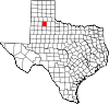
Foard County 155 Crowell 1891 Cottle County, Hardeman County, King County und Knox County Robert Levi Foard, Soldat 1.622 1.831 km² (707 sq mi) 
Fort Bend County 157 Richmond 1837 Austin County, Brazoria County und Harris County Haus am Brazos River 354.452 2.266 km² (875 sq mi) 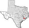
Franklin County 159 Mount Vernon 1875 Titus County Benjamin Cromwell Franklin (1805–1873), Früher Richter und Politiker in Texas 9.458 741 km² (286 sq mi) 
Freestone County 161 Fairfield 1850 Limestone County Eine Art Pfirsiche[3] 17.867 2.292 km² (885 sq mi) 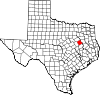
Frio County 163 Pearsall 1858 Atascosa County, Bexar County und Uvalde County Frio River
(Frio: Kalt)16.252 2.934 km² (1.133 sq mi) 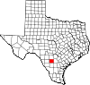
Gaines County 165 Seminole 1876 Bexar County James Gaines, Händler und Unterzeichner der Texas Declaration of Independence 14.467 3.890 km² (1.502 sq mi) 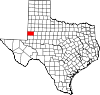
Galveston County 167 Galveston 1838 Brazoria County, Harris County und Liberty County Bernardo de Gálvez, Spanischer Gouverneur des Louisiana Territory (1777–1785) 277.563 1.033 km² (399 sq mi) 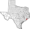
Garza County 169 Post 1876 Bexar County The pioneer family of José Antonio de la Garza 4.872 2.321 km² (896 sq mi) 
Gillespie County 171 Fredericksburg 1848 Bexar County und Travis County Robert Addison Gillespie, Händler und Soldat im Mexikanisch-Amerikanischen Krieg 20.814 2.748 km² (1.061 sq mi) 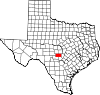
Glasscock County 173 Garden City 1887 Tom Green County George Washington Glasscock (1810–1868), früher Siedler und Soldat 1.406 2.334 km² (901 sq mi) 
Goliad County 175 Goliad 1836 Eines der ursprünglichen 23 Countys Goliad, seinen Hauptort, als Anagram des mexikanischen Patrioten Miguel Hidalgo 6.928 2.212 km² (854 sq mi) 
Gonzales County 177 Gonzales 1836 Eines der ursprünglichen 23 Countys Gonzales (Texas), Nach Gouverneur Rafael Gonzales von Coahuila y Tejas 18.628 2.766 km² (1.068 sq mi) 
Gray County 179 Pampa 1876 Bexar County Peter W. Gray (1819–1874), Soldat im Bürgerkrieg 22.744 2.404 km² (928 sq mi) 
Grayson County 181 Sherman 1846 Fannin County Peter Wagener Grayson, Politiker 110.595 2.419 km² (934 sq mi) 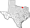
Gregg County 183 Longview 1873 Upshur County John Gregg (1828–1864), Konföderierter Kriegsheld 111.379 710 km² (274 sq mi) 
Grimes County 185 Anderson 1846 Montgomery County Jesse Grimes (1788–1866), Unterzeichner der Unabhängigkeitserklärung und Siedler 23.552 2.056 km² (794 sq mi) 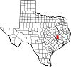
Guadalupe County 187 Seguin 1846 Bexar County und Gonzales County Guadalupe River, nach Our Lady of Guadalupe 89.023 1.841 km² (711 sq mi) 
Hale County 189 Plainview 1876 Bexar County John C. Hale, Offizier, der während der Schlacht von San Jacinto fiel 36.602 2.603 km² (1.005 sq mi) 
Hall County 191 Memphis 1876 Bexar County und Young County Warren DeWitt Clinton Hall, Kriegsminister von Texas (1836) 3.782 2.339 km² (903 sq mi) 
Hamilton County 193 Hamilton 1856 Bosque County, Comanche County und Lampasas County James Hamilton Jr., Gouverneur von South Carolina (1830–1832), der die Republik Texas finanziell unterstützte 8.229 2.165 km² (836 sq mi) 
Hansford County 195 Spearman 1876 Bexar County und Young County John M. Hansford, Politiker und Richter 5.369 2.383 km² (920 sq mi) 
Hardeman County 197 Quanah 1858 Fannin County Bailey und Thomas Jones Hardeman, Politiker 4.724 1.800 km² (695 sq mi) 
Hardin County 199 Kountze 1858 Jefferson County und Liberty County Die Hardin-Familie aus Liberty County 48.073 2.315 km² (894 sq mi) 
Harris County 201 Houston 1836 Eines der ursprünglichen 23 Countys John Richardson Harris,Siedler
Hieß Harrisburg County bis 18393.693.050 4.478 km² (1.729 sq mi) 
Harrison County 203 Marshall 1839 Shelby County Jonas Harrison, Anwalt 62.110 2.328 km² (899 sq mi) 
Hartley County 205 Channing 1876 Bexar County und Young County Oliver C. und Rufus K. Hartley, Politiker 5.537 3.787 km² (1.462 sq mi) 
Haskell County 207 Haskell 1858 Fannin County und Milam County Charles Ready Haskell, getötet im Goliad-Massaker 6.093 2.339 km² (903 sq mi) 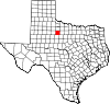
Hays County 209 San Marcos 1848 Travis County John Coffee Hays (1817–1883), Texas Ranger und offizier im Mexikanisch-Amerikanischen Krieg 97.589 1.756 km² (678 sq mi) 
Hemphill County 211 Canadian 1876 Bexar County und Young County John Hemphill (1803–1862), Richter und Politiker 3.351 2.357 km² (910 sq mi) 
Henderson County 213 Athens 1846 Houston County und Nacogdoches County James Pinckney Henderson, Erster Gouverneur von Texas (1846–1847) 73.277 2.264 km² (874 sq mi) 
Hidalgo County 215 Edinburg 1852 Cameron County Miguel Hidalgo y Costilla (1753–1811), Priester, der maßgeblich an der mexikanischen Unabhängigkeit beteiligt war 569.463 4.064 km² (1.569 sq mi) 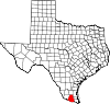
Hill County 217 Hillsboro 1853 Navarro County George Washington Hill, Politiker 32.321 2.492 km² (962 sq mi) 
Hockley County 219 Levelland 1876 Bexar County und Young County George Washington Hockley (1802–1854), Soldat und Politiker 22.716 2.352 km² (908 sq mi) 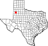
Hood County 221 Granbury 1866 Johnson County John Bell Hood (1831–1879), konföderierter Offizier und Chef der Hood's Texas Brigade 41.100 1.093 km² (422 sq mi) 
Hopkins County 223 Sulphur Springs 1846 Lamar County und Nacogdoches County Die Familie von David Hopkins, einem frühen Siedler im späteren Texas 31.960 2.033 km² (785 sq mi) 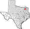
Houston County 225 Crockett 1837 Nacogdoches County Sam Houston (1793–1863), General bei der texanischen Revolution, später Präsident der Republik Texas sowie Gouverneur und Senator 23.185 3.188 km² (1.231 sq mi) 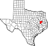
Howard County 227 Big Spring 1876 Bexar County Volney Eskine Howard, Abgeordneter des Staates Texas (1849–1853) 33.627 2.339 km² (903 sq mi) 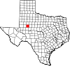
Hudspeth County 229 Sierra Blanca 1917 El Paso County Claude Benton Hudspeth, a state congressman (1919–1931), Rancher und Zeitungsverleger 3.344 11.839 km² (4.571 sq mi) 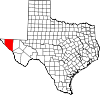
Hunt County 231 Greenville 1846 Fannin County und Nacogdoches County Memucan Hunt, Jr. (1807–1856) 76.596 2.178 km² (841 sq mi) 
Hutchinson County 233 Stinnett 1876 Bexar County Andrew Hutchinson, Attorney General 23.857 2.297 km² (887 sq mi) 
Irion County 235 Mertzon 1889 Tom Green County Robert Anderson Irion (1804–1861), Secretary of State der Republik Texas 1.771 2.725 km² (1.052 sq mi) 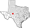
Jack County 237 Jacksboro 1856 Cooke County Die Gebrüder Patrick Churchill und William Houston Jack, Beteiligte an den Unruhen von Anahuac 8.763 2.375 km² (917 sq mi) 
Jackson County 239 Edna 1836 Eines der ursprünglichen 23 Countys Andrew Jackson, Held in der Schlacht von New Orleans und siebter Präsident der Vereinigten Staaten (1829–1837) 14.391 2.150 km² (830 sq mi) 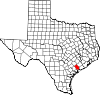
Jasper County 241 Jasper 1836 Eines der ursprünglichen 23 Countys William Jasper (1750–1779), Held im Amerikanischen Unabhängigkeitskrieg 35.604 2.429 km² (938 sq mi) 
Jeff Davis County 243 Fort Davis 1887 Presidio County Jefferson Davis, Präsident der Könföderierten Staaten von Amerika (1861–1865) 2.207 5.866 km² (2.265 sq mi) 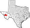
Jefferson County 245 Beaumont 1836 Eines der ursprünglichen 23 Countys Thomas Jefferson, dritter Präsident der USA(1801–1809) 252.051 2.341 km² (904 sq mi) 
Jim Hogg County 247 Hebbronville 1913 Brooks County und Duval County James Stephen Hogg, zwanzigster Gouverneur von Texas (1891–1895) 5.281 2.942 km² (1.136 sq mi) 
Jim Wells County 249 Alice 1911 Nueces County James Babbage Wells Jr., mächtiger Politiker aus dem südlichen Texas 39.326 2.240 km² (865 sq mi) 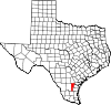
Johnson County 251 Cleburne 1854 Ellis County, Hill County und Navarro County Middleton Tate Johnson, Texas Ranger, Soldat und Politiker 126.811 1.888 km² (729 sq mi) 
Jones County 253 Anson 1854 Bexar County und Bosque County Anson Jones, fünfter Präsident der Republik Texas (1844–1846) 20.785 2.411 km² (931 sq mi) 
Karnes County 255 Karnes City 1854 Bexar County, DeWitt County, Goliad County, Gonzales County und San Patricio County Henry Karnes (1812–1840), Soldat 15.446 1.942 km² (750 sq mi) 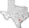
Kaufman County 257 Kaufman 1848 Henderson County David Spangler Kaufman, Jüdischer Senator und der zweite Jude im Repräsentantenhaus 71.313 2.036 km² (786 sq mi) 
Kendall County 259 Boerne 1862 Blanco County und Kerr County George Wilkins Kendall, Journalist und Schafzüchter 23.743 1.715 km² (662 sq mi) 
Kenedy County 261 Sarita 1921 Hidalgo County und Willacy County Mifflin Kenedy, Rancher 414 3.774 km² (1.457 sq mi) 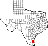
Kent County 263 Jayton 1876 Bexar County und Young County Andrew Kent, starb in der Schlacht von The Alamo 859 2.336 km² (902 sq mi) 
Kerr County 265 Kerrville 1856 Bexar County James Kerr (1790–1850), Siedler und Soldat 43.653 2.865 km² (1.106 sq mi) 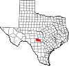
Kimble County 267 Junction 1858 Bexar County George C. Kimbell, starb in der Schlacht von The Alamo 4.468 3.240 km² (1.251 sq mi) 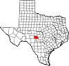
King County 269 Guthrie 1876 Bexar County William Phillip King,starb in der Schlacht von The Alamo 356 2.362 km² (912 sq mi) 
Kinney County 271 Brackettville 1850 Bexar County Henry Lawrence Kinney, nicht erfolgreicher Spekulant 3.379 3.533 km² (1.364 sq mi) 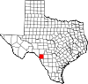
Kleberg County 273 Kingsville 1913 Nueces County Robert Justus Kleberg (1803–1888), deutscher Siedler und Soldat bei der Schlacht von San Jacinto 31.549 2.256 km² (871 sq mi) 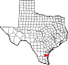
Knox County 275 Benjamin 1858 Bexar County und Young County Henry Knox, erster US-Kriegsminister (1785–1794) 4.253 2.212 km² (854 sq mi) 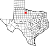
Lamar County 277 Paris 1840 Red River County Mirabeau B. Lamar, dritter Präsident der Republik Texas (1838–1842) 48.499 2.375 km² (917 sq mi) 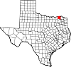
Lamb County 279 Littlefield 1876 Bexar County George A. Lamb, starb in der Schlacht von San Jacinto 14.709 2.631 km² (1.016 sq mi) 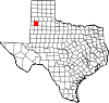
Lampasas County 281 Lampasas 1856 Bell County, Coryell County und Travis County The Lampasas River
(Lampasas bedeutet Lilien)17.762 1.844 km² (712 sq mi) 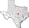
La Salle County 283 Cotulla 1858 Bexar County René Robert Cavelier, Sieur de La Salle (1643–1687), französischer Entdecker 5.866 3.856 km² (1.489 sq mi) 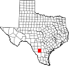
Lavaca County 285 Hallettsville 1842 Colorado County, Fayette County, Gonzales County, Jackson County und Victoria County
Hieß La Buca County bis 1846Lavaca River
(La vaca bedeutet Kuh)19.210 2.512 km² (970 sq mi) 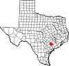
Lee County 287 Giddings 1874 Bastrop County, Burleson County, Fayette County und Washington County Robert Edward Lee (1807–1870), befehlshabender General der Konföderierten während des Bürgerkrieges 15.657 1.629 km² (629 sq mi) 
Leon County 289 Centerville 1846 Robertson County Unsicher: Entweder nach Martín De León, der Victoria (Texas) gegründet hat, oder dem león, eine besondere Art des Gelben Wolfes 15.335 2.776 km² (1.072 sq mi) 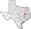
Liberty County 291 Liberty 1836 Eines der ursprünglichen 23 Countys Seiner Hauptstadt, die entweder wegen des vorangehenden Erfolges im Mexikanischen Unabhängigkeitskrieg oder wegen Liberty (Mississippi) so heisst 70.154 3.004 km² (1.160 sq mi) 
Limestone County 293 Groesbeck 1846 Robertson County Sandsteinabagerungen in der Region (limestone=Sandstein) 22.051 2.354 km² (909 sq mi) 
Lipscomb County 295 Lipscomb 1876 Bexar County Abner Smith Lipscomb, Richter (1846–1856) und Staatssekretär von Texas (1840) 3.057 2.414 km² (932 sq mi) 
Live Oak County 297 George West 1856 Nueces County und San Patricio County Die „Lebendige Eiche(=Oak) von Texas“ 12.309 2.683 km² (1.036 sq mi) 
Llano County 299 Llano 1856 Bexar County, Gillespie County The Llano River
(Llano bedeutet Ebene)17.044 2.422 km² (935 sq mi) 
Loving County 301 Mentone 1931 Tom Green County Oliver Loving (1812–1867), Viehzüchter und Pionier der grossen Herdenwanderungen 67 1.743 km² (673 sq mi) 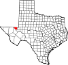
Lubbock County 303 Lubbock 1876 Bexar County Thomas Saltus Lubbock (1817–1862), Texas Ranger und Soldat 242.628 2.331 km² (900 sq mi) 
Lynn County 305 Tahoka 1876 Garza County William Lynn,Soldat aus Massachusetts, Gefallen in The Alamo? 6.550 2.310 km² (892 sq mi) 
McCulloch County 307 Brady 1856 Bexar County Benjamin McCulloch (1811–1862), Veteran der Schlacht von San Jacinto (Texas) 8.205 2.769 km² (1.069 sq mi) 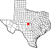
McLennan County 309 Waco 1850 Limestone County und Milam County Neil McLennan,früher Siedler 213.517 2.699 km² (1.042 sq mi) 
McMullen County 311 Tilden 1858 Atascosa County, Bexar County und Live Oak County John McMullen (1832–1883), Irischer Gründer einer Kolonie in Texas 851 2.883 km² (1.113 sq mi) 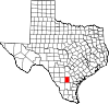
Madison County 313 Madisonville 1853 Grimes County, Leon County und Walker County James Madison, vierter Präsident der USA(1809–1817) 12.940 1.217 km² (470 sq mi) 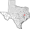
Marion County 315 Jefferson 1860 Cass County Francis Marion (1732–1795), General im Unabhängigkeitskrieg 10.941 987 km² (381 sq mi) 
Martin County 317 Stanton 1876 Bexar County Wylie Martin, Siedler und Politiker 4.746 2.370 km² (915 sq mi) 
Mason County 319 Mason 1858 Gillespie County Fort Mason, benannt entweder nach Lt. George T. Mason, getötet im Mexikanisch-Amerikanischen Krieg oder für General Richard Barnes Mason 3.738 2.414 km² (932 sq mi) 
Matagorda County 321 Bay City 1836 Eines der ursprünglichen 23 Countys Spanische Bezeichnung für das dichte Gebüsch, das hier einst wuchs 37.957 2.885 km² (1.114 sq mi) 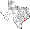
Maverick County 323 Eagle Pass 1856 Kinney County Samuel Maverick (1803–1870), früher Rechtsgelehrter und Politiker 47.297 3.315 km² (1.280 sq mi) 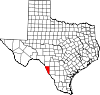
Medina County 325 Hondo 1848 Bexar County Medina River, nach Pedro Medina, spanischer Ingenieur 39.304 3.440 km² (1.328 sq mi) 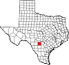
Menard County 327 Menard 1858 Bexar County Michel Branamour Menard, Gründer der Stadt Galveston 2.360 2.336 km² (902 sq mi) 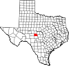
Midland County 329 Midland 1885 Tom Green County Seinem Hauptort, der in der Mitte zwischen Fort Worth und El Paso an der Texas and Pacific Railway liegt (Midway (Texas) gab es schon) 116.009 2.331 km² (900 sq mi) 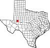
Milam County 331 Cameron 1836 Eines der ursprünglichen 23 Countys Benjamin Rush Milam (1788–1835), Kolonist und Soldat 24.238 2.634 km² (1.017 sq mi) 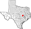
Mills County 333 Goldthwaite 1887 Brown County, Comanche County, Hamilton County und Lampasas County John T. Mills (1817–1871), Richter 5.151 1.937 km² (748 sq mi) 
Mitchell County 335 Colorado City 1876 Bexar County Asa und Eli Mitchell, frühe Siedler und Soldaten 9.698 2.357 km² (910 sq mi) 
Montague County 337 Montague 1857 Cooke County Daniel Montague, Staatssenator und Landvermesser 19.117 2.411 km² (931 sq mi) 
Montgomery County 339 Conroe 1837 Washington County Montgomery (Texas), das seinen Namen von Montgomery County (Alabama) hat 293.768 2.704 km² (1.044 sq mi) 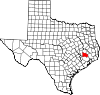
Moore County 341 Dumas 1876 Bexar County Edwin Ward Moore (1810–1865), Kommodore der Texan Navy 20.121 2.331 km² (900 sq mi) 
Morris County 343 Daingerfield 1875 Titus County William Wright Morris, Rechtsgelehrter 13.048 658 km² (254 sq mi) 
Motley County 345 Matador 1876 Bexar County Junius William Mottley, Unterzeichner der texanischen Unabhängigkeitserklärung 1.426 2.561 km² (989 sq mi) 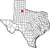
Nacogdoches County 347 Nacogdoches 1836 Eines der ursprünglichen 23 Countys Sein Hauptort, nach den Nacogdoche-Indianern 59.203 2.453 km² (947 sq mi) 
Navarro County 349 Corsicana 1846 Robertson County José Antonio Navarro (1795–1871), Tejano und Unterzeichner der texanischen Unabhängigkeitserklärung 45.124 2.774 km² (1.071 sq mi) 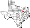
Newton County 351 Newton 1846 Jasper County John Newton (1755–1780), Kriegsveteran 15.072 2.416 km² (933 sq mi) 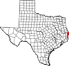
Nolan County 353 Sweetwater 1876 Bexar County Philip Nolan (1771–1801), von spanischen Truppen getötet 15.802 2.362 km² (912 sq mi) 
Nueces County 355 Corpus Christi 1846 San Patricio County The Nueces River
(Nueces is Spanish for "nuts")313.645 2.165 km² (836 sq mi) 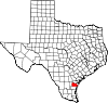
Ochiltree County 357 Perryton 1876 Bexar County William Beck Ochiltree (1811–1867), früher Siedler, Richter und Rechtsgelehrter 9.006 2.378 km² (918 sq mi) 
Oldham County 359 Vega 1876 Bexar County Williamson Simpson Oldham, Senator der Konföderation 2.185 3.888 km² (1.501 sq mi) 
Orange County 361 Orange 1852 Jefferson County Einem Orangenhain, der am Sabine River gepflanzt worden war 84.966 922 km² (356 sq mi) 
Palo Pinto County 363 Palo Pinto 1856 Bosque County und Navarro County Palo Pinto Creek
(Palo Pinto)27.026 2.468 km² (953 sq mi) 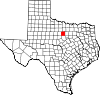
Panola County 365 Carthage 1846 Harrison County und Shelby County Indianisches Wort für Baumwolle 22.756 2.075 km² (801 sq mi) 
Parker County 367 Weatherford 1855 Bosque County und Navarro County Isaac Parker (1838–1896), Rechtsgelehrter 88.495 2.341 km² (904 sq mi) 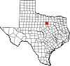
Parmer County 369 Farwell 1876 Bexar County Martin Parmer (1778–1850), Rechtsgelehrter, Richter und Unterzeichner der texanischen Unabhängigkeitserklärung 10.016 2.284 km² (882 sq mi) 
Pecos County 371 Fort Stockton 1871 Presidio County Pecos River, nach dem Pecos Pueblo, dessen Etymologie unbekannt ist 16.809 12.339 km² (4.764 sq mi) 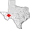
Polk County 373 Livingston 1846 Liberty County James K. Polk, elfter Präsident der Vereinigten Staaten (1845–1849) 41.133 2.738 km² (1.057 sq mi) 
Potter County 375 Amarillo 1876 Bexar County Robert Potter (1800–1842), Unterzeichner der texanischen Unabhängigkeitserklärung 113.546 2.354 km² (909 sq mi) 
Presidio County 377 Marfa 1850 Bexar County Presidio del Norte, Fort südlich des Rio Grande 7.304 9.987 km² (3.856 sq mi) 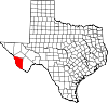
Rains County 379 Emory 1870 Hopkins County, Hunt County und Wood County Emory Rains (1800–1878), Siedler und Vermesser 9.139 601 km² (232 sq mi) 
Randall County 381 Canyon 1876 Bexar County Horace Randal, Konföderierter Brigadegeneral 104.312 2.367 km² (914 sq mi) 
Reagan County 383 Big Lake 1903 Tom Green County John H. Reagan (1818–1905), General, Texanischer Gouverneur und demokratischer Politiker 3.326 3.043 km² (1.175 sq mi) 
Real County 385 Leakey 1913 Bandera County, Edwards County und Kerr County Julius Real, Rancher und Rechtsgelehrter 3.047 1.813 km² (700 sq mi) 
Red River County 387 Clarksville 1836 Eines der ursprünglichen 23 Countys Red River 14.314 2.719 km² (1.050 sq mi) 
Reeves County 389 Pecos 1883 Pecos County George Robertson Reeves, Rechtsgelehrter und Soldat 13.137 6.827 km² (2.636 sq mi) 
Refugio County 391 Refugio 1836 Eines der ursprünglichen 23 Countys Seine Hauptstadt, nach der Spanischen Mission Nuestra Señora del Refugio, „Our Lady of Refuge“ 7.828 1.994 km² (770 sq mi) 
Roberts County 393 Miami 1876 Bexar County John S. Roberts, Unterzeichner der Unabhängigkeitserklärung und Oran Milo Roberts (1879–1883), siebter Gouverneur von Texas 887 2.393 km² (924 sq mi) 
Robertson County 395 Franklin 1837 Bexar County, Milam County und Nacogdoches County Sterling Clack Robertson, Gründer einer frühen Kolonie in Texas 16.000 2.214 km² (855 sq mi) 
Rockwall County 397 Rockwall 1873 Kaufman County Sein Hauptort, weil dort eine Steinwand gefunden wurde 43.080 334 km² (129 sq mi) 
Runnels County 399 Ballinger 1858 Bexar County und Travis County Hiram Runnels, Neunter Gouverneur von Mississippi (1833–1835) 11.495 2.730 km² (1.054 sq mi) 
Rusk County 401 Henderson 1843 Nacogdoches County Thomas Jefferson Rusk (1803–1857), General 47.372 2.393 km² (924 sq mi) 
Sabine County 403 Hemphill 1836 Eines der ursprünglichen 23 Countys Sabine River, der das County östlich begrenzt
(Sabine bedeutet „Zypresse“ auf Spanisch)10.469 1.269 km² (490 sq mi) 
San Augustine County 405 San Augustine 1836 Eines der ursprünglichen 23 Countys Wahrscheinlich Augustinus von Hippo (354–430) 8.946 1.368 km² (528 sq mi) 
San Jacinto County 407 Coldspring 1870 Liberty County, Montgomery County, Polk County und Walker County Die Schlacht von San Jacinto, in der Texas die Unabhängigkeit von Mexiko erlangte 22.246 1.479 km² (571 sq mi) 
San Patricio County 409 Sinton 1846 Refugio County Nach seinem früheren Hauptort San Patricio de Hibernia, eine irische Kolonie benannt nach Patrick von Irland 67.138 1.792 km² (692 sq mi) 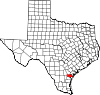
San Saba County 411 San Saba 1856 Bexar County San Saba River, entdeckt am Fest des Heiligen Sabas 6.186 2.937 km² (1.134 sq mi) 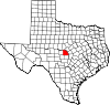
Schleicher County 413 Eldorado 1887 Crockett County Gustav Schleicher, früher Ingenieur und Siedler in Texas 2.935 3.395 km² (1.311 sq mi) 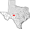
Scurry County 415 Snyder 1876 Bexar County William Read Scurry (1821–1864), Rechtsgelehrter und Soldat 16.361 2.339 km² (903 sq mi) 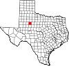
Shackelford County 417 Albany 1874 Jack County Jack Shackelford, Soldat im texanischen Unabhängigkeitskrieg 3.302 2.367 km² (914 sq mi) 
Shelby County 419 Center 1836 Eines der ursprünglichen 23 Countys Isaac Shelby, Soldat aus Tennessee Gouverneur von Kentucky (1792–1796) (1812–1816) 25.224 2.056 km² (794 sq mi) 
Sherman County 421 Stratford 1876 Bexar County Sidney Sherman (1805–1873), Soldat 3.186 2.391 km² (923 sq mi) 
Smith County 423 Tyler 1846 Nacogdoches County James Smith, General während der Revolution 174.706 2.404 km² (928 sq mi) 
Somervell County 425 Glen Rose 1875 Hood County Alexander Somervell, Soldat und Expeditionsführer 6.809 484 km² (187 sq mi) 
Starr County 427 Rio Grande City 1848 Nueces County James Harper Starr (1809–1890), Politiker 53.597 3.168 km² (1.223 sq mi) 
Stephens County 429 Breckenridge 1858 Bosque County
Hieß Buchanan County bis 1861Alexander Hamilton Stephens, einziger Vizepräsident der Konföderierten Staaten von Amerika (1861–1865) 9.674 2.318 km² (895 sq mi) 
Sterling County 431 Sterling City 1891 Tom Green County W. S. Sterling, früher Rancher und Büffeljäger 1.393 2.391 km² (923 sq mi) 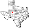
Stonewall County 433 Aspermont 1876 Bexar County und Young County Thomas Jonathan "Stonewall" Jackson (1824–1863), berühmter General der Konföderierten 1.693 2.380 km² (919 sq mi) 
Sutton County 435 Sonora 1887 Crockett County John Schuyler Sutton, Texas Ranger und Soldat in mehreren Kriegen 4.077 3.766 km² (1.454 sq mi) 
Swisher County 437 Tulia 1876 Bexar County und Young County James Gibson Swisher, Soldat 8.378 2.331 km² (900 sq mi) 
Tarrant County 439 Fort Worth 1849 Navarro County Edward H. Tarrant, General, der die Indianer aus dem zukünftigen Staat vertrieb 1.446.219 2.238 km² (864 sq mi) 
Taylor County 441 Abilene 1858 Bexar County und Travis County Edward Taylor (1812–1836), George Taylor (1816–1836), und James Taylor (1814–1836), drei Brüder, die in der Schlacht von the Alamo starben 126.555 2.372 km² (916 sq mi) 
Terrell County 443 Sanderson 1905 Pecos County Alexander Watkins Terrell, Offizier, Rechtsgelehrter 1.081 6.107 km² (2.358 sq mi) 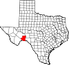
Terry County 445 Brownfield 1876 Bexar County Frank Terry, Texas Ranger und Offizier 12.761 2.305 km² (890 sq mi) 
Throckmorton County 447 Throckmorton 1858 Fannin County William Edward Throckmorton, früher Siedler im Collin County 1.850 2.362 km² (912 sq mi) 
Titus County 449 Mount Pleasant 1846 Bowie County Andrew Jackson Titus, Rechtsgelehrter 28.118 1.064 km² (411 sq mi) 
Tom Green County 451 San Angelo 1874 Bexar County Thomas Green (1814–1864), Brigadegeneral 104.010 3.942 km² (1.522 sq mi) 
Travis County 453 Austin 1840 Bastrop County William Barret Travis (1809–1836), Kommandant der Texaner in der Schlacht vom Alamo 812.280 2.561 km² (989 sq mi) 
Trinity County 455 Groveton 1850 Houston County Trinity River 13.779 1.795 km² (693 sq mi) 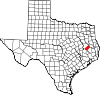
Tyler County 457 Woodville 1846 Liberty County John Tyler, zehnter Präsident der Vereinigten Staaten (1841–1845) 20.871 2.391 km² (923 sq mi) 
Upshur County 459 Gilmer 1846 Harrison County Abel P. Upshur, 15. US-Außenminister (1843–1844) 35.291 1.523 km² (588 sq mi) 
Upton County 461 Rankin 1887 Tom Green County John Cunningham und William Felton Upton, Brüder und Offiziere der Konföderierten Armee 3.404 3.217 km² (1.242 sq mi) 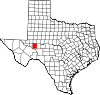
Uvalde County 463 Uvalde 1850 Bexar County Cañón de Ugalde, einem nahen Schlachtfeld, wo Juan de Ugalde einen Überraschungsangriff gegen 300 Apachen gewann. 25.926 4.033 km² (1.557 sq mi) 
Val Verde County 465 Del Rio 1885 Crockett County, Kinney County und Pecos County Battle of Val Verde im Mexikanisch-Amerikanischen Krieg 44.856 8.213 km² (3.171 sq mi) 
Van Zandt County 467 Canton 1848 Henderson County Isaac Van Zandt (1813–1847), Siedler, Attorney General 48.140 2.199 km² (849 sq mi) 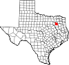
Victoria County 469 Victoria 1836 Eines der ursprünglichen 23 Countys Seinem Hauptort, der nach Guadalupe Victoria, Mexikanischer Revolutionsführer und erster Präsident Mexikos (1824–1829) 84.088 2.287 km² (883 sq mi) 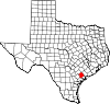
Walker County 471 Huntsville 1846 Montgomery County Samuel Hamilton Walker (1815–1847), Texas Ranger und Soldat 61.758 2.041 km² (788 sq mi) 
Waller County 473 Hempstead 1873 Austin County und Grimes County Edwin Waller (1800–1881), Unterzeichner der Unabhängigkeitserklärung und erster Bürgermeister von Austin 32.663 1.331 km² (514 sq mi) 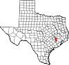
Ward County 475 Monahans 1887 Tom Green County Thomas William Ward, Bürgermeister von Austin und Landverwalter 10.909 2.165 km² (836 sq mi) 
Washington County 477 Brenham 1836 Eines der ursprünglichen 23 Countys George Washington, erster Präsident der Vereinigten Staaten (1789–1797) 30.373 1.577 km² (609 sq mi) 
Webb County 479 Laredo 1848 Nueces County James Webb, Minister in Texas 193.117 8.695 km² (3.357 sq mi) 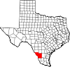
Wharton County 481 Wharton 1846 Colorado County, Jackson County und Matagorda County William Harris Wharton (1802–1839) and John Austin Wharton (1828–1865), Brüder und Führer der Revolution 41.188 2.823 km² (1.090 sq mi) 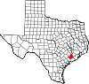
Wheeler County 483 Wheeler 1876 Bexar County und Young County Royal Tyler Wheeler, zweiter Oberrichter am Texas Supreme Court 5.284 2.367 km² (914 sq mi) 
Wichita County 485 Wichita Falls 1858 Cooke County Wichita-Indianer 131.664 1.627 km² (628 sq mi) 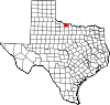
Wilbarger County 487 Vernon 1858 Bexar County Josiah Pugh (1801–1845) und Mathias Wilbarger, Brüder und frühe Siedler 14.676 2.515 km² (971 sq mi) 
Willacy County 489 Raymondville 1911 Cameron County und Hidalgo County John G. Willacy (Texas) 20.082 1.546 km² (597 sq mi) 
Williamson County 491 Georgetown 1848 Milam County Robert McAlpin Williamson, Veteran der Schlacht von San Jacinto 249.967 2.911 km² (1.124 sq mi) 
Wilson County 493 Floresville 1860 Bexar County, Guadalupe County und Karnes County James Charles Wilson, Texanischer Senator(1851–1853) 32.408 2.090 km² (807 sq mi) 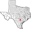
Winkler County 495 Kermit 1887 Tom Green County Clinton McKamy Winkler, Richter und Offizier 7.173 2.178 km² (841 sq mi) 
Wise County 497 Decatur 1856 Cooke County Henry Alexander Wise, später Gouverneur von Virginia (1856–1860) 48.793 2.344 km² (905 sq mi) 
Wood County 499 Quitman 1850 Van Zandt County George T. Wood, zweiter Gouverneur von Texas (1847–1849) 36.752 1.683 km² (650 sq mi) 
Yoakum County 501 Plains 1876 Bexar County Henderson King Yoakum (1810–1856), Soldat und Geschichtsschreiber 7.322 2.072 km² (800 sq mi) 
Young County 503 Graham 1856 Bosque County and Fannin County William Cocke Young, Siedler, Sheriff und United States Marshal 17.943 2.388 km² (922 sq mi) 
Zapata County 505 Zapata 1858 Starr County und Webb County Antonio Zapata, Rancher und Colonel der kurzlebigen Republic of the Rio Grande 12.182 2.582 km² (997 sq mi) 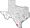
Zavala County 507 Crystal City 1846 Maverick County Lorenzo de Zavala (1788–1836), Unterzeichner der texanischen Unabhängigkeitserklärung und erster Vizepräsident der Republik Texas 11.600 3.364 km² (1.299 sq mi) 
Nicht mehr existierende Countys
Es gab mindestens 32 Countys, die gemäss texanischem Recht eingerichtet wurden, aber nicht mehr existieren. Darunter fallen solche, die provisorisch während der Gründung vorgeschlagen waren, solche, deren Land nicht mehr zu Texas gehören oder auch Countys, deren Namen geändert haben.[4]
Einige Beispiele:
- Buchel County, gegründet 1887 aus Presidio County. 1897 zu Brewster County geschlagen.
- Dawson County, gegründet 1858 in Kinney County und Uvalde County, aufgelöst 1866. Nicht identisch mit dem noch existenten Dawson County
- Encinal County, gegründet 1856. Aufgelöst 1899 und zu Webb County geschlagen.
- Foley County, gegründet 1887 aus Presidio County. 1897 zu Brewster County.
- Greer County, gegründet 1860. Durch den U.S. Supreme Court Texas abgesprochen, siehe United States v. State of Texas, [5].
- Perdido County, gegründet 1824, vergessen in den Wirren der 1840s. Verbleib und offizielle Auflösung unklar.
- Santa Fe County, gegründet 1848 aus Ländern Mexikos. Es umfasste die Ländereien von New Mexico östlich des Rio Grande. Aufgelöst durch den Kompromiss von 1850.
- Wegefarth County, gegründet 1873 im Texas Panhandle, aufgelöst 1876.
- Worth County, 1850 aus einem Teil von Santa Fe County gegründet, aufgelöst durch den Kompromiss von 1850.
Einzelnachweise
- ↑ EPA County FIPS Code Listing. EPA. Abgerufen am 9. April 2007.
- ↑ a b c National Association of Counties: NACo - Find a county. Abgerufen am 26. April 2007.
- ↑ Texas Association of Counties facts. Texas Association of Counties. Archiviert vom Original am 8. April 2007. Abgerufen am 12. April 2007.
- ↑ TSHA Defunct Counties. The Texas State Historical Association. Abgerufen am 20. April 2007.
- ↑ US 1 (1896)
Alabama | Alaska | Arizona | Arkansas | Colorado | Connecticut | Delaware | Florida | Georgia | Hawaii | Idaho | Illinois | Indiana | Iowa | Kalifornien | Kansas | Kentucky | Louisiana | Maine | Maryland | Massachusetts | Michigan | Minnesota | Mississippi | Missouri | Montana | Nebraska | Nevada | New Hampshire | New Jersey | New Mexico | New York | North Carolina | North Dakota | Ohio | Oklahoma | Oregon | Pennsylvania | Rhode Island | South Carolina | South Dakota | Tennessee | Texas | Utah | Vermont | Virginia | Washington | West Virginia | Wisconsin | Wyoming
Wikimedia Foundation.
Schlagen Sie auch in anderen Wörterbüchern nach:
Liste der Countys auf Hawaii — Counties Hawaiis Der US Bundesstaat Hawaii ist in 5 Countys unterteilt: Lage County Fläche Einwohner 1. Juli 2005 Verwaltungs sitz Einwohner 1. April 2000 Bereich … Deutsch Wikipedia
Liste der Countys in Lousiana — Parishes in Louisiana Der US Bundesstaat Louisiana in den Vereinigten Staaten ist in 64 Parishes unterteilt. Ihr Status entspricht dem der Countys in den anderen Bundesstaaten. Acadia … Deutsch Wikipedia
Liste der Countys in Missouri — Der US amerikanische Bundesstaat Missouri ist in 114 Countys eingeteilt. Die Stadt St. Louis gehört keinem County an. Die offizielle Abkürzung von Missouri lautet MO, der FIPS Code ist 29. Der FIPS Code jedes einzelnen Countys beginnt also stets… … Deutsch Wikipedia
Liste der Countys in Oklahoma — Der US amerikanische Bundesstaat Oklahoma ist in 77 Countys unterteilt. Die offizielle Abkürzung des Staates Oklahoma lautet OK, der FIPS Code ist 40[1]. Der FIPS Code für jedes einzelne County beginnt also stets mit 40, an die jeweils eine… … Deutsch Wikipedia
Liste der Countys in Nevada — Der US Bundesstaat Nevada ist in 17 Countys unterteilt. Die Hauptstadt Carson City ist eine unabhängige Stadt, zählt jedoch nach dem US Census Bureau als County. County Einwohner (1. Juli 2006) Verwaltungssitz Einwohner (1. Juli 2005) Carson City … Deutsch Wikipedia
Liste der Countys in Kentucky — Boone Ken ton Camp bell Pend leton Bracken Robertson … Deutsch Wikipedia
Liste der Countys in Montana — LN FH LK SA MN MS … Deutsch Wikipedia
Liste der Countys in Michigan — Keweenaw Houghton Ontonagon Gogebic Iron Baraga … Deutsch Wikipedia
Liste der Countys in Maryland — Garrett Allegany Washington Frederick Carroll Baltimore … Deutsch Wikipedia
Liste der Counties in North Carolina — Der US Bundesstaat North Carolina ist in 100 Countys unterteilt: Alamance County Alexander County Alleghany County Anson County Ashe County Avery County Beaufort County Bertie County … Deutsch Wikipedia
Liste der Countys in Texas


18+
© Academic, 2000-2024
- Kontaktieren Sie uns: Unterstützung, Werbung
Wörterbücher Export, schritte mit PHP, Joomla, Drupal, WordPress, MODx.