- Lecanto
-
Lecanto 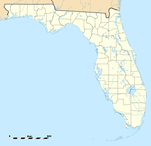

Lecanto Lage in FloridaBasisdaten Staat: Vereinigte Staaten Bundesstaat: Florida County: Koordinaten: 28° 51′ N, 82° 29′ W28.848888888889-82.48111111111114Koordinaten: 28° 51′ N, 82° 29′ W Zeitzone: Eastern Standard Time (UTC−5) Einwohner: 5161 (Stand: 2000) Bevölkerungsdichte: 73,7 Einwohner je km² Fläche: 70,0 km² (ca. 27 mi²)
davon 70,0 km² (ca. 27 mi²) LandHöhe: 14 m Postleitzahlen: 34460, 34461 Vorwahl: +1 352 FIPS: 12-39825 GNIS-ID: 0285422 Lecanto ist eine Stadt im Citrus County im US-Bundesstaat Florida, Vereinigte Staaten, mit 5.161 Einwohnern (Stand: 2000). Es ist ein Vorort von Beverly Hills, Florida. Das Stadtgebiet hat eine Größe von 70,1 km².
Schulen
- Lecanto Primary School
- Crest School
- Central Catholic School Of City
- Seven Rivers Christian School
- Lecanto Middle School
- Lecanto High School
- Cypress Hill Academy
Religion
In Lecanto gibt es derzeit sieben verschiedene Kirchen aus sieben unterschiedlichen Konfessionen. Weiterhin gibt es eine zu keiner Konfession gehörende Kirchen (Stand: 2004).
Demografische Daten
Das durchschnittliche Einkommen eines Haushalts liegt bei 40.826 USD, das durchschnittliche Einkommen einer Familie bei 46.987 USD.
Männer haben ein durchschnittliches Einkommen von 30.625 USD gegenüber den Frauen mit durchschnittlich 27.296 USD. Das Pro-Kopf-Einkommen liegt bei 20.625 USD.
9,1 % der Einwohner und 5,3 % der Familien leben unterhalb der Armutsgrenze.
20,5 % der Einwohner sind unter 18 Jahre alt und auf 100 Frauen ab 18 Jahre und darüber kommen statistisch 101,4 Männer.
Das Durchschnittsalter beträgt 45 Jahre. (Stand: 2000).Städte und Gemeinden im Citrus CountyBeverly Hills | Black Diamond | Citrus Hills | Citrus Springs | Crystal River | Floral City | Hernando | Homosassa | Homosassa Springs | Inverness Highlands North | Inverness Highlands South | Inverness | Lecanto | Pine Ridge | Sugarmill Woods
Wikimedia Foundation.
Schlagen Sie auch in anderen Wörterbüchern nach:
Lecanto — Lugar designado por el censo de los Estados Unidos … Wikipedia Español
Lecanto — Lecanto, FL U.S. Census Designated Place in Florida Population (2000): 5161 Housing Units (2000): 2095 Land area (2000): 27.044994 sq. miles (70.046209 sq. km) Water area (2000): 0.009053 sq. miles (0.023446 sq. km) Total area (2000): 27.054047… … StarDict's U.S. Gazetteer Places
Lecanto, FL — U.S. Census Designated Place in Florida Population (2000): 5161 Housing Units (2000): 2095 Land area (2000): 27.044994 sq. miles (70.046209 sq. km) Water area (2000): 0.009053 sq. miles (0.023446 sq. km) Total area (2000): 27.054047 sq. miles (70 … StarDict's U.S. Gazetteer Places
Lecanto — 28° 50′ 56″ N 82° 28′ 52″ W / 28.848889, 82.481111 … Wikipédia en Français
Lecanto — Original name in latin Lecanto Name in other language State code US Continent/City America/New York longitude 28.85165 latitude 82.4876 altitude 17 Population 5882 Date 2011 05 14 … Cities with a population over 1000 database
Lecanto High School — is a secondary school in Lecanto, Florida. It is a public high school in Citrus County encompassing grades 9 12, with a total school population of approximately 1740 students. LHS provides a broad curriculum to prepare students for further… … Wikipedia
Lecanto Middle School — is a public middle school, situated approximately 79 miles from Tampa, Florida, in the United States. The school serves grades six to eight, and is part of the Citrus County school district. *Student Teacher Ratio:19.2External links*… … Wikipedia
Lecanto, Florida — Infobox Settlement official name = Lecanto, Florida other name = native name = nickname = settlement type = CDP motto = imagesize = image caption = flag size = image seal size = image shield = shield size = image blank emblem = blank emblem type … Wikipedia
34460 — Lecanto, Fl (Miscellaneous » ZIP Codes) … Abbreviations dictionary
34461 — Lecanto, Fl (Miscellaneous » ZIP Codes) … Abbreviations dictionary
Lecanto

18+
© Academic, 2000-2024
- Kontaktieren Sie uns: Unterstützung, Werbung
Wörterbücher Export, schritte mit PHP, Joomla, Drupal, WordPress, MODx.