Lake Darbonne

Lake Darbonne
Lake Darbonne
Lake Darbonne
Lake Darbonne
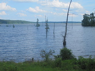
Geographische Lage Union Parish, Louisiana, USA
Zuflüsse Bayou D’Arbonne
Abfluss Bayou D’Arbonne → Ouachita River
Städte am Ufer Farmerville
Daten
Koordinaten 32° 45′ 41″ N, 92° 25′ 26″ W32.761389-92.42388924Koordinaten: 32° 45′ 41″ N, 92° 25′ 26″ W
Lake Darbonne (Louisiana)
Lake Darbonne
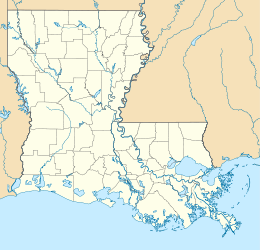
Höhe über Meeresspiegel 24 m
Fläche 62 km²f5

Der Lake Darbonne ist ein Stausee im Norden des US-Bundesstaates Louisiana. Er liegt in unmittelbarer Nähe der Kleinstadt Farmerville, dem Verwaltungssitz des Union Parish. Die Wasserfläche beträgt 62 Quadratkilometer.

Der See liegt isoliert in ländlicher Umgebung und dient als Fischgrund. Er ist namengebend für den angrenzenden Lake D’Arbonne State Park, ein vom Staat Louisiana getragenes Camping- und Erholungsgebiet.

Weblinks


Wikimedia Foundation.

Игры ⚽ Поможем решить контрольную работу

Schlagen Sie auch in anderen Wörterbüchern nach:

  • Lake Darbonne — Infobox lake lake name = Lake Darbonne image lake = caption lake = image bathymetry = caption bathymetry = location = Farmerville, Louisiana coords = coord|32|45|41|N|92|25|26|W|type:waterbody region:US LA|display=inline,title type = inflow =… …   Wikipedia

  • Union Parish — Courthouse in Farmerville Verwaltung US Bundesstaat: Louisiana …   Deutsch Wikipedia

  • Arbonne (Begriffsklärung) — Arbonne bezeichnet: eine Stadt im Département Pyrénées Atlantiques in Frankreich, siehe Arbonne eine Gemeinde im Département Seine et Marne in Frankreich, siehe Arbonne la Forêt einen Stausee im Norden des US Bundesstaates Louisiana, siehe Lake… …   Deutsch Wikipedia

  • St. Landry Parish, Louisiana — Saint Landry Parish, Louisiana Location in the state of Louisiana …   Wikipedia

  • Opelousas, Louisiana — Opelousas is also a common name of the flathead catfish. Coordinates: 30°31′41″N 92°05′04″W / 30.52806°N 92.08444°W / …   Wikipedia

  • Wendigo — Le wendigo (pluriel : wendigowak / wendigos[1]) est une créature surnaturelle, maléfique et cannibale, issue de la mythologie des Amérindiens algonquiens du Canada, qui s est étendue à tout le folklore d Amérique du Nord. Cette légende est… …   Wikipédia en Français

  • Melville, Louisiana — Coordinates: 30°41′36″N 91°44′44″W / 30.69333°N 91.74556°W / 30.69333; 91.74556 …   Wikipedia

  • National Register of Historic Places listings in St. Landry Parish, Louisiana — Location of St. Landry Parish in Louisiana This is a list of the National Register of Historic Places listings in St. Landry Parish, Louisiana. This is intended to be a complete list of the properties and districts on the National Register of… …   Wikipedia

Share the article and excerpts

Direct link
Do a right-click on the link above
and select “Copy Link”