- Kuwana
-
Kuwana-shi
桑名市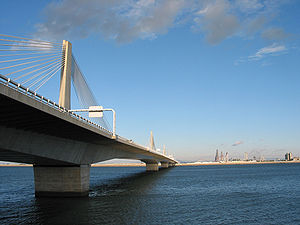
Geographische Lage in Japan 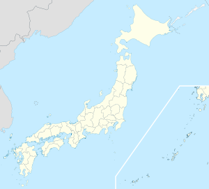

Region: Kinki Präfektur: Mie Koordinaten: 35° 4′ N, 136° 41′ O35.062222222222136.68361111111Koordinaten: 35° 3′ 44″ N, 136° 41′ 1″ O Basisdaten Fläche: 136,61 km² Einwohner: 140.594
(1. Oktober 2011)Bevölkerungsdichte: 1.029 Einwohner je km² Gemeindeschlüssel: 24205-5 Symbole Flagge/Wappen: 
Rathaus Adresse: Kuwana City Hall
2-37 Chūō-chō
Kuwana-shi
Mie 511-8601Webadresse: http://www.city.kuwana.lg.jp Lage Kuwanas in der Präfektur Mie 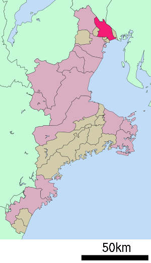
Kuwana (jap. 桑名市, -shi) ist eine Stadt in der japanischen Präfektur Mie.
Inhaltsverzeichnis
Geographie
Kuwana liegt südwestlich von Nagoya und nördlich von Yokkaichi an der Ise-Bucht.
Geschichte
 Hiroshige: 53 Stationen des Tōkaidō: Kuwana
Kuwana war während der Edo-Zeit eine Poststation (宿場町, Shukuba-machi) der Tōkaidō.
Sehenswürdigkeiten
 Burg Kuwana
- Burg Kuwana
Verkehr
- Straße:
- Nationalstraße 1, Richtung Tokio oder Kyoto
- Tōkaidō
- Zug:
- JR Kansai-Hauptlinie
- Kintetsu-Nagoya-Linie
- Kintetsu-Yōrō-Linie
Söhne und Töchter der Stadt
- Toshihiko Seko (Langstreckenläufer)
- Tsugio Matsuda (Rennfahrer)
Angrenzende Städte und Gemeinden
- Präfektur Mie
- Präfektur Aichi
- Präfektur Gifu
Weblinks
 Commons: Kuwana – Sammlung von Bildern, Videos und Audiodateien
 Rathaus von Kuwana
 Gemeinden und Landkreise in der Präfektur Mie
Kreisfreie Städte (shi): Iga | Inabe | Ise | Kameyama | Kumano | Kuwana | Matsusaka | Nabari | Owase | Shima | Suzuka | Toba | Tsu (Verwaltungssitz) | Yokkaichi
Inabe-gun: Tōin | Kitamuro-gun: Kihoku | Kuwana-gun: Kisosaki | Mie-gun: Asahi | Kawagoe | Komono | Minamimuro-gun: Kihō | Mihama | Taki-gun: Meiwa | Odai | Taki | Watarai-gun: Minami-ise | Taiki | Tamaki | Watarai
Wikimedia Foundation.
Schlagen Sie auch in anderen Wörterbüchern nach:
Kuwana — 35°04′00″N 136°40′00″E / 35.066667, 136.666667 … Wikipédia en Français
Kuwana — Original name in latin Kuwana Name in other language Kumana, Kuwana, sang ming shi State code JP Continent/City Asia/Tokyo longitude 35.06667 latitude 136.7 altitude 0 Population 113107 Date 2012 01 19 … Cities with a population over 1000 database
Kuwana — ▪ Japan city, Mie ken (prefecture), Honshu, Japan. It is situated on the delta of the Ibi, Nagara, and Kiso rivers. Mentioned as a hamlet as early as the 10th century, it became a commercial port on Ise Bay during the Muromachi period… … Universalium
Kuwana District, Mie — Kuwana (桑名郡; gun) is a district located in Mie, Japan.As of the December, 2004 merger but with 2003 population estimates, the district has an estimated population of 7,091 and a density of 451 persons per km². The total area is 15.72 km².Towns… … Wikipedia
Kuwana, Mie — Infobox City Japan Name= Kuwana JapaneseName= 桑名市 Map Region=Kinki, Tōkai Prefecture=Mie District= Area km2=136.61 PopDate=April 2008 Population=140,798 Density km2=1030 Coords= LatitudeDegrees= 35 LatitudeMinutes= 4 LatitudeSeconds=… … Wikipedia
Kuwana-juku — nihongo|Kuwana juku|桑名宿|Kuwana juku was the forty second of the fifty three stations of the Tōkaidō. It is located in the present day city of Kuwana, in Mie Prefecture, Japan. It was located on the western shores of the Ibi River and is… … Wikipedia
Kuwana Domain — The nihongo|Kuwana Domain|桑名藩|Kuwana han was a Japanese domain of the Edo period, located in Ise Province (modern day Kuwana, Mie).List of Daimyo*Honda clan (Fudai, 100,000 koku)#Tadakatsu #Tadamasa*Matsudaira (Hisamatsu) clan (Shinpan, 110,000… … Wikipedia
Kuwana Station — nihongo|Kuwana Station|桑名駅|Kuwana eki| is a train station in Kuwana, Mie Prefecture, Japan.Lines*Central Japan Railway Company (JR Central) **Kansai Main Line *Kintetsu **Nagoya Line *Yōrō Railway **Yōrō LineSangi Railway s Nishi Kuwana Station… … Wikipedia
Kuwana Yoshinari — was a senior retainer under the Chōsokabe clan during the latter years of the Sengoku period of Feudal Japan. He was also known as Kuwana Kazutaka (桑名一孝) … Wikipedia
Kuwana-gun — Admin ASC 2 Code Orig. name Kuwana gun Country and Admin Code JP.23.1857966 JP … World countries Adminstrative division ASC I-II
Kuwana


18+
© Academic, 2000-2024
- Kontaktieren Sie uns: Unterstützung, Werbung
Wörterbücher Export, schritte mit PHP, Joomla, Drupal, WordPress, MODx.