Anguillita

Anguillita

Vorlage:Infobox Insel/Wartung/Bild fehltVorlage:Infobox Insel/Wartung/Fläche fehltVorlage:Infobox Insel/Wartung/Höhe fehlt

Anguillita
Gewässer Karibisches Meer
Inselgruppe Kleine Antillen
Geographische Lage 18° 9′ 23″ N, 63° 10′ 34″ W18.156389-63.176111Koordinaten: 18° 9′ 23″ N, 63° 10′ 34″ W
Anguillita (Anguilla)
Anguillita
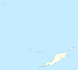
Länge 300 m
Breite 100 m

Anguillita ist eine kleine, felsige Karibikinsel vor der Südwestspitze Anguillas und gehört wie die Hauptinsel zum gleichnamigen britischen Überseegebiet. Die unbewohnte Insel misst etwa 300 mal 100 Meter und ist von Anguilla durch einen knapp 400 Meter breiten Meeresarm getrennt. In der Mitte der Insel verläuft ein schmaler Kanal, so dass Anguillita zumindest bei Flut aus zwei Inselchen und einigen Felsen besteht.

Da Anguillita keine Sandstrände aufweist, ist das Eiland für Touristen – mit Ausnahme von Tauchern – uninteressant. Ende des 20. Jahrhunderts wurde auf Anguillita ein Feldexperiment zur Erforschung der Verbreitung karibischer Echsen der Gattung Anolis durchgeführt. Dazu wurden Tiere einer fremden Anolis-Art eingeführt und die Wechselwirkungen mit den einheimischen Echsen studiert.[1]

Einzelnachweise

  1. W. G. Ernst: Earth Systems: Processes and Issues, Cambridge University Press, 2000, Seite 270

Wikimedia Foundation.

Игры ⚽ Нужна курсовая?

Schlagen Sie auch in anderen Wörterbüchern nach:

  • Anguillita — es una pequeña isla rocosa en la punta occidental del territorio británico de ultramar de Anguila. Anguillita no es el punto más occidental de Anguila, esa posición se la queda una ubicada aun mas al oeste los Cayos Prickly Pear. Sin embargo, es… …   Wikipedia Español

  • Anguillita — Géographie Pays  Royaume Uni Archipel Petites Antilles Loca …   Wikipédia en Français

  • Anguillita — Location map Anguilla label = Anguillita position = left lat deg = 18 lat min = 9 lat sec = 0 lat dir = N lon deg = 63 lon min = 11 lon sec = 0 lon dir = W caption = Location of Anguillita float = right width = 250Anguillita is a small, rocky… …   Wikipedia

  • Anguilla — This article is about the Caribbean British overseas territory. For other uses, see Anguilla (disambiguation). Anguilla …   Wikipedia

  • Geography of Anguilla — This article describes the geography of Anguilla. Anguilla Continent North America Subregion …   Wikipedia

  • List of places with fewer than ten residents — This list is incomplete; you can help by expanding it. This is a list of places with a permanent population of fewer than ten people. Some may be virtually deserted and others may be places where people work, but do not live. Contents 1… …   Wikipedia

  • List of islands in the Caribbean — This is a list of islands of the Caribbean region, organized by the political territory each island belongs to.Anguilla* Anguilla * Anguillita * Blowing Rock * Cove Cay * Crocus Cay * Deadman s Cay * Dog Island * East Cay * Little Island * Little …   Wikipedia

  • List of islands of United Kingdom — The United Kingdom of Great Britain and Northern Ireland has thousands of islands within its territory and several external territories. This is a list of selected British islands grouped by Constituent country or Overseas territory. The largest… …   Wikipedia

  • Anguilla — Anguilla …   Deutsch Wikipedia

  • Liste von Inseln der Britischen Überseegebiete — Inhaltsverzeichnis 1 Britische Überseeinseln in der Karibik 1.1 Anguilla 1.2 Britische Jungferninseln 1.3 Kaimaninseln …   Deutsch Wikipedia

Share the article and excerpts

Direct link
Do a right-click on the link above
and select “Copy Link”