Kilmaurs

Kilmaurs
Kilmaurs
Koordinaten 55° 38′ N, 4° 32′ W55.640277777778-4.53Koordinaten: 55° 38′ N, 4° 32′ W
Kilmaurs (Schottland)
Kilmaurs
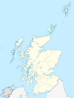
Kilmaurs
Bevölkerung 2.601 (Zensus 2001)
Verwaltung
Post town KILMARNOCK
Postleitzahlen­abschnitt KA3
Vorwahl 01563
Landesteil Scotland
Unitary authority East Ayrshire
Britisches Parlament Kilmarnock and Loudoun
Schottisches Parlament Kilmarnock and Irvine Valley

Kilmaurs ist ein Dorf mit etwa 2.670 Einwohnern (Schätzung 2004[1]) im Verwaltungsbezirks East Ayrshire im Südwesten Schottlands. Es liegt östlich des Carmel Water und etwa drei Kilometer nördlich von Kilmarnock an der A735.

Inhaltsverzeichnis

Geschichte

Die Ursprünge Kilmaurs liegen südlich des Carmel Water bei einem Gebäude namens Kilmaurs Place, das erst um das Jahr 1620 errichtet wurde. An dieser Stelle oder in unmittelbarer Nähe standen allerdings schon seit dem 12. Jahrhundert verschiedene andere Gebäude, wie Wohnhäuser und Wehranlagen. Noch heute gibt es in Kilmaurs eine Kirche aus dem Jahr 1170. Kilmaurs Place war Sitz der Earls von Glencairn und erhielt die Royal Charter (Grundungsurkunde) 1527.

Wirtschaft und Infrastruktur

Die wichtigsten Wirtschaftszweige von Kilmaurs im 19. und frühen 20. Jahrhundert waren neben der Landwirtschaft (Getreidemühlen) die Herstellung von Maschenwaren sowie die Kohlebergwerke in der näheren Umgebung. Heute werden neben Maschenwaren vor allem Milchprodukte in Kilmaurs hergestellt. Seit den sechziger Jahren ist Kilmaurs durch den Zuzug von Pendlern als Vorort der Einzugsgebiete Kilmarnock und Glasgow stetig gewachsen.

Kultur und Sehenswürdigkeiten

Kilmaurs Place wurde im 17. Jahrhundert an der Stelle des heute restlos verschwundenen Kilmaurs Castle errichtet. Zu den früheren Bewohnern gehörte der 9. Earl of Glencairn und die Montgomeries of Eglinton. Heute ist Kilmaurs Place in privatem Besitz, kann aber von dem öffentlichen Park aus, in dem es liegt, besichtigt werden.

Nahe Kilmaurs liegt Rowallan Castle, das in seiner heutigen Form erst am Anang des 20. Jahrhunderts von der Familie Corbett errichtet wurde. Es liegt in unmittelbarer Nähe zu den Ruinen eines Schlosses der Muirs aus dem frühen 16. Jahrhundert.

Persönlichkeiten

Der schottische Arzt und Biologe John Boyd Orr wurde in Kilmaurs geboren. Er erhielt 1949 den Friedensnobelpreis.

Weblinks

 Commons: Kilmaurs – Sammlung von Bildern, Videos und Audiodateien

Einzelnachweise

  1. General Register Office for Scotland: http://www.gro-scotland.gov.uk/statistics/publications-and-data/settlements-and-localities/mid-2004-population-estimates-for-settlements-in-scotland.html Mid-2004 Population Estimates for Settlements in Scotland

Wikimedia Foundation.

Игры ⚽ Поможем сделать НИР

Schlagen Sie auch in anderen Wörterbüchern nach:

  • Kilmaurs —    KILMAURS, a burgh of barony and a parish, in the district of Cunninghame, county of Ayr; containing, with the villages of Knockentiber, Kirkton, Milton, and Crosshouse, 2617 inhabitants, of whom 1035 are in the burgh, 2 miles (N. N. W.) from… …   A Topographical dictionary of Scotland

  • Kilmaurs — infobox UK place country = Scotland official name= Kilmaurs gaelic name= Cille Mhàra scots name= population= population density= area total sq mi= os grid reference= NS407413 latitude= 55.639444 longitude= 4.530278 unitary scotland= East Ayrshire …   Wikipedia

  • Kilmaurs — Original name in latin Kilmaurs Name in other language Cille Mhara, Cille Mhra, Cille Mhra, Kilmaurs State code GB Continent/City Europe/London longitude 55.63801 latitude 4.5273 altitude 61 Population 2528 Date 2011 03 03 …   Cities with a population over 1000 database

  • Kilmaurs Place — or The Place, is an old mansion house at gbmapping|NS41234112 in Kilmaurs, East Ayrshire, Scotland. The house stands on a prominence above the Carmel Water and has a commanding view of the surrounding area. Location map Scotland label = Kilmaurs… …   Wikipedia

  • Kilmaurs Castle — Location Kilmaurs, East Ayrshire, Scotland Established …   Wikipedia

  • Kilmaurs railway station — Infobox UK station name = Kilmaurs other name= code = KLM caption = Kilmaurs station looking towards Stewarton manager = First ScotRail locale = Kilmaurs borough = East Ayrshire latitude = 55.6368 longitude = 4.5306 pte = SPT platforms = 1… …   Wikipedia

  • Lambroughton — infobox UK place country = Scotland official name= Lambroughton gaelic name= scots name= population= population density= area total sq mi= os grid reference= NS402439 latitude= 55.662752 longitude= 4.539894 unitary scotland= East Ayrshire… …   Wikipedia

  • Knockentiber — (Scottish Gaelic: Cnoc an Tobair , hill of the well) is a village in East Ayrshire, Parish of Kilmaurs, Scotland. Knockentiber is convert|2|mi|km WNW of Kilmarnock and 1/2 mile NE of Crosshouse. Latitude:55.6193°N Longitude:4.5455°W and… …   Wikipedia

  • Thorntoun house and estate — Thorntoun School was opened by Barnardo s in September 1971 for children with emotional difficulties aged 11 to 16 years. The school closed in 1990 and Thorntoun is now a Nursing Home. The complex lies between the villages of Springside (North… …   Wikipedia

  • Gatehead, East Ayrshire — Infobox UK place official name= Gatehead gaelic name= scots name= local name= country= Scotland map type= Scotland population= population density= os grid reference= NS393364 edinburgh distance= london distance= latitude= 55.5955 longitude=… …   Wikipedia

Share the article and excerpts

Direct link
Do a right-click on the link above
and select “Copy Link”