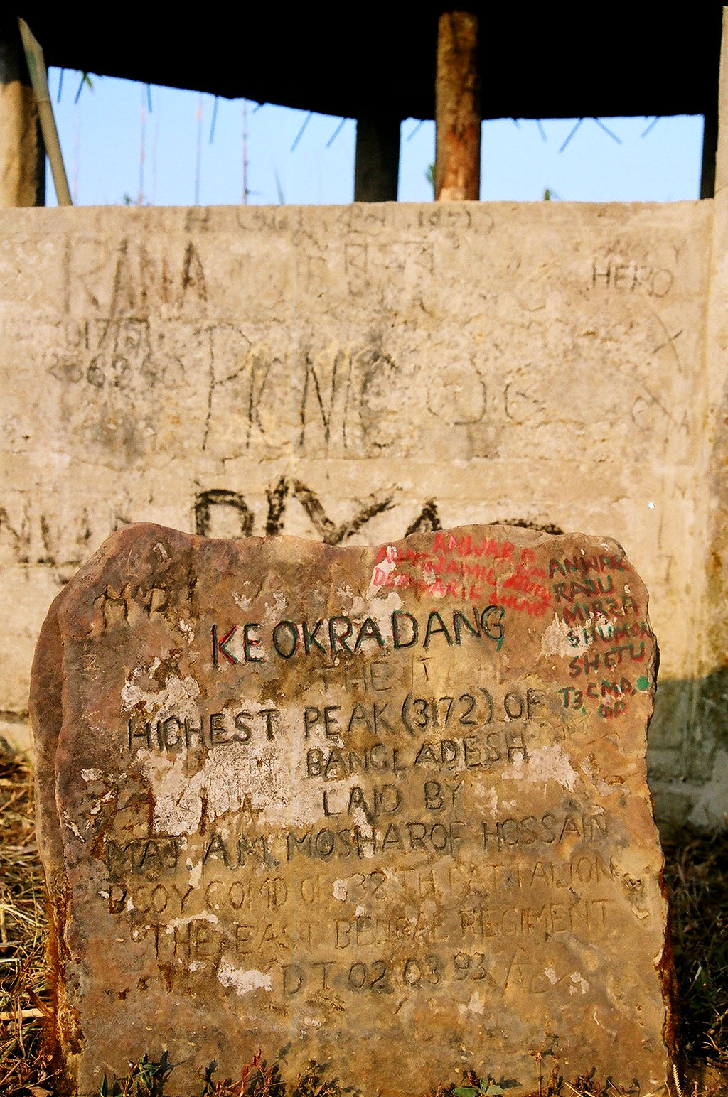
Keokradong

Keokradong
Keokradong

Photo-request.svg

Bild gesucht 

BWf1

Höhe 1.230 m
Lage Bangladesch / Asien
Geographische Lage 21° 47′ 11″ N, 92° 36′ 36″ O21.78638888888992.611230Koordinaten: 21° 47′ 11″ N, 92° 36′ 36″ O
Keokradong (Bangladesch)
Keokradong
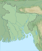
Besonderheiten Höchster Berg in Bangladesch; Messung ist angezweifelt
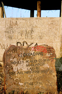
Gipfelmarkierung

Gipfelmarkierung

Der Keokradong (auch: Keokradang) ist mit 1.230 m der offiziell höchste Berg in Bangladesch, wobei diese Einschätzung aber derzeit angezweifelt wird. Eine GPS-Messung sowie eine davon unabhängige russische topografische Vermessung mittels SRTM stellen seine Höhe mit 974 m fest. Zusätzlich gibt es Diskussionen um die korrekte Lage der mit Keokradong bezeichneten Höhe; eine russische Karte bezeichnet so eine weiter nördlich gelegene Erhebung mit 883 m Höhe.

Die offizielle Höhenmessung ist noch gültig, doch die Diskussion um den in Wirklichkeit höchsten Gipfel des Landes hat begonnen. Sowohl der Mowdok Mual mit Höhenangaben zwischen 1.052 und 1.063 m als auch der Reng Tlāng (806 - 957 m) werden zuweilen als höchste Berge des Landes bezeichnet.

Der Keokradong liegt im Distrikt Bandarban im Nordosten des Landes, nahe der Grenze zu Myanmar.


Wikimedia Foundation.

Игры ⚽ Поможем написать курсовую

Schlagen Sie auch in anderen Wörterbüchern nach:

  • Keokradong — (or Keokradang) ( bn. কেওক্রাডং) is the third highest mountain peak located in South Eastern Bangladesh. It was long claimed as the highest peak there, a mistaken information that still features in respected sources including some Bangladesh… …   Wikipedia

  • Keokradong — 21°56′59″N 92°30′51″E / 21.94972, 92.51417 Keokradong est un sommet au Bangladesh de 1,230 m d altitude …   Wikipédia en Français

  • Keokradang — f1 Keokradong Höhe 1.230 m Lage Bangladesch / Asien Geographische Lage …   Deutsch Wikipedia

  • Kreokradang — f1 Keokradong Höhe 1.230 m Lage Bangladesch / Asien Geographische Lage …   Deutsch Wikipedia

  • Geografía de Bangladés — Este artículo o sección necesita ser wikificado con un formato acorde a las convenciones de estilo. Por favor, edítalo para que las cumpla. Mientras tanto, no elimines este aviso puesto el 5 de agosto de 2011. También puedes ayudar wikificando… …   Wikipedia Español

  • List of Bangladesh-related topics — This page lists articles on Wikipedia that are related to Bangladesh, Bengal and Bangladesh/Bengali culture. This is so that those interested in the subject can monitor changes to the pages by clicking on Related changes in the… …   Wikipedia

  • Geografía de Bangladesh — Saltar a navegación, búsqueda Bangladesh es un país con pocas elevaciones sobre la altura del mar, con grandes ríos en todo su territorio situado en el sur de Asia. Su costa es una inmensa jungla pantanosa de 710 kilómetros de longitud, limitando …   Wikipedia Español

  • Geography of Bangladesh — Map of Bangladesh Bangladesh is a low lying, riverine country located in South Asia with a largely marshy jungle coastline of 710 km (441 mi) on the northern littoral of the Bay of Bengal. Formed by a delta plain at the confluence of… …   Wikipedia

  • Bandarban District — Infobox of BD districts native name = Bandarban skyline = Bandarban1.jpg skyline size = skyline caption = Skyline of Bandarban locator position = left latd = 22.20 longd = 92.35 division name = Chittagong Division population as of = 1991… …   Wikipedia

  • Saka Haflong — Saka Haphong is a mountain on the Bangladesh and Myanmar border in Bangladesh. Recently two trekking clubs counted the height of Saka Haphong as 3,488 and 3,461 feet respectively. Any of these two figure would make it the highest mountain in… …   Wikipedia

Share the article and excerpts

Direct link
Do a right-click on the link above
and select “Copy Link”