- Katano
-
Katano-shi
交野市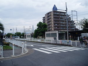
Geographische Lage in Japan 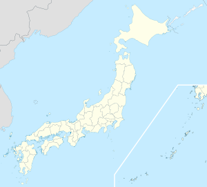

Region: Kinki Präfektur: Ōsaka Koordinaten: 34° 47′ N, 135° 41′ O34.787958333333135.6799777777827230-2Koordinaten: 34° 47′ 17″ N, 135° 40′ 48″ O Höhe: 27.230-2 m Basisdaten Fläche: 25,55 km² Einwohner: 77.966
(1. Juli 2011)Bevölkerungsdichte: 3.052 Einwohner je km² Symbole Baum: Kirsche Blume: Azalee Vogel: Buntfasan Rathaus Adresse: Katano City Hall
1-1-1, Kisabe
Katano-shi
Ōsaka 576-0052Webadresse: http://www.city.katano.osaka.jp Lage Katanos in der Präfektur Ōsaka 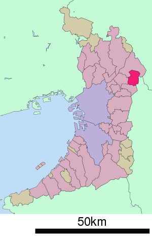
Katano (jap. 交野市, -shi) ist eine Stadt in der Präfektur Ōsaka in Japan.
Inhaltsverzeichnis
Geographie
Katano liegt östlich von Ōsaka.
Geschichte
Katano bekam am 3. November 1971 das Stadtrecht.
Sehenswürdigkeiten
 Shishikutsu-ji
- Botanischer Garten der naturwissenschaftlichen Fakultät der Städtischen Universität Ōsaka
- Shishikutsu-ji (獅子窟寺, buddhistischer Tempel)
Verkehr
- Straße:
- Nationalstraße 168
Städtepartnerschaft
Angrenzende Städte und Gemeinden
- Präfektur Ōsaka
- Präfektur Nara
Weblinks
 Commons: Katano – Sammlung von Bildern, Videos und Audiodateien
 Rathaus von Katano
 Gemeinden und Landkreise in der Präfektur Ōsaka
Kreisfreie Städte (shi): Daitō | Fujiidera | Habikino | Hannan | Higashiōsaka | Hirakata | Ibaraki | Ikeda | Izumi | Izumiōtsu | Izumisano | Kadoma | Kaizuka | Kashiwara | Katano | Kawachinagano | Kishiwada | Matsubara | Minō | Moriguchi | Neyagawa | Ōsaka (Verwaltungssitz) | Ōsakasayama | Sakai | Sennan | Settsu | Shijōnawate | Suita | Takaishi | Takatsuki | Tondabayashi | Toyonaka | Yao
Minamikawachi-gun: Chihaya-Akasaka | Kanan | Taishi | Mishima-gun: Shimamoto | Semboku-gun: Tadaoka | Sennan-gun: Kumatori | Misaki | Tajiri | Toyono-gun: Nose | Toyono
Wikimedia Foundation.
Schlagen Sie auch in anderen Wörterbüchern nach:
Katano (Begriffsklärung) — Katano (jap. 片野) bezeichnet: eine Stadt in der Präfektur Ōsaka, siehe Katano ein Dorf in der Präfektur Ibaraki, heute: Ishioka ein Lehen mit Sitz in diesem, siehe Katano (Han) … Deutsch Wikipedia
Katano Station — (片野駅; eki ) is a Kitakyushu monorail station in Kokura Kita ward, Kitakyushu, Japan. The station opened on 9 January 1985.Line served* Kitakyushu Monorail … Wikipedia
Katano, Osaka — Infobox City Japan Name= Katano JapaneseName= 交野市 Map Region= Kansai Prefecture= Osaka District= Area km2= 25.55 PopDate= June 2006 Population= 79,792 Density km2= 3123 Coords= coord|34|47|N|135|41|E|region:JP type:city Tree= Sakura Flower=… … Wikipedia
Katano-shi — Admin ASC 2 Code Orig. name Katano shi Country and Admin Code JP.32.1859848 JP … World countries Adminstrative division ASC I-II
Keihan Katano Line — The Nihongo|Katano Line|交野線|Katano sen is a 6.9km length railway line of a Japanese private railway company Keihan Electric Railway, in northern Osaka Prefecture from Hirakatashi Station on the Keihan Main Line southbound to Kisaichi… … Wikipedia
Takashi Katano — nihongo|Takashi Katano|片野 尚志|Katano Takashi is a video game programmer working for the Square Enix corporation. He has been credited on the following titles during his employment with the company:* Final Fantasy X (2001; as Main Event Programmer) … Wikipedia
Hirakata — shi 枚方市 Geographische Lage in Japan … Deutsch Wikipedia
Shijonawate — 四條畷市 Shijōnawate shi … Deutsch Wikipedia
Osaka Prefecture — Japanese transcription(s) – Japanese 大阪府 – Rōmaji Ōsaka fu … Wikipedia
Osaka Prefectural Board of Education — is a branch of the government of Osaka Prefecture, Japan. The board supervises individual municipal school systems and directly operates public high schools in Osaka prefecture. Contents 1 Schools operated by the prefecture 1.1 High schools… … Wikipedia
Katano


18+
© Academic, 2000-2024
- Kontaktieren Sie uns: Unterstützung, Werbung
Wörterbücher Export, schritte mit PHP, Joomla, Drupal, WordPress, MODx.