Katakolo

Katakolo
Katakolo
Κατάκολο
Katakolo (Griechenland)
Bluedot.svg
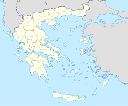
Basisdaten
Staat: Griechenland
Region: Westgriechenland
Regionalbezirk: Elis
Gemeinde: Pyrgos
Geographische Koordinaten: 37° 39′ N, 21° 19′ O37.651821.3162Koordinaten: 37° 39′ N, 21° 19′ O
Höhe ü. d. M.: 218 m
Einwohner: 601 (2001)
Postleitzahl: GR-251 00
Kreuzfahrtschiffe im Hafen von Katakolo am 18. Oktober 2011

Katakolo (griechisch Κατάκολο (n. sg.)) ist ein Dorf und eine Ortschaft in der Gemeinde Pyrgos auf der Peloponnes, in der griechischen Region Westgriechenland. Das Dorf hat 595 Einwohner, die Ortschaft 601 (Stand: 2001).

Der Ort liegt auf einer Landzunge, die in der Antike den Namen Ichthys (Ἰχθύς „Fisch“) trug.

Der Ort verfügt über einen kleinen Hafen, der häufig von Kreuzfahrtschiffen angelaufen wird, um den Passagieren einen Besuch der historischen Stätten in Olympia zu ermöglichen.

Einwohnerentwicklung

Einwohnerentwicklung
Jahr Einwohner (Dorf) Einwohner (Ortschaft)
1991 594 -
2001 595 601

Persönlichkeiten

Weblinks

 Commons: Katakolo – Sammlung von Bildern, Videos und Audiodateien

Wikimedia Foundation.

Игры ⚽ Нужно решить контрольную?

Schlagen Sie auch in anderen Wörterbüchern nach:

  • Katakolo — (Greek: Κατάκολο; before the 1970s: Κατάκολον or Katakolon) is a seaside town in western Ilia in the municipality of Pyrgos. Katakolo is part of the municipality of Pyrgos (Ilia). It is located south of Patras and Dounaiika, 12 km off downtown… …   Wikipedia

  • Katakolo — Katakolo, 1) Hafenort in der Eparchie Gastuni der griechischen Nomarchie Elis; Ausfuhr von Getreide, Vieh, Fellen, Seide, Baumwolle etc.; 2) Vorgebirg in Arkadia …   Pierer's Universal-Lexikon

  • Katákolo — Κατάκολο Katákolo …   Wikipedia Español

  • Katakolo — Sp Katãkolas Ap Κατάκολο/Katakolo L kyš. ir g tė V Graikijoje …   Pasaulio vietovardžiai. Internetinė duomenų bazė

  • Ligne de Pyrgos à Katakolo — Ligne Pyrgos Katakolo Ligne de Pyrgos à Katakolo Pays  Grece !Grèce Historique Mise en service 1883 …   Wikipédia en Français

  • Skafidia — (Greek: Σκαφιδιά), also with the second a accented is a Greek settlement located about 10 km northwest of Pyrgos, about 95 km (old: 99 km) south southwest of Patras and about 20 km south of Amaliada, . Skafidia is located 4 km west of the GR… …   Wikipedia

  • Hellenic Railways Organisation — Hellenic Railways Organization Οργανισμός Σιδηροδρόμων Ελλάδος Type State owned group of companies Industry Rail transport Founded 1 January 1971 …   Wikipedia

  • Organismós Sidirodrómon Elládos — Infobox Company company name = Organismos Sidirodromon Ellados (O.S.E.) company type = State owned group of companies company company slogan = Speeding to the Future (Με Ταχύτητα στο Μέλλον) foundation = 1877 (Hellenic Railways) / January 1, 1971 …   Wikipedia

  • Pheia (Elis) — For the arctiid genera, see Pheia Pheia (Φειᾷ, modern forms: Feia or Fia ) was an small town and a lake in Elis in the ancient country of Pisatis. It was built by a natural gulf on an island which it does not exist today next to the drylands and… …   Wikipedia

  • Elis — Präfektur Elis (1930–2010) Νομός Ηλείας Basisdaten (April 2010)[1] Staat …   Deutsch Wikipedia

Share the article and excerpts

Direct link
Do a right-click on the link above
and select “Copy Link”