Iwajuku

Iwajuku
36.399291666667139.28571944444
Iwajuku (Japan)
Iwajuku
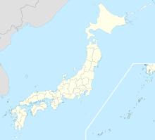
Iwajuku

Iwajuku (jap. 岩宿) ist ein bedeutender archäologischer Fundort in Japan. Iwajuku befindet sich in Kasakake, Midori, Landkreis Nitta in der Präfektur Gunma.

Die Funde brachten den Beweis für die Anwesenheit des Menschen in Japan vor 10.000 v. Chr. und stellen damit die ältesten Zeugnisse menschlicher Besiedelung in Japan dar.

Nach der Entdeckung der Fundstätte 1946 durch Aizawa Tadahiro folgte 1949 eine Nachuntersuchung, wobei Aizawa eine Pfeilspitze in einer rötlichen Kulturschicht entdecken konnte. Dieser Neufund veranlasste ihn bei Archäologen der Meiji-Universität vorzusprechen, um die Ausgrabungen an dieser Stelle zu intensivieren, wodurch die Existenz zweier Kulturschichten bestätigt werden konnte. Eine der Schichten enthielt kleine Werkzeuge wie Pfeilspitzen und Klingen aus Obsidian und Achat.

Wegen der generell ungünstigen chemikalischen Zusammensetzung japanischer Böden blieben keine fossilen Knochen erhalten, die eine Altersbestimmung ermöglicht hätten. Dieser Umstand führt bis in die Gegenwart zu lebhaften Diskussionen, welcher Spezies die Erstbesiedlung der japanischen Hauptinsel zuzuschreiben ist.

Weblink


Wikimedia Foundation.

Игры ⚽ Поможем написать курсовую

Schlagen Sie auch in anderen Wörterbüchern nach:

  • Iwajuku — The site of a major archeological discovery, Iwajuku (岩宿) provided evidence of habitation of Japan by humans before 10,000 BC. To date, these are the oldest record of human dwellings from Japan s past. Excavations in 1949 following the discovery… …   Wikipedia

  • Iwajuku — 36° 23′ 57″ N 139° 17′ 09″ E / 36.39929167, 139.28571944 …   Wikipédia en Français

  • List of archaeological sites sorted by country — This is a list of notable archaeological sites sorted by country. For one sorted by continent and time period, see the list of archaeological sites sorted by continent and age.Afghanistan*Buddhas of Bamyan *Haji Piyada mosque in… …   Wikipedia

  • Gunma Prefecture — Infobox Prefecture Japan Name = Gunma Fullname = Gunma Prefecture JapaneseName = 群馬県 Rōmaji = Gunma ken Symbol = PrefSymbol Gunma.png Capital = Maebashi Region = Kantō Island = Honshū TotalArea = 6,363.16 AreaRank = 21st PCWater = 0.2 PopDate =… …   Wikipedia

  • Kasakake, Gunma — Kasakake (笠懸町; machi) is a former town that was located in the now dissolved Nitta District, Gunma, Japan. As of 27 March, 2006, the town has become part of the new city of Midori.The Iwajuku archaeological site is in Kasakake …   Wikipedia

  • Oyama Station — Not to be confused with Ōyama Station. Coordinates: 36°18′46″N 139°48′23″E / 36.312808°N 139.80639°E / 36.312808; 139.80639 …   Wikipedia

  • Maebashi Station — (前橋駅, Maebashi eki?) is a railway station on the Ryōmō Line of East Japan Railway Company (JR East) located in Maebashi, Gunma Prefecture, Japan. It is one of two main railway stations of Maebashi; the other is Chūō Maebashi Station of the Jōmō… …   Wikipedia

  • Midori (Gunma) — Midori shi みどり市 Geographische Lage in Japan …   Deutsch Wikipedia

  • Ryōmō-Linie — Baureihe 115 am Bahnhof Oyama …   Deutsch Wikipedia

  • Gunma — Préfecture de Gunma Préfecture de Gunma · 群馬県 Gunma ken Carte du Japon avec la Préfecture de Gunma mise en évidence. Pays …   Wikipédia en Français

Share the article and excerpts

Direct link
Do a right-click on the link above
and select “Copy Link”