- Innamincka
-
Innamincka 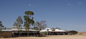
Pub, Informationszentrum und General StoreStaat:  Australien
Bundesstaat:  South Australia
Koordinaten: 27° 44′ S, 140° 44′ O-27.733333333333140.73333333333Koordinaten: 27° 44′ S, 140° 44′ O Einwohner: 131 (2006[1]) Zeitzone: ACST (UTC+9:30) 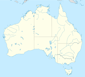

Innamincka Innamincka ist eine kleine Siedlung im Nord-Osten von South Australia, die 1065 km nordöstlich von Adelaide liegt. Sie ist über den Strzelecki Track ausgehend von Lyndhurst zur erreichen. Sie liegt am Ufer des Cooper Creek, innerhalb des Innamincka Regional Reserve und ist von der Strzelecki-Wüste, Tirariwüste und Sturts Steinige Wüste umgeben.
Geschichte
Traditionell ist diese Gegend Heimat der Aboriginesstämme Yandruwandha, Dieri und Yarrawarrka. Als erster Europäer kam Charles Sturt 1845 in diese Gegend, 1858 gefolgt von Augustus Gregory, Robert O'Hara Burke und William John Wills. Letztere starben vor Erschöpfung und Wassermangel am Cooper Creek und zu ihrem Gedenken wurde in Innamincka 1944 ein Denkmal errichtet.
 Übergang über den Cooper Creek in der Strzelecki Desert
Ursprünglich Hopetown bezeichnet, wurde Innamincka 1890 zur Stadt ernannt. Obwohl sie nie sehr groß war, besaß Innamicka ein Hotel, ein Geschäft und eine Polizeistation, die auch die Zollgebühren für Vieh das von Queensland nach South Australia gebracht wurde, eingetrieben hat. 1928 errichtete die Australian Inland Mission (als Teil des Royal Flying Doctor Service of Australia) ein Krankenhaus, das Elizabeth Symon Nursing Home. Als Folge einer schweren Dürre und der Abgeschiedenheit wurden das Hotel und Krankenhaus wieder geschlossen, die Polizeistation folgte 1951. Die Stadt wurde aufgegeben und heute hat sie etwa 15 Einwohner.
Verstärkter Tourismus und die Entdeckung von Gas- und Ölvorkommen führte in den späten 1960er Jahren zur Gründung der Cooper Creek Hotel Motel Pty Ltd, welche zunächst ein Hotel und ein Geschäft eröffnete. 1994 wurde das Elizabeth Symon Nursing Home restauriert und dient heute als Informationszentrum für South Australia's Parks, Flora und Fauna.
Weblinks
 Commons: Innamincka, South Australia – Sammlung von Bildern, Videos und Audiodateien
Einzelnachweise
- ↑ Australian Bureau of Statistics (25. Oktober 2007): Innamincka (State Suburb) (Englisch). 2006 Census QuickStats. Abgerufen am 6. Januar 2010.
Kategorie:- Ort in South Australia


Wikimedia Foundation.