- Hunt County
-
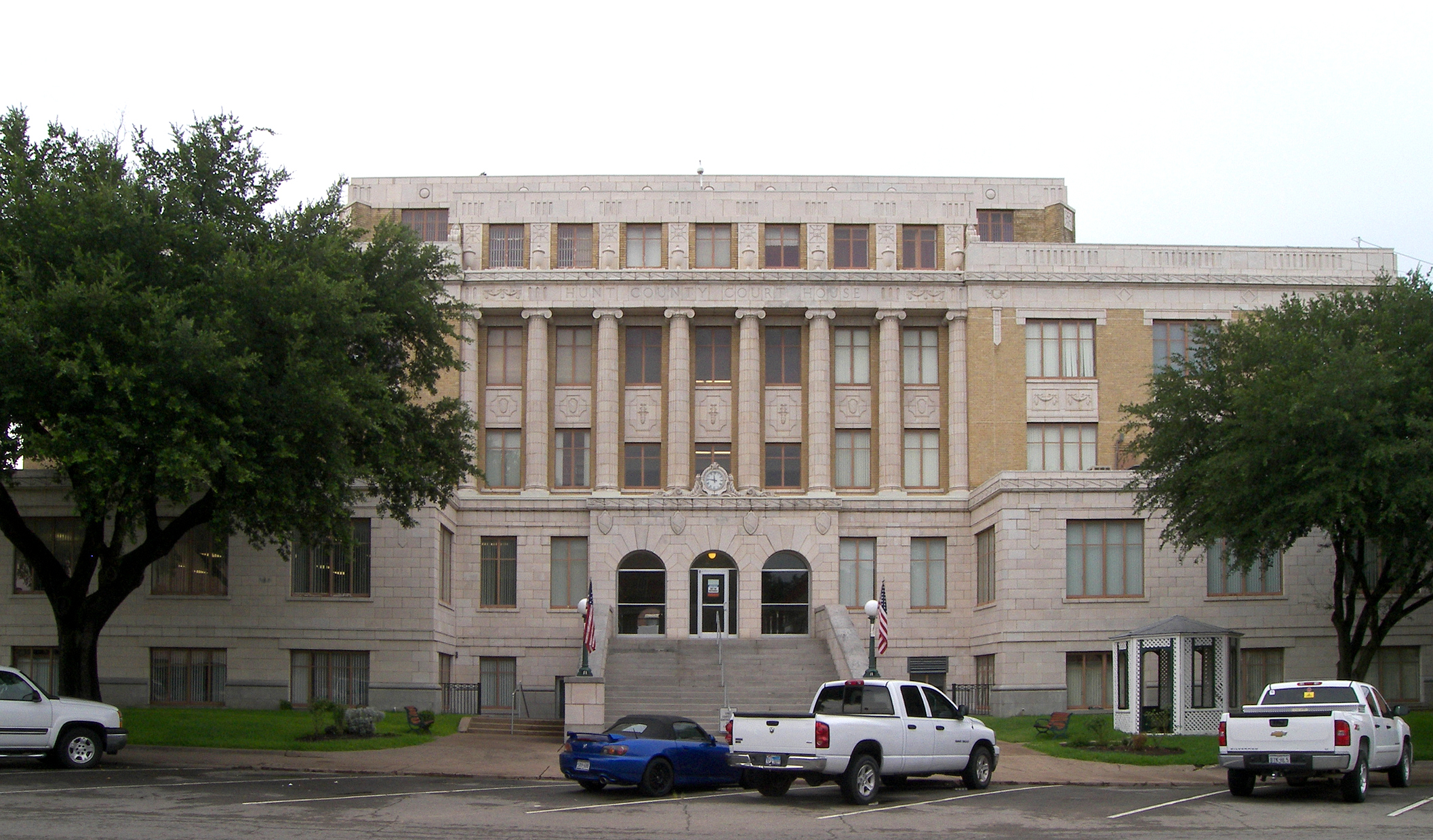
Verwaltung US-Bundesstaat: Texas Verwaltungssitz: Greenville Adresse des
Verwaltungssitzes:Hunt County Courthouse
P.O. Box 1316
Greenville, TX 75403Gründung: 1846 Gebildet aus: Fannin County
Nacogdoches CountyVorwahl: 001 903 Demographie Einwohner: 76.596 (2000) Bevölkerungsdichte: 35,2 Einwohner/km² Geographie Fläche gesamt: 2.284 km² Wasserfläche: 106 km² Karte 
Website: www.huntcounty.net Das Hunt County[2] ist ein County im Bundesstaat Texas der Vereinigten Staaten von Amerika. Im Jahr 2000 hatte das County 76.596 Einwohner und eine Bevölkerungsdichte von 35 Einwohnern pro Quadratkilometer. Der Verwaltungssitz (County Seat) ist Greenville. Das County ist Teil von der Dallas-Fort Worth Metropolregion.
Inhaltsverzeichnis
Geographie
Das County liegt im Nordosten von Texas und ist im Norden etwa 50 km von Oklahoma entfernt. Es hat eine Fläche von 2284 Quadratkilometern, wovon 106 Quadratkilometer Wasserfläche sind. Es grenzt im Uhrzeigersinn an folgende Countys: Fannin County, Delta County, Hopkins County, Rains County, Van Zandt County, Rockwall County und Collin County.
Geschichte
Hunt County wurde 1846 aus Teilen des Fannin County und Nacogdoches County gebildet. Benannt wurde es nach Memucan Hunt, einem Marineminister der Republik Texas.
Demografische Daten
Historische Einwohnerzahlen Census Einwohner ± in % 1850 1520 — 1860 6630 300 % 1870 10.291 60 % 1880 17.230 70 % 1890 31.885 90 % 1900 47.295 50 % 1910 48.116 2 % 1920 50.350 5 % 1930 49.016 -3 % 1940 48.793 -0,5 % 1950 42.731 -10 % 1960 39.399 -8 % 1970 47.948 20 % 1980 55.248 20 % 1990 64.343 20 % 2000 76.596 20 % Vor 1900[3] 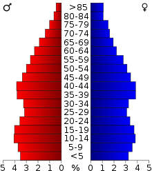 Alterspyramide für das Hunt County
Nach der Volkszählung im Jahr 2000 lebten im Hunt County 76.596 Menschen; es wurden 28.742 Haushalte und 20.521 Familien gezählt. Die Bevölkerungsdichte betrug 35 Einwohner pro Quadratkilometer. Ethnisch betrachtet setzte sich die Bevölkerung zusammen aus 83,57 Prozent Weißen, 9,45 Prozent Afroamerikanern, 0,73 Prozent amerikanischen Ureinwohnern, 0,54 Prozent Asiaten, 0,07 Prozent Bewohnern aus dem pazifischen Inselraum und 3,93 Prozent aus anderen ethnischen Gruppen; 1,70 Prozent stammten von zwei oder mehr Ethnien ab. 8,31 Prozent der Einwohner waren spanischer oder lateinamerikanischer Abstammung.
Von den 28.742 Haushalten hatten 32,9 Prozent Kinder oder Jugendliche, die mit ihnen zusammen lebten. 56,2 Prozent waren verheiratete, zusammenlebende Paare 11,0 Prozent waren allein erziehende Mütter und 28,6 Prozent waren keine Familien. 24,1 Prozent waren Singlehaushalte und in 9,6 Prozent lebten Menschen im Alter von 65 Jahren oder darüber. Die durchschnittliche Haushaltsgröße betrug 2,60 und die durchschnittliche Familiengröße betrug 3,08 Personen.
26,5 Prozent der Bevölkerung war unter 18 Jahre alt, 10,0 Prozent zwischen 18 und 24, 28,0 Prozent zwischen 25 und 44, 22,8 Prozent zwischen 45 und 64 und 12,6 Prozent waren 65 Jahre alt oder älter. Das Durchschnittsalter betrug 36 Jahre. Auf 100 weibliche Personen kamen 98,1 männliche Personen und auf 100 Frauen im Alter von 18 Jahren oder darüber kamen 95,3 Männer.
Das jährliche Durchschnittseinkommen eines Haushalts betrug 36.752 USD, das Durchschnittseinkommen einer Familie betrug 44.388 USD. Männer hatten ein Durchschnittseinkommen von 33.347 USD, Frauen 23.085 USD. Das Prokopfeinkommen betrug 17.554 USD. 8,6 Prozent der Familien und 12,8 Prozent der Einwohner lebten unterhalb der Armutsgrenze. [6]
Orte
- Aberfoyle
- Ardis Heights
- Caddo Mills
- Campbell
- Cash
- Celeste
- Clinton
- Commerce
- Concord
- Dixon
- Fairlie
- Floyd
- Greenville
- Hawk Cove
- Hickory Creek
- Jacobia
- Jardin
- Josephine
- Kingston
- Lane
- Lone Oak
- Merit
- Mineral Heights
- Neylandville
- Peniel
- Quinlan
- Reavilon
- South Sulphur
- Tidwell
- Union Valley
- West Tawakoni
- White Rock
- Wolfe City
- Yowell
Siehe auch
Einzelnachweise
- ↑ Auszug aus dem National Register of Historic Places. Abgerufen am 13. März 2011
- ↑ Hunt County im Geographic Names Information System des United States Geological Survey. Abgerufen am 22. Februar 2011
- ↑ U.S. Census Bureau - Census of Population and Housing. Abgerufen am 15. März 2011
- ↑ Auszug aus Census.gov. Abgerufen am 21. Februar 2011
- ↑ Auszug aus factfinder.census.gov Abgerufen am 26. Februar 2011
- ↑ Hunt County, Texas, Datenblatt mit den Ergebnissen der Volkszählung im Jahre 2000 bei factfinder.census.gov.
Weblinks

Liste der Countys in Texas
Anderson | Andrews | Angelina | Aransas | Archer | Armstrong | Atascosa | Austin | Bailey | Bandera | Bastrop | Baylor | Bee | Bell | Bexar | Blanco | Borden | Bosque | Bowie | Brazoria | Brazos | Brewster | Briscoe | Brooks | Brown | Burleson | Burnet | Caldwell | Calhoun | Callahan | Cameron | Camp | Carson | Cass | Castro | Chambers | Cherokee | Childress | Clay | Cochran | Coke | Coleman | Collin | Collingsworth | Colorado | Comal | Comanche | Concho | Cooke | Coryell | Cottle | Crane | Crockett | Crosby | Culberson | Dallam | Dallas | Dawson | Deaf Smith | Delta | Denton | DeWitt | Dickens | Dimmit | Donley | Duval | Eastland | Ector | Edwards | El Paso | Ellis | Erath | Falls | Fannin | Fayette | Fisher | Floyd | Foard | Fort Bend | Franklin | Freestone | Frio | Gaines | Galveston | Garza | Gillespie | Glasscock | Goliad | Gonzales | Gray | Grayson | Gregg | Grimes | Guadalupe | Hale | Hall | Hamilton | Hansford | Hardeman | Hardin | Harris | Harrison | Hartley | Haskell | Hays | Hemphill | Henderson | Hidalgo | Hill | Hockley | Hood | Hopkins | Houston | Howard | Hudspeth | Hunt | Hutchinson | Irion | Jack | Jackson | Jasper | Jeff Davis | Jefferson | Jim Hogg | Jim Wells | Johnson | Jones | Karnes | Kaufman | Kendall | Kenedy | Kent | Kerr | Kimble | King | Kinney | Kleberg | Knox | La Salle | Lamar | Lamb | Lampasas | Lavaca | Lee | Leon | Liberty | Limestone | Lipscomb | Live Oak | Llano | Loving | Lubbock | Lynn | Madison | Marion | Martin | Mason | Matagorda | Maverick | McCulloch | McLennan | McMullen | Medina | Menard | Midland | Milam | Mills | Mitchell | Montague | Montgomery | Moore | Morris | Motley | Nacogdoches | Navarro | Newton | Nolan | Nueces | Ochiltree | Oldham | Orange | Palo Pinto | Panola | Parker | Parmer | Pecos | Polk | Potter | Presidio | Rains | Randall | Reagan | Real | Red River | Reeves | Refugio | Roberts | Robertson | Rockwall | Runnels | Rusk | Sabine | San Augustine | San Jacinto | San Patricio | San Saba | Schleicher | Scurry | Shackelford | Shelby | Sherman | Smith | Somervell | Starr | Stephens | Sterling | Stonewall | Sutton | Swisher | Tarrant | Taylor | Terrell | Terry | Throckmorton | Titus | Tom Green | Travis | Trinity | Tyler | Upshur | Upton | Uvalde | Val Verde | Van Zandt | Victoria | Walker | Waller | Ward | Washington | Webb | Wharton | Wheeler | Wichita | Wilbarger | Willacy | Williamson | Wilson | Winkler | Wise | Wood | Yoakum | Young | Zapata | Zavala
Wikimedia Foundation.
Schlagen Sie auch in anderen Wörterbüchern nach:
Hunt County — Comté de Hunt Comté de Hunt (Hunt County) Administration Pays … Wikipédia en Français
Hunt County — Admin ASC 2 Code Orig. name Hunt County Country and Admin Code US.TX.231 US … World countries Adminstrative division ASC I-II
Hunt County, Texas — Infobox U.S. County county = Hunt County founded = 1846 state = Texas map size = 250 seat = Greenville | area total sq mi =882 area land sq mi =841 area water sq mi =41 area percentage = 4.63% census yr = 2000 pop = 76596 density km2 =15 web =… … Wikipedia
Liste der Einträge im National Register of Historic Places im Hunt County — Die Liste der Registered Historic Places im Hunt County führt alle Bauwerke und historischen Stätten im texanischen Hunt County auf, die in das National Register of Historic Places aufgenommen wurden. Aktuelle Einträge Lfd. Nr. Name im NRHP Bild… … Deutsch Wikipedia
Hunt — may refer to:Hunting* Hunting, activity during which humans or animals chase prey * Collective reference to a group of hunters practicing such a hunt, especially with dogs, e.g. Berkeley Hunt ** Fox hunting * See also Hunting (disambiguation) for … Wikipedia
Hunt (Begriffsklärung) — Hunt bezeichnet: Hunt, einen historischen Förderwagen im Bergbau Hunt (Familienname) ein historisches Flächenmaß, siehe historische Maße und Gewichte einen historischen Torfkahn aus dem Teufelsmoor Orte in den USA: Hunt (Arkansas) Hunt (New York) … Deutsch Wikipedia
County collecting — is keeping track of the counties and other major census divisions one has visited in the United States. Many county collectors try to go for blackout, to visit every county unit in the United States. Others try to black out individual states, and … Wikipedia
Hunt House (St. Charles, Illinois) — Hunt House U.S. National Register of Historic Places … Wikipedia
County Kildare — Contae Chill Dara Coat of arms Motto … Wikipedia
Hunt Valley Towne Centre — Hunt Valley Towne Centre, formerly Hunt Valley Mall, is an outdoor shopping mall in northern Baltimore County, Maryland. The development was constructed following the closure of Hunt Valley Mall (other than its anchor stores) in 2000. The anchor… … Wikipedia
Hunt County


18+
© Academic, 2000-2024
- Kontaktieren Sie uns: Unterstützung, Werbung
Wörterbücher Export, schritte mit PHP, Joomla, Drupal, WordPress, MODx.