Harilaid

Harilaid

Vorlage:Infobox Insel/Wartung/Bild fehlt

Harilaid
Gewässer Ostsee
Inselgruppe Moonsund-Inseln
Geographische Lage 58° 58′ 14″ N, 23° 5′ 3″ O58.97055555555623.0841666666672.9Koordinaten: 58° 58′ 14″ N, 23° 5′ 3″ O
Harilaid (Estland)
Harilaid
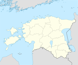
Fläche 0,15 km²
Höchste Erhebung 2,9 m

Harilaid (schwedisch Grasö) ist eine estnische Insel. Sie liegt etwa vier Kilometer westlich der Insel Vormsi.

Harilaid ist 15 Hektar groß. Die höchste Erhebung befindet sich 2,9 m über dem Meeresspiegel. Die Insel ist steinig und mit Wacholder bewachsen.

1849 wurde erstmals ein Leuchtturm auf Harilaid errichtet. Der derzeitige Turm hat eine Höhe von 19 m.

Weblinks


Wikimedia Foundation.

Игры ⚽ Нужна курсовая?

Schlagen Sie auch in anderen Wörterbüchern nach:

  • Harilaid — The Harilaid peninsula is a peninsula on the north west coast of the island of Saaremaa in Estonia.Harilaid covers an area of 4.5 km² and is low lying (the highest elevation is 4.6m). It is connected to the mainland by a 300 metre wide neck of… …   Wikipedia

  • Harilaid (Halbinsel) — Harilaid Gewässer Ostsee Geographische Lage …   Deutsch Wikipedia

  • Mihkel Harilaid — Born 26 December 1966 (1966 12 26) (age 44) Ontario, Canada Occupation CEO and Executive Producer Years active 1992–present Mihkel Harilaid also known as Mike Harilaid is the CEO and executive producer of Black Walk …   Wikipedia

  • Mikhel Harilaid — Born 26 December 1966 (1966 12 26) (age 44) Ontario, Canada Occupation CEO and Executive Producer Years active 1994–present Mihkel Harilaid is the CEO and executive producer of Black Walk, an independent feature film production co …   Wikipedia

  • Kiipsaare tuletorn — (auch Harilaid tuletorn oder Kiipsaare päevamärk) ist ein Leuchtturm an der äußersten Spitze der Halbinsel Harilaid (estn. Harilaid poolsaar) auf der Insel Saaremaa in Estland. Der Leuchtturm wurde 1933 erbaut und hat eine Höhe von 25 Metern …   Deutsch Wikipedia

  • Saaremaa — This article is about the island. For the village in Võru County, see Saaremaa, Võru County. Saaremaa …   Wikipedia

  • Hiiumaa — Tahkuna peninsula is the most northern part of Hiiumaa Geography …   Wikipedia

  • Vormsi — Estonia s fourth largest island, Vormsi (German: Worms, Swedish: Ormsö), is located between Hiiumaa and the mainland with a total area of 93 square kilometers. It is part of a rural municipality Vormsi Parish. From mainland, Vormsi is separated… …   Wikipedia

  • Mark Holland — Member of the Canadian Parliament for Ajax Pickering In office June 28, 2004 – May 2, 2011 Preceded by …   Wikipedia

  • Muhu — (German: Mohn/Moon; in Estonian also called Muhumaa), is an island in the Baltic Sea. With an area of 198 km² it is the third largest island belonging to Estonia, after Saaremaa and Hiiumaa. Together with neighbouring smaller islands of… …   Wikipedia

Share the article and excerpts

Direct link
Do a right-click on the link above
and select “Copy Link”