- Grendelbruch
-
Grendelbruch 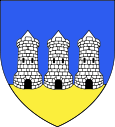
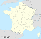

Region Elsass Département Bas-Rhin Arrondissement Molsheim Kanton Rosheim Koordinaten 48° 30′ N, 7° 19′ O48.49257.3227777777778516Koordinaten: 48° 30′ N, 7° 19′ O Höhe 516 m (399–1.031 m) Fläche 14,63 km² Einwohner 1.240 (1. Jan. 2008) Bevölkerungsdichte 85 Einw./km² Postleitzahl 67190 INSEE-Code 67167 Grendelbruch ist eine Gemeinde im Département Bas-Rhin in Frankreich. Durch das Gemeindegebiet verläuft die Wasserscheide zwischen dem Grendelbach, der in die Bruche fließt, und der Magel, die von Süden kommt und anschließend nach Osten fließt. Das zu den Vogesen gehörende Gebiet um Grendelbruch ist größtenteils bewaldet. Nordöstlich liegt der Forêt de Guirbaden. Grendelbach ist Mitglied der Communauté de communes du Canton de Rosheim.
Bevölkerungsentwicklung
Jahr 1882 1962 1968 1975 1982 1990 1999 2007 Einwohner 1606 1017 1062 1004 953 918 1127 1228 Weblinks
 Commons: Grendelbruch – Sammlung von Bildern, Videos und Audiodateien
Bischoffsheim | Bœrsch | Grendelbruch | Griesheim-près-Molsheim | Mollkirch | Ottrott | Rosenwiller | Rosheim | Saint-Nabor
Wikimedia Foundation.
Schlagen Sie auch in anderen Wörterbüchern nach:
Grendelbruch — Escudo … Wikipedia Español
Grendelbruch — is a village and commune in the Bas Rhin département of north eastern France.ee also*Communes of the Bas Rhin department … Wikipedia
Grendelbruch — 48° 29′ 35″ N 7° 19′ 24″ E / 48.49305556, 7.32333333 … Wikipédia en Français
Grendelbruch — Original name in latin Grendelbruch Name in other language Grendelbruch State code FR Continent/City Europe/Paris longitude 48.49272 latitude 7.32239 altitude 519 Population 1222 Date 2011 02 14 … Cities with a population over 1000 database
Rosheim — 48° 29′ 51″ N 7° 28′ 13″ E / 48.4975, 7.4703 … Wikipédia en Français
Grenzorte des alemannischen Dialektraums — Das traditionelle Verbreitungsgebiet westoberdeutscher (=alemannischer) Dialektmerkmale im 19. und 20. Jahrhundert … Deutsch Wikipedia
Armorial des communes du Bas-Rhin (A-H) — Article principal : Armorial des communes du Bas Rhin. Sur les autres projets Wikimedia : « Armorial des communes du Bas Rhin (A H) », sur Wikimedia Commons (ressources multimédia) L’armorial des communes du Bas Rhin regroupe… … Wikipédia en Français
Eichwaeldel — Ottrott Ottrott Ottrott vue depuis le Mont Sainte Odile qui s étire autour de l arborétum du Windeck. Au premier plan, les carrières d Ottrott Saint Nabor … Wikipédia en Français
Eichwaelder — Ottrott Ottrott Ottrott vue depuis le Mont Sainte Odile qui s étire autour de l arborétum du Windeck. Au premier plan, les carrières d Ottrott Saint Nabor … Wikipédia en Français
Laubenheim — Mollkirch Mollkirch Pays Franc … Wikipédia en Français
Grendelbruch


18+
© Academic, 2000-2024
- Kontaktieren Sie uns: Unterstützung, Werbung
Wörterbücher Export, schritte mit PHP, Joomla, Drupal, WordPress, MODx.