- Gravesham
-
Borough of Gravesham 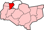
Lage in KentStatus Borough Region South East England Verw.grafschaft Kent Verwaltungssitz Gravesend Fläche 99,02 km² (245.) Einwohner 97.700 (231.) ONS-Code 29UG Website www.gravesham.gov.uk Gravesham ist ein Borough (Verwaltungsbezirk) im nordwestlichen Teil von Kent, England östlich von Greater London. Es liegt am südlichen Ufer der Themse gegenüber Tilbury (Essex). Im Bezirk leben etwa 95.000 Einwohner, davon zwischen 8 und 9% asiatischer Abstammung. Die Fläche beträgt 99,02 km². Die Verwaltung hat ihren Sitz in Gravesend, in seiner jetzigen Form besteht der Bezirk seit einer Gebietsreform im Jahre 1974.
Im Rahmen der Städtepartnerschaften ist Gravesham seit 1980 verschwistert mit Neumünster.
Wirtschaft
Wie in vielen anderen Regionen der Industrieländer, so hat sich auch in Gravesham ein massiver Wandel vom produzierenden Gewerbe zu Dienstleistungen vollzogen, dabei liegt die heutige Arbeitslosenquote mit etwa 2,8% unter dem britischen Durchschnitt von knapp 4%, die durchschnittlichen Einkommen liegen allerdings ebenfalls unter dem Landesdurchschnitt.

Ashford | Canterbury | Dartford | Dover | Gravesham | Maidstone | Sevenoaks | Shepway | Swale | Thanet | Tonbridge and Malling | Tunbridge Wells
Wikimedia Foundation.
Schlagen Sie auch in anderen Wörterbüchern nach:
Gravesham — is a local government district and borough in the north west of Kent, England. It has borders with The River Thames to the north; the city of Medway to the east; the borough of Tonbridge and Malling (to the south); and the boroughs of Sevenoaks… … Wikipedia
Gravesham — Distrito del Reino Unido Ubicación en el condado de Kent … Wikipedia Español
Gravesham — Borough de Gravesham Géographie Status: Borough Région: Angleterre du Sud Est Comté: Ken … Wikipédia en Français
Gravesham (UK Parliament constituency) — UK constituency infobox Name = Gravesham Map1 = Gravesham Map2 = Kent Entity = Kent Type = County Year = 1983 Entity = Kent County = Kent EP = South East England MP = Adam Holloway Party = ConservativeGravesham is a constituency represented in… … Wikipedia
Gravesham — /grayv sheuhm/, n. a borough in NW Kent, in SE England. 95,329. * * * ▪ district, England, United Kingdom borough (district), administrative and historic county of Kent, southeastern England. Its centre is the town of Gravesend, but it… … Universalium
Gravesham — /grayv sheuhm/, n. a borough in NW Kent, in SE England. 95,329 … Useful english dictionary
Hook Green, Gravesham — infobox UK place country = England official name= Hook Green latitude= 51.413 longitude= 0.317 population = shire district= Dartford shire county = Kent region= South East England Ambulance= constituency westminster= post town= postcode district … Wikipedia
Gravesend, Kent — Long Reach redirects here. For the neighbourhood in the eastern United States, see Long Reach, Columbia, Maryland. Coordinates: 51°26′29″N 0°22′07″E / 51.4415°N 0.3685°E … Wikipedia
Northfleet — For the ship wrecked on January 22, 1873, see Northfleet (ship). Coordinates: 51°26′51″N 0°19′29″E / 51.447588°N 0.324783°E / … Wikipedia
Meopham — Coordinates: 51°21′50″N 0°21′36″E / 51.364°N 0.360°E / 51.364; 0.360 … Wikipedia
Gravesham

18+
© Academic, 2000-2024
- Kontaktieren Sie uns: Unterstützung, Werbung
Wörterbücher Export, schritte mit PHP, Joomla, Drupal, WordPress, MODx.