- Gloucester County (Virginia)
-
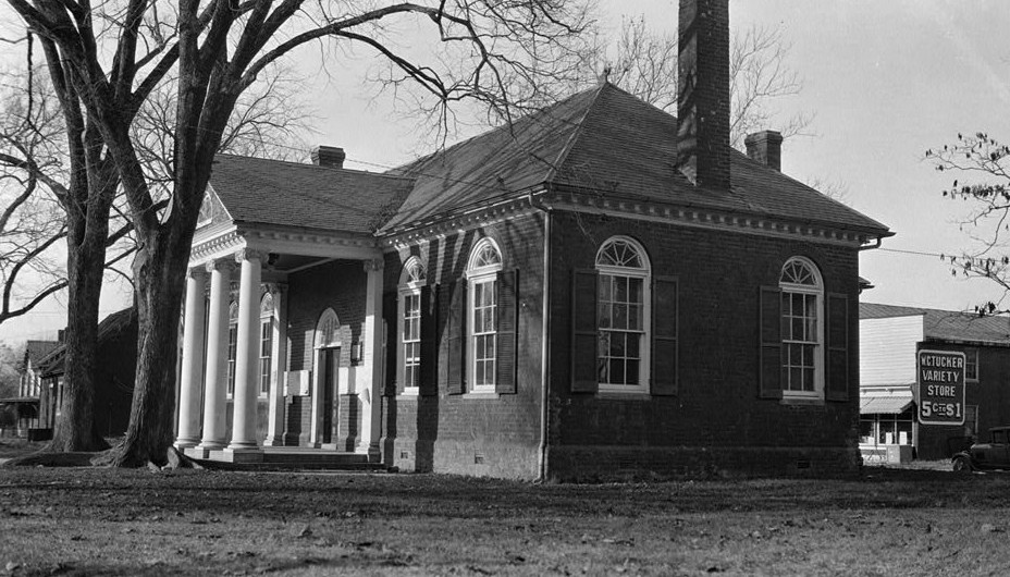
 Gloucester County Courthouse in Gloucester
Verwaltung US-Bundesstaat: Virginia Verwaltungssitz: Gloucester Adresse des
Verwaltungssitzes:County Courthouse
P.O. Box 329
Gloucester, VA 23061-0329Gründung: 1651 Gebildet aus: York County Vorwahl: 001 804 Demographie Einwohner: 34.780 (2000) Bevölkerungsdichte: 62 Einwohner/km² Geographie Fläche gesamt: 746 km² Wasserfläche: 185 km² Karte 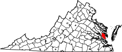
Website: www.co.gloucester.va.us Gloucester County[1] ist ein County im Bundesstaat Virginia der Vereinigten Staaten von Amerika. Bei der Volkszählung im Jahr 2000 hatte das County 34.780 Einwohner und eine Bevölkerungsdichte von 62 Einwohner pro Quadratkilometer. Der Verwaltungssitz (County Seat) ist Gloucester.
Inhaltsverzeichnis
Geografie
Gloucester County liegt im Osten von Virginia, grenzt an den Atlantik und hat eine Fläche von 746 Quadratkilometern, wovon 185 Quadratkilometer Wasserfläche sind. Es grenzt im Uhrzeigersinn an folgende Countys: Middlesex County, Mathews County, York County, James City County und King and Queen County.
Geschichte
Gebildet wurde es 1651 aus Teilen des York County. Benannt wurde es nach Heinrich, Herzog von Gloucester, dem dritten Sohn von Karl I., König von England, Schottland und Irland und seiner Gemahlin Henrietta Maria Bourbonen, Tochter des französischen Königs Heinrich IV. und der Maria di Medici.
Demografische Daten
Historische Einwohnerzahlen Census Einwohner ± in % 1790 13.498 — 1800 8181 -40 % 1810 10.427 30 % 1820 9678 -7 % 1830 10.608 10 % 1840 10.715 1 % 1850 10.527 -2 % 1860 10.956 4 % 1870 10.211 -7 % 1880 11.876 20 % 1890 11.653 -2 % 1900 12.832 10 % 1910 12.477 -3 % 1920 11.894 -5 % 1930 11.019 -7 % 1940 9548 -10 % 1950 10.343 8 % 1960 11.919 20 % 1970 14.059 20 % 1980 20.107 40 % 1990 30.131 50 % 2000 34.780 20 % 2010 36.858 6 % Vor 1900[2]  Alterspyramide für das Gloucester County
Nach der Volkszählung im Jahr 2000 lebten im Gloucester County 34.780 Menschen in 13.127 Haushalten und 9.884 Familien. Die Bevölkerungsdichte betrug 62 Einwohner pro Quadratkilometer. Ethnisch betrachtet setzte sich die Bevölkerung zusammen aus 86,68 Prozent Weißen, 10,31 Prozent Afroamerikanern, 0,42 Prozent amerikanischen Ureinwohnern, 0,69 Prozent Asiaten, 0,05 Prozent Bewohnern aus dem pazifischen Inselraum und 0,40 Prozent aus anderen ethnischen Gruppen; 1,45 Prozent stammten von zwei oder mehr Ethnien ab. 1,61 Prozent der Bevölkerung waren spanischer oder lateinamerikanischer Abstammung.
Von den 13.127 Haushalten hatten 35,2 Prozent Kinder und Jugendliche unter 18 Jahre, die bei ihnen lebten. 61,4 Prozent waren verheiratete, zusammenlebende Paare, 9,9 Prozent waren allein erziehende Mütter, 24,7 Prozent waren keine Familien, 20,3 Prozent waren Singlehaushalte und in 8,2 Prozent lebten Menschen im Alter von 65 Jahren oder darüber. Die Durchschnittshaushaltsgröße betrug 2,62 und die durchschnittliche Familiengröße lag bei 3,02 Personen.
Auf das gesamte County bezogen setzte sich die Bevölkerung zusammen aus 26,2 Prozent Einwohnern unter 18 Jahren, 6,8 Prozent zwischen 18 und 24 Jahren, 30,4 Prozent zwischen 25 und 44 Jahren, 24,8 Prozent zwischen 45 und 64 Jahren und 11,8 Prozent waren 65 Jahre alt oder darüber. Das Durchschnittsalter betrug 38 Jahre. Auf 100 weibliche Personen kamen 96,5 männliche Personen. Auf 100 Frauen im Alter von 18 Jahren oder darüber kamen statistisch 92,9 Männer.
Das jährliche Durchschnittseinkommen eines Haushalts betrug 45.421 USD, das Durchschnittseinkommen der Familien betrug 51.426 USD. Männer hatten ein Durchschnittseinkommen von 35.838 USD, Frauen 24.325 USD. Das Pro-Kopf-Einkommen betrug 19.990 USD. 6,8 Prozent der Familien und 7,7 Prozent der Bevölkerung lebten unterhalb der Armutsgrenze. Davon waren 9,7 Prozent Kinder oder Jugendliche unter 18 Jahre und 8,5 Prozent waren Menschen über 65 Jahre. [5]
Einzelnachweise
- ↑ Gloucester County im Geographic Names Information System des United States Geological Survey. Abgerufen am 22. Februar 2011
- ↑ U.S. Census Bureau _ Census of Population and Housing. Abgerufen am 28. Februar 2011
- ↑ Auszug aus Census.gov. Abgerufen am 28. Februar 2011
- ↑ Auszug aus factfinder.census.gov Abgerufen am 28. Februar 2011
- ↑ Gloucester County, Virginia, Datenblatt mit den Ergebnissen der Volkszählung im Jahre 2000 bei factfinder.census.gov.

Liste der Countys und Kreisfreien Städte in Virginia
Countys: Accomack | Albemarle | Alleghany | Amelia | Amherst | Appomattox | Arlington | Augusta | Bath | Bedford | Bland | Botetourt | Brunswick | Buchanan | Buckingham | Campbell | Caroline | Carroll | Charles City | Charlotte | Chesterfield | Clarke | Craig | Culpeper | Cumberland | Dickenson | Dinwiddie | Essex | Fairfax | Fauquier | Floyd | Fluvanna | Franklin | Frederick | Giles | Gloucester | Goochland | Grayson | Greene | Greensville | Halifax | Hanover | Henrico | Henry | Highland | Isle of Wight | James City | King and Queen | King George | King William | Lancaster | Lee | Loudoun | Louisa | Lunenburg | Madison | Mathews | Mecklenburg | Middlesex | Montgomery | Nelson | New Kent | Northampton | Northumberland | Nottoway | Orange | Page | Patrick | Pittsylvania | Powhatan | Prince Edward | Prince George | Prince William | Pulaski | Rappahannock | Richmond | Roanoke | Rockbridge | Rockingham | Russell | Scott | Shenandoah | Smyth | Southampton | Spotsylvania | Stafford | Surry | Sussex | Tazewell | Warren | Washington | Westmoreland | Wise | Wythe | YorkKreisfreie Städte: Alexandria | Bedford | Bristol | Buena Vista | Charlottesville | Chesapeake | Colonial Heights | Covington | Danville | Emporia | Fairfax | Falls Church | Franklin | Fredericksburg | Galax | Hampton | Harrisonburg | Hopewell | Lexington | Lynchburg | Manassas | Manassas Park | Martinsville | Newport News | Norfolk | Norton | Petersburg | Poquoson | Portsmouth | Radford | Richmond | Roanoke | Salem | Staunton | Suffolk | Virginia Beach | Waynesboro | Williamsburg | Winchester
Wikimedia Foundation.
Schlagen Sie auch in anderen Wörterbüchern nach:
Gloucester County, Virginia — Infobox U.S. County county = Gloucester County state = Virginia map size = 225 founded = 1651 seat = Gloucester Courthouse | area total sq mi =288 area water sq mi =71 area percentage = 24.79% census yr = 2000 pop = 34780 density km2 =62 web =… … Wikipedia
National Register of Historic Places listings in Gloucester County, Virginia — Map of all coordinates from Google Map of all coordinates from Bing … Wikipedia
Concord, Gloucester County, Virginia — Concord, Gloucester County is an unincorporated community in Gloucester County, in the U. S. state of Virginia. References U.S. Geological Survey Geographic Names Information System: Concord, Gloucester County, Virginia … Wikipedia
Mill Creek, Gloucester County, Virginia — Mill Creek, Gloucester County is an unincorporated community in Gloucester County, in the U. S. state of Virginia. References U.S. Geological Survey Geographic Names Information System: Mill Creek, Gloucester County, Virginia … Wikipedia
Millwood, Gloucester County, Virginia — Millwood, Gloucester County is an unincorporated community in Gloucester County, in the U. S. state of Virginia. References U.S. Geological Survey Geographic Names Information System: Millwood, Gloucester County, Virginia … Wikipedia
Clopton, Gloucester County, Virginia — Clopton is an unincorporated community in Gloucester County, in the U. S. state of Virginia. References U.S. Geological Survey Geographic Names Information System: Clopton, Gloucester County, Virginia … Wikipedia
Gloucester Point, Virginia — Infobox Settlement official name = Gloucester Point, Virginia settlement type = CDP nickname = motto = imagesize = image caption = image mapsize = 250px map caption = Location of Gloucester Point, Virginia mapsize1 = map caption1 = subdivision… … Wikipedia
Gloucester Courthouse, Virginia — Infobox Settlement official name = Gloucester Courthouse, Virginia settlement type = CDP nickname = motto = imagesize = image caption = image mapsize = 250px map caption = Location of Gloucester Courthouse, Virginia mapsize1 = map caption1 =… … Wikipedia
Gloucester County Public Schools — is a Virginia public school division which serves Gloucester County, Virginia. The school division operates nine schools, of which, six elementary (grades K 5), two intermediate (grades 6 8), and one high school (grades 9 12). There have been… … Wikipedia
Gloucester County — is the name of several counties in the United States:* Gloucester County, New Jersey * Gloucester County, VirginiaIn Canada: * Gloucester County, New BrunswickThe name may also be used (mistakenly) to refer to Gloucestershire in England.In… … Wikipedia
Gloucester County (Virginia)


18+
© Academic, 2000-2024
- Kontaktieren Sie uns: Unterstützung, Werbung
Wörterbücher Export, schritte mit PHP, Joomla, Drupal, WordPress, MODx.