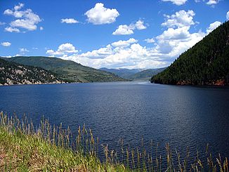
Fryingpan River — The Frying Pan River is a tributary of the Roaring Fork River, approximately 30 mi (48 km) long, in west central Colorado in the United States.It rises in northeastern Pitkin County, in the White River National Forest in the Sawatch Mountains… … Wikipedia
Fryingpan-Arkansas Project — The Fryingpan Arkansas Project, or Fry Ark, is a water diversion, storage and delivery project serving southeastern Colorado. The project was authorized in 1962 by President Kennedy, began construction that same year, and was completed in 1981.… … Wikipedia
Fryingpan Glacier — Infobox Glacier | glacier name = Fryingpan Glacier caption = Fryingpan Glacier and Little Tahoma Peak in 2007 type = Mountain glacier location = Little Tahoma, Washington, U.S. coordinates = coord|46|51|14|N|121|41|14|W|type:glacier [Google Earth … Wikipedia
Colorado River — 1. a major US river that runs through the Grand Canyon. It begins in the Rocky Mountains in northern Colorado and flows 1 450 miles/2 333 kilometres to the Gulf of California. For 90 miles/145 kilometres it is in Mexico. See also Hoover Dam. 2. a … Universalium
Roaring Fork River — Hardwick Bridge über den Roaring Fork River bei CarbondaleVorlage:Infobox Fluss/KARTE fehlt … Deutsch Wikipedia
Crystal River (Colorado) — Crystal River[1] Crystal River at Redstone, with Chair Mountain in distance … Wikipedia
Roaring Fork River — The Roaring Fork River is a tributary of the Colorado River, approximately 70 mi (113 km) long, in west central Colorado in the United States. The river drains a populated and economically vital area of the Colorado Western Slope called the… … Wikipedia
List of rivers of Colorado — The headwaters of the Arkansas River near Leadville, Colorado. Main article: Geography of Colorado See also: Colorado drainage basins Lists of rivers and streams in the U.S. State of Colorado … Wikipedia
Roaring Fork Valley — The Roaring Fork Valley is a geographical region in western Colorado in the United States. One of the most populated and economically vital areas of the Colorado Western Slope, it is defined by the valley of the Roaring Fork River and its… … Wikipedia
Liste der Flüsse in den Vereinigten Staaten — Die folgende Liste zeigt die Flüsse in den Vereinigten Staaten. A Alabama River Alabama Allegheny River Pennsylvania, New York Alsea River Oregon Altamaha River Georgia Amargosa River Kalifornien American River Kalifornien Anacostia River… … Deutsch Wikipedia