Fort Simpson

Fort Simpson
Fort Simpson
Lage in Kanada
Fort Simpson (Kanada)
Fort Simpson
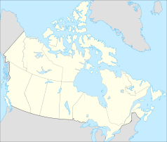
Fort Simpson
Staat: Kanada
Territorium: Nordwest-Territorien
Region: Dehcho Region
Koordinaten: 61° 52′ N, 121° 21′ W61.863055555556-121.355Koordinaten: 61° 52′ N, 121° 21′ W
Einwohner: 1216 (Stand: 2006)
Webpräsenz: www.fortsimpson.com

Fort Simpson (Slavey: Liidli „Zusammenfluss“) ist eine Siedlung in der Dehcho Region der kanadischen Nordwest-Territorien. Sie liegt auf einer Flussinsel am Zusammenfluss des Mackenzie und des Liard River und war ursprünglich ein Handelsposten der Hudson’s Bay Company (HBC), für die die Flüsse wichtige Handelsrouten darstellten. Fort Simpson ist nach dem früheren Leiter der HBC George Simpson benannt.

2006 wurden 1216 Einwohner gezählt; eine Zunahme von 5 % gegenüber 2001, die abgeschwächt einer Zunahme von 11 % der Nordwest-Territorien insgesamt folgt.[1] Die Bewohner sind vorwiegend europäisch-stämmig, eine Minderheit von ca. 7 % setzt sich aus indianischen Dene und einigen europäisch-indianischen Métis zusammen.

Quellen

  1. Angaben des kanadischen Statistikamtes zu Fort Simpson aus der Zählung 2006

Wikimedia Foundation.

Игры ⚽ Поможем написать курсовую

Schlagen Sie auch in anderen Wörterbüchern nach:

  • Fort Simpson — Pour les articles homonymes, voir Simpson. 61°51′47″N 121°21′18″O / …   Wikipédia en Français

  • Fort Simpson, Northwest Territories — Infobox Settlement name = Fort Simpson native name = Liidli Kue other name = Location map polarx CanadaGeo caption = lon shift = 4.1 label= Fort Simpson label size=70 | lat skew=1.2 background = #DDDD22 position=top lat = 61.863056 long = 121.355 …   Wikipedia

  • Fort Simpson Airport — Infobox Airport name = Fort Simpson Airport IATA = YFS ICAO = CYFS owner = operator = Government of the Northwest Territories city served = location = Fort Simpson, Northwest Territories elevation f = 555 elevation m = 169 coordinates =… …   Wikipedia

  • Fort Simpson Island Airport — is located adjacent to Fort Simpson, Northwest Territories, Canada. Prior permission is required to land except in the case of an emergency.Airlines*Wolverine Air *Simpson Airee also*Fort Simpson Airport *Fort Simpson Island Water… …   Wikipedia

  • Fort Simpson Island Water Aerodrome — adjacent to Fort Simpson, Northwest Territories, Canada on the Mackenzie River and open from the middle of June until October.ee also*Fort Simpson Airport *Fort Simpson Island AirportReferences …   Wikipedia

  • Fort Simpson —    1) At mouth of Liard River.    Index: D Built by Hudson s Bay Company, at mouth of Liard River, 125.    Bib.: Richardson, Arctic Searching Expedition.    2) On coast of British Columbia, near Alaskan boundary.    Index: D Built by Hudson s Bay …   The makers of Canada

  • Aeropuerto de Fort Simpson — Fort Simpson Airport IATA: YFS   OACI: CYFS Sumario Tipo Público …   Wikipedia Español

  • Fort McLoughlin — was a fur trading post established in 1833 by the Hudson s Bay Company (HBC) on Campbell Island in present day British Columbia, Canada.One of the primary reasons for the establishment of Fort McLoughlin, as well as Fort Simpson to the north, was …   Wikipedia

  • Fort St. John Group — Stratigraphic range: Lower Cretaceous …   Wikipedia

  • Fort Smith Region, Northwest Territories — Fort Smith Region is one of Statistics Canada s two census divisions of the Northwest Territories, Canada. It contains more than 77 percent of the population and more than 54 percent of the land area of the Northwest Territories. Its main… …   Wikipedia

Share the article and excerpts

Direct link
Do a right-click on the link above
and select “Copy Link”